Download
1 / 26
260 likes | 388 Views
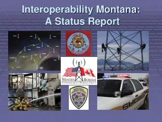
Interoperability Montana: A Status Report. IM’s Purpose: Saving Lives. “No person shall lose his or her life because public safety officials can not communicate.” -MT Statewide Communications Interoperability Plan. Interoperability Montana: Who We Are. Created in 2005

E N D
IM’s Purpose: Saving Lives “No person shall lose his or her life because public safety officials can not communicate.” -MT Statewide Communications Interoperability Plan
Interoperability Montana: Who We Are • Created in 2005 • “Statewide Interoperability” provider • Created by counties & • sovereign Indian nations • working in regional “consortia” • 501c4 Non-profit Assoc. (2010)
Interoperability Montana: Who We Are • Board of “Project Directors” 9 consortia leaders (local jurisdictions) 4 state departments (Justice, Transportation, DNRC, State User’s Group) 1 federal user group (US Air Force, Interior, Justice, etc.) • Technical Support Staff and Contracted Services
Who can use the IM system? • Law enforcement • Fire services • Emergency medical • Disaster services • State & federal agencies • Public works • Hospital & ambulance • School bus providers • Utilities (public or private) • Industry / private services
IM: A Statewide Vision IM intends to serve all 56 Counties and all 7 Indian Reservations within Montana.
IM: Locally-based Governance • Counties & Tribes select representatives. • Representatives participate in regional “Consortium.” • Consortium elects “Project Director” to to serve on statewide governing board of IM. • Consortium members pool their DHS grant money.
IM Funding Sources • Homeland Security Grants (2005-2010) • Other Grants (PSIC, COPS) • State Agencies • State Legislature • MT National Guard • U.S. Air Force • Counties • Tribes • Private Sector
Demonstrating Interoperability(Concept Demonstration Projects) Lewis & Clark County Northern Tier Project (CDP #1) (CDP #2) Both are operational.
Lewis and Clark County The Northern Tier Project 400 users to 2,900 users since 2005 • City police • County sheriff • Rural fire districts • Public works • State agencies • Federal agencies • Hospital & ambulance
Expanding IM: 2009-2010 • MT 200 Corridor: Great Falls, Lewistown *Connects Northern Tier-Lewis & Clark projects *U.S. Air Force towers serve Malmstrom AFB missile fields and IM users
Expanding IM: 2009-2010 • I-15 corridor: Butte, Dillon *Financed by PSIC grant *Links Lewis & Clark project to I-90/I-15 *Creates “Southwest Loop” *Partnership with Idaho (Sawtell site)
Expanding IM: 2009-2010 • I-90 corridor: Bozeman, Billings *Financed by PSIC grant *Adds southern arm to “backbone loop” *Provides a solution for Billings/ Yellowstone County systems issues
Expanding IM: 2011-2013 • I-94 corridor: Miles City, Glendive, Sidney *Link southern arm with Northern Tier *Working towards the Completion of the “backbone loop” *2nd master controller at Richland Co. Law & Justice center (Sidney)
Expanding IM: 2011-2013 • US Highway 2 corridor: Northern Tier Border Interoperability *Cross border communication capabilities *Enhance mobile data capabilities for local jurisdictions *Could provide AVL capabilities for first responders and dispatch centers
Looking to the Future: 2013 and Beyond • Southeast: I-90 & U.S. 212 (inc. Crow and N. Cheyenne Res.) • West: U.S. 93 & I-90 (Ravalli / Missoula / Lake / Mineral Co’s.)
Looking to the Future:Key Decisions • COVERAGE GOALS: • 95% mobile radio • coverage on state/ • federal highways • 90% mobile data • coverage on highways • 100% portable radio • coverage in urban areas
Looking to the Future:Key Decisions • FINANCE. • Annual fees for all • system users • Reimbursements to • tower site owners for • maintenance costs • Long-term plan for • statewide funding sources
IM’s 2011 Legislative Agenda • Create interim study committee on Statewide Interoperability to: • Gather input from local and statewide users and stakeholders. • Make long-term funding recommendations to 2013 legislature.
Border Grant Project • 1) Enhance utilization of Montana’s mutual aid channel for improved cross-border communications • 2) Improve interagency voice and data (IV&D) capability in remote border areas • 3) increase trunking and conventional radio coverage along the border • 4) Demonstrate an Automatic Vehicle Location (AVL) pilot system • 5) Initiate cross-border security training and exercises.
Remembering the Bottom Line “No person shall lose his or her life because public safety officials can not communicate.” -MT Statewide Communications Interoperability Plan