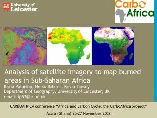
Download
1 / 26
260 likes | 417 Views
ANALYZING TIME SERIES OF SATELLITE IMAGERY USING TEMPORAL MAP ALGEBRA. Jeremy Mennis 1 and Roland Viger 1,2 1 Dept. of Geography, University of Colorado 2 U.S. Geological Survey. Objective.

E N D
ANALYZING TIME SERIES OF SATELLITE IMAGERY USINGTEMPORAL MAP ALGEBRA Jeremy Mennis1 and Roland Viger1,2 1 Dept. of Geography, University of Colorado 2 U.S. Geological Survey
Objective To develop a prototype implementation of a library of temporal map algebra functions for spatio-temporal image analysis. Map algebra: an approach to raster data handling which treats spatial data layers as variables which may be combined using mathematical operators. (Tomlin, 1990)
0 1 2 0 1 2 0 1 2 0 1 2 5 6 7 3 4 5 5 6 7 3 4 5 10 11 12 6 7 8 10 11 12 6 7 8 Approach Spatio-temporal data raster sets are treated as 3-D ‘data cubes.’ Map algebra functions are extended from 2 to 3 dimensions. Temporal map algebra functions are referred to as ‘cube functions.’
0 0 0 1 1 1 2 2 2 9 0 9 11 10 1 11 13 2 0 0 0 1 1 1 2 2 2 Conventional Map Algebra Local Function 0 27 27 28 29 1 29 2 31 5 5 5 6 6 6 7 7 7 12 15 3 13 17 4 19 14 5 5 5 5 6 6 6 7 7 7 + 33 3 30 35 4 31 32 5 37 10 10 10 11 11 11 12 12 12 15 6 21 7 23 16 8 25 17 10 10 10 11 11 11 12 12 12 33 39 6 34 7 41 8 35 43 Three-Dimensional Map Algebra Local Function + Local Functions
Row 1 0 1 2 3 4 0 1 2 3 4 2 0 1 2 3 4 0 1 2 3 4 5 6 7 8 9 1 5 6 7 8 9 Row 3 5 6 7 8 9 5 6 7 8 9 10 11 12 13 14 2 10 11 12 13 14 4 10 11 12 13 14 10 11 12 13 14 15 16 17 18 19 3 15 16 17 18 19 5 15 16 17 18 19 15 16 17 18 19 21 22 23 24 25 4 21 22 23 24 25 5 21 22 23 24 25 4 21 22 23 24 25 5 3 2 1 Timestep 1 2 3 4 5 1 2 3 4 5 Column Column Focal Functions Conventional Map Algebra 3x3 Focal Neighborhood Three-Dimensional Map Algebra 3x3x3 Focal Neighborhood
0 1 2 0 1 2 5 6 7 5 6 7 10 11 12 0 1 2 10 11 12 0 1 2 0 1 2 0 1 2 5 6 7 Value Cube Zone Cube 3 4 5 5 6 7 3 4 5 10 11 12 6 7 8 10 11 12 6 7 8 Zone Zone Sum Sum Zonal Functions Output Table Value Layer Zone Layer Conventional Map Algebra + + Three-Dimensional Map Algebra Output Table
Interactive Data Language (IDL) • Language and Environment used for implementation • is an interpreted language developed by Research Systems, Inc. (now owned by Kodak) • has a library of image processing, math, statistics, visualization, and user interface components. • was developed for remote sensing image processing (ENVI)
Row Timestep Column Spatio-Temporal Data Structure 3 Dimensional Array of the form: [row, column, timestep]
Example Implementation: cubeFocalSum …iterates over each [row, column, timestep] to sum a set of values within a spatial, temporal, or spatio-temporal neighborhood. 1 function cubeFocalSum, arr_in ….. 7 for row=0,x[1]-1 do begin 8 for col=0,x[2]-1 do begin 9 for time=0,x[3]-1 do begin 10 arr_out[row,col,time] = FocalSum ( arr_in,row,col,time ) 11 end 12 end 13 end
Case Study: ENSO-Vegetation Dynamics Objective: To determine the effect of ENSO on southern African vegetation, over different land covers
NINO 3.4 Sea Surface Temperature Anomaly Case Study: ENSO-Vegetation Dynamics ENSO Phase Data: Monthly, 1982-1993 Southern Oscillation Index 5 Month Running Mean (http://iri.columbia.edu/climate)
Case Study: ENSO-Vegetation Dynamics Land Cover Data:
Row Timestep Column Case Study: ENSO-Vegetation Dynamics Zone Cube • ENSO anomolies • 3 categories (warm, neutral, cold) • Varying over time • Land Cover • 6 categories (woodland, etc…) • Constant through time Merged with cubeLocalSum operation, assigning a unique identifier to each combination of land cover and ENSO phase.
Case Study: ENSO-Vegetation Dynamics Vegetation Dynamics NDVI - Monthly 1982-1993
Case Study: ENSO-Vegetation Dynamics Functions: cubeZonalMean of NDVI data cube and (cubeLocalSum of ENSO phase and Land Cover data cubes)
Case Study: ENSO-Vegetation Dynamics Functions: cubeZonalMean of NDVI data cube and (cubeLocalSum of ENSO phase and Land Cover data cubes)
Case Study: ENSO-Vegetation Dynamics Functions: cubeZonalMean of (cubeFocalVariance of NDVI data cube) and (cubeLocalSum of ENSO phase and Land Cover data cubes)
Case Study: ENSO-Vegetation Dynamics Functions: cubeZonalMean of (cubeFocalVariance of NDVI data cube) and (cubeLocalSum of ENSO phase and Land Cover data cubes)
Case Study: ENSO-Vegetation Dynamics • Vegetation response lags behind the occurrence of an ENSO event. • Alternate NDVI used • focused on the growing season after an ENSO phse
Case Study: ENSO-Vegetation Dynamics Functions: cubeZonalMean of NDVI data cube and (cubeLocalSum of Growing Season ENSO phase and Land Cover data cubes)
Case Study: ENSO-Vegetation Dynamics Functions: cubeZonalMean of NDVI data cube and (cubeLocalSum of Growing Season ENSO phase and Land Cover data cubes)
Conclusion • Temporal map algebra provides a useful approach for manipulation and analysis of time series of imagery • The cube function approach provides an extensible framework for the implementation of temporal map algebra • Future research: a rich, non-proprietary library of temporal map algebra functions
Acknowledgements Thanks to Jun Wei Liu for data preprocessing. Data were provided by NASA Goddard Distributed Active Archive Center, the University of Maryland Global Land Cover Facility, and the National Oceanic and Atmospheric Administration Climate Diagnostics Center. This research was supported by NASA grant NAG5-12598. Jeremy Mennis: jeremy@colorado.edu Roland Viger: rviger@usgs.gov
Data Input • 1. A text file that encodes a unique ID for each location. • \ • 2. A text file where the first column encodes the locational ID and subsequent columns encode time series of observations.