Download
1 / 17
170 likes | 323 Views
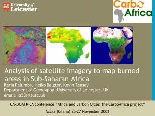
Analysis of satellite imagery to map burned areas in Sub-Saharan Africa . Ilaria Palumbo, Heiko Balzter, Kevin Tansey Department of Geography, University of Leicester, UK email: ip53@le.ac.uk . CARBOAFRICA conference “Africa and Carbon Cycle: the CarboAfrica project”

E N D
Analysis of satellite imagery to map burned areas in Sub-Saharan Africa Ilaria Palumbo, Heiko Balzter, Kevin TanseyDepartment of Geography, University of Leicester, UKemail: ip53@le.ac.uk CARBOAFRICA conference “Africa and Carbon Cycle: the CarboAfrica project” Accra (Ghana) 25-27 November 2008
Fire activity in Africa Vegetation index (green) and fire dynamics in Africa in the year 2001 seen from satellite. Source: NASA http://landdb1.nascom.nasa.gov/animation/images/Africa_Fire_NDVI_2001.gif
Why mapping burned areas? • derive estimations of fire emissions; • information about the extent; • information about the temporal occurrence; • information about the intensity of burning;
Products available • GBA2000SPOT-VGT images, 1km; • GlobscarATSR-2, 1km; • GlobcarbonVGT, (A)ATSR and MERIS, 1km; • L3JRC SPOT-VGT images, 1km - 7 years; • MCD45 MODIS, 500m - since 2002; • others;
the AATSR imagery • global level coverage since the 1990s, • 1km spatial resolution; • dual view – nadir & forward; • possible Aerosol Optical Depth retrieval • and correction; Can we use AATSR for burned area mapping?
Processing AATSR data • run model for the AOD retrieval; • derive surface reflectance @1km; • use the corrected reflectance for burned • area mapping; AOD aerosol optical depth
Processing AATSR data AATSR data extract parameters TOA, VZA, SZA, lat, lon, cloud flags INVERSION LUT cont. LUT ocean LUT urban LUT dust LUT smoke Rsurf, τocean, E Rsurf, τurban, E Rsurf, τdust, E Rsurf, τsmoke, E Rsurf, τcont, E select Best-fit τ select ‘best’ Rsurf TOA: Top Of the Atmosphere
Results corrected surface reflectance 1-10th July 2003 RGB: 1600, 870, 670 nm
Results …and problems period 1st-10h July 2003 RGB: 1600, 870, 550 nm
Can we use AATSR for burned area mapping? maybe not at continental level… some potentials exist though
corrected surface reflectance 2nd August 2002 7.51am AATSR RGB: 1600, 870, 550 nm
Comparison AATSR/MODIS MODIS/Terra - 500m AATSR - 1km 2002-08-24 2002-08-2
MODIS burned area product • MODIS vs AATSR • higher spatial resolution (500m); • better spatial coverage of the study area, limited missing data; • validated using ETM+ scenes over southern Africa; • information about quality assessment is provided.
MODIS MCD45A1 burned area product MONTHLY BURNED AREA MAPS
Use MODIS product for further analysis • extract burned area info per vegetation class; • derive fire emissions at continental and country level; • analysis of the climate-human-fire interactions; MCD45A1 burned areas Globcover
Conclusions • the aerosol corrected ATSR series reflectance can be used to map burned area at regional level and before year 2000; • the improved spatial resolution and more frequent coverage of the MODIS product is better suited to the needs of CARBOAFRICA; • a reliable burned area map is needed to derive accurate emissions from fires.