Download

1 / 23
230 likes | 1.1k Views
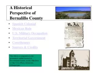
This Site is a companion to the permanent exhibit located in Government Center, on the 10th floor of One Civic Plaza, downtown Albuquerque. A Historical Perspective of Bernalillo County Spanish Colonial Mexican Rule U.S. Military Occupation Territorial Government Courthouses

E N D
This Site is a companion to the permanent exhibit located in Government Center, on the 10th floor of One Civic Plaza, downtown Albuquerque. A HistoricalPerspective ofBernalillo County • Spanish Colonial • Mexican Rule • U.S. Military Occupation • Territorial Government • Courthouses • Sources & Credits
Spanish ColonialPeriod 1598-1821 Go to Historical Maps of This Era During the period of 1610 to 1680, New Mexico's historical archives show the Spanish influence on the natives of the land. Clashes over missionary efforts eventually gave rise to the Pueblo Revolt of 1680. For a time the Indians were victorious in driving out their European conquerors. The Spanish reconquest did not truly succeed until years later when Don Diego de Vargas finally claimed the territory as "New Spain" in 1696. Petition of the Citizens of the recently founded Villa of Albuquerque for a detachment of ten soldiers with their Captain for protection from Indian attack, October 15, 1712. Main Menu
Americae Sive Novi Orbis, Nova Descriptio "Americae Sive Nova Orbis, Nova Descriptio" -- Map of New Spain It is believed that French cartographers created early maps, such as this one, from reports of explorers and traders, explaining its inaccuracies. The map depicts Hispania Nova, "New Spain", as viewed in the 16th Century. Next
Le Nouveau Mexique Le Nouveau Mexique Map - Bonne Map of Northern New Spain - 1780 While Coronado’s exploration of “New Spain” occurred as early as 1540 in the Tiguex area near present-day Bernalillo, the first colony was not settled until 1598. Next
Spanish Borderland Maps Spanish Borderlands While Coronado's explorations of "New Spain" occurred as early as 1540 in the Tiguex area near present-day Bernalillo, the first colony was not settled until 1598. The Village of Bernalillo was originally a military outpost and not recognized by that name until 1695. Spanish Colonial Period
Mexican Rule1821-1846 Go to Historical Maps and Pictures of This Era In 1821, Mexico declared itself free from Spain. Under Mexican rule, the vast land area of "Nuevo Mejico" was divided into four cabeceras (headquarters) on January 4, 1823. This new governmental division, which extended as far south as Socorro, can be considered the origin of Bernalillo County. The Mexican Junta Department on June 17, 1844, reorganized the subdivisions of the province creating three prefecturas. The third subdivision consisted of the Rio Abajo area, which eventually evolved into the counties of Bernalillo, Socorro and Valencia. Main Menu
de los Estados Unidos de Mejico "de los Estados Unidos de Mejico" - 1847 Map This 1847 map is more accurate than earlier maps, yet still had serious flaws, causing some major problems in the Treaty of Guadalupe Hidalgo between the U.S. and Mexico. This map was off by 34 latitudinal miles and 100 longitudinal miles from El Paso's true location. Next
Territories of New Mexico & Utah "Territories of New Mexico & Utah" -- 1862 Map Under Mexican rule the original boundaries of Bernalillo County extended from Texas to California. In this 1862 map, Bernalillo County still extended to the San Bernardino Valley in California. Notice the town of Bernalillo is called Bernalita, further evidence for the origin of "little Bernal" -- a village named after the children of the Bernal family. Next
Manuel Armijo House This 40-room hacienda, belonging to Manuel Armijo, Governor of New Mexico during the Mexican period, stood on the Southeast side of Albuquerque’s Old Town until its demolition in 1910. It was modeled after the governor's mansion in Santa Fe. Purchased from the Albuquerque Museum, (c) 1993 Cobb Studio Collection Mexican Rule Photograph -- Manuel Armijo House
U. S. Military Occupation1821-1846 Go to Historical Document of this Era The issue of "Manifest Destiny" came to a head with the election of President James K. Polk and the announcement of his intention to acquire the territory of California from Mexico. After the Mexican Government refused to sell the land to the United States for $25-million, President Polk decided to force the issue. He ordered General Zachary Taylor to lead approximately three thousand troops across the Nueces River and all the way to the Rio Grande. Mexican General Pedro Ampudia sent word that the US troops must move or face war with Mexico. When Taylor did not move, fighting broke out on April 25, 1846. By May 13, 1846, US Congress officially declared war on Mexico. Main Menu
Kearny’s Code By June of 1846, the US military takeover was in full force in New Mexico. On August 18, 1846 General Stephen W. Kearny claimed New Mexico for the United States, telling the people "they had nothing to fear if they would peacefully accept US rule." Kearny's conquest was reportedly a "bloodless affair” U. S. Military Occupation
U. S. Territorial Government1850-1912 Go to Historical Documents and Pictures of This Era It appears Bernalillo County was named for the town of Bernalillo, the original county seat. Records show that in 1849, the town of Bernalillo was one of the largest in the territory and housed the Circuit Court. The origin of the name Bernalillo is believed to be from the family name Bernal, original settlers of the village. The Territorial Legislature moved the Bernalillo County seat to Ranchos de Albuquerque in 1851 and required District Court to be held there. Albuquerque did not become the permanent County Seat until 1883. This is the official 1853 Territorial Legislative Act setting forth the boundaries of the County of Bernalillo Main Menu
1853 Oath of Office While many official Bernalillo County records can only be traced to 1863, this rare 1853 Oath of Office shows Lorenzo Montano as the first Justice of the Peace (October 17, 1853), Henry Winslow as the County Clerk and Rafael Armijo as Probate Judge and Prefect. At that time the Prefect was the highest ranking County official. Next
Ambrosio Armijo House Photograph - "Ambrosio Armijo House", 1890 The Ambrosio Armijo house was built between 1880-1882 and was used as both a home and store. The interior staircase is believed to have been imported from St. Louis. The Armijo house still stands in Old Town and is a popular restaurant. Purchased from the Albuquerque Museum, (c) 1993 Photo by Harvey Caplin Next
Bernalillo County Courthouse - 1886 Photograph - Bernalillo County Courthouse, 1886 This courthouse, built in 1886 at a cost of $62,053.81, was constructed of gray stone with a peaked shingled roof and an exterior tower reaching three stories high. The courthouse stood at the current San Felipe Elementary School site. Purchased from the Albuquerque Museum, (c) 1993 Cobb Studio Collection. Territorial Government
County Seats & Courthouses Go to Historical Courthouse Pictures As early as 1849, records show the town of Bernalillo was the first County Seat and housed the Circuit Court. The Territorial Legislature moved the Bernalillo County seat to Ranchos de Albuquerque in 1851 and required District Court to be held there. In 1854, the legislature transferred the County Seat to the "old town" of Albuquerque, where the Armijo's rambling adobe served as the County headquarters until 1878. During a bitter election in 1878, the County Seat was returned to the town of Bernalillo and remained there until May of 1883. Albuquerque became the permanent County Seat May 15, 1883 with offices in the home of Ambrosio Armijo at Old Town Plaza and later in the Meddler Building on South Second Street, until the beautiful gray stone courthouse was built in 1886. The current Bernalillo County Courthouse was built in 1926 and at one time housed all county offices, including the jail. Today, the courthouse is used only for District Court, the County Attorney and other legal offices. Main Menu
Manuel Armijo House Photograph -- Manuel Armijo House This 40-room hacienda, belonging to Manuel Armijo, Governor of New Mexico during the Mexican period, stood on the Southeast side of Albuquerque’s Old Town until its demolition in 1910. It was modeled after the governor's mansion in Santa Fe. Purchased from the Albuquerque Museum, (c) 1993 Cobb Studio Collection Next
Ambrosio Armijo House Photograph - "Ambrosio Armijo House", 1890 The Ambrosio Armijo house was built between 1880-1882 and was used as both a home and store. The interior staircase is believed to have been imported from St. Louis. The Armijo house still stands in Old Town and is a popular restaurant. Purchased from the Albuquerque Museum, (c) 1993 Photo by Harvey Caplin Next
Bernalillo County Courthouse - 1886 This courthouse, built in 1886 at a cost of $62,053.81, was constructed of gray stone with a peaked shingled roof and an exterior tower reaching three stories high. The courthouse stood at the current San Felipe Elementary School site. Purchased from the Albuquerque Museum, (c) 1993 Cobb Studio Collection. Photograph - Bernalillo County Courthouse, 1886 Next
1926 Courthouse Photograph - 1926 Courthouse This Courthouse was built in 1926 with bricks imported from Colorado. Built in the center of its own park, the symmetrical design gave the building a Grecian, temple of justice effect. Next
1964 - 2001 Photograph - 1964 Courthouse The 1964 courthouse is actually the 1926 brick courthouse expanded and refinished with sheets of marble. Next
2001 - Present Photograph - 2001 Courthouse The building is comprised of distinctive arches, hundreds of reflective windows and a welcoming entrance. The design is a classical architectural theme with Spanish colonial influence throughout.The 2001 courthouse stands seven stories high with 17 jury courtrooms, eight motion rooms, and chambers for 24 civil and criminal judges. County Seats & Courthouses
Sources & Credits Then & Now: A Historical Perspective of Bernalillo County Project Advisor, Richard Salazar, Ret. Chief Archivist - NM State Records Center & Archives, Santa Fe, NM Project Consultants: Dr. Joseph Sanchez Dir. Spanish Colonial Research Center Laurel Drew Branch Mgr. Special Collections Public Library Mary Davis, Ret, Historian/Author Albq. City Planning Dept. Nancy Brown, Historian/Librarian Center for Southwest Research Zimmerman Library, UNM Sources : original documents and research at the New Mexico State Records Center and archives. Special Collections Branch - Albuquerque/Bernalillo County Public Library the Sandoval County Historical Society Center for SW Research, UNM "History of New Mexico" by Charles Coan "New Mexico Historical Review” "Centuries of Santa Fe" by Paul Horgan; "New Mexico in Maps" by UNM Professor Jerry L. Wilson and "Albuquerque" by Marc Simmons. PowerPoint Show created by George Powell, Media Specialist, Bernalillo County Public Information Media Services. Send questions and comments to: info@bernco.gov Main Menu