Download
1 / 18
180 likes | 289 Views
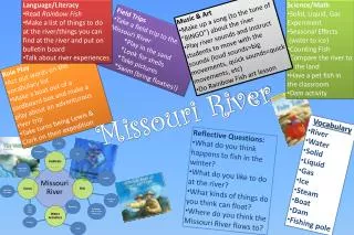
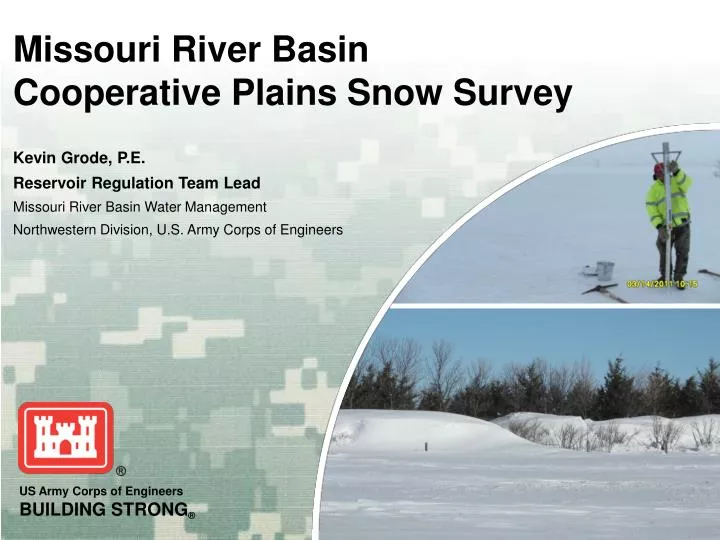
Missouri River Basin Cooperative Plains Snow Survey. Kevin Grode, P.E. Reservoir Regulation Team Lead Missouri River Basin Water Management Northwestern Division, U.S. Army Corps of Engineers. Cooperative Plains Snow Survey. Periodic plains snow survey Depth & SWE Two-week frequency

E N D
Missouri River BasinCooperative Plains Snow Survey Kevin Grode, P.E. Reservoir Regulation Team Lead Missouri River Basin Water Management Northwestern Division, U.S. Army Corps of Engineers
Cooperative Plains Snow Survey • Periodic plains snow survey • Depth & SWE • Two-week frequency • Standardized method & reporting • Volunteer surveyors • Northern Plains in Missouri Basin • Stationary sites where surveyors are available • Supports flood, runoff/water-supply, and reservoir release forecasts
Cooperating Agencies • State of North Dakota & South Dakota • County Emergency Managers • National Weather Service • U.S. Army Corps of Engineers • U.S. Geological Survey • Private citizens
Data Uses • NOAA Snow model verification (NOHRSC) • MRBWM short/long-term forecasting • Monthly volume forecasts • Modeled snowmelt runoff forecasting • Aid regulation decisions • Emergency management decisions
Survey Equipment • 40-inch snow tube* • Spring or digital scale • Sample bucket • Shovel • Snow survey data sheet • Pick axe * Omaha District design, locally fabricated
Survey Data #2 • Snow depth/water equivalent from composite sample • Frost depth & estimated soil moisture • Ground ice thickness #5 #1 #3 #4
2011 Survey Network • 77 individual locations sampled • 38 repeat locations • 27 supplemental locations • Surveyor profile • 6 USACE reservoir projects • 5 National Weather Service offices • 14 county and state governments or private citizens • Omaha District personnel
2012 Snow Survey • Surveys scheduled every two weeks from Jan. 3 – Apr. 2 • Due to lack of plains snow, surveys will commence if/when significant snow develops • Data posted to MRBWM website • Data will be shared with NOHRSC & all cooperators
Plains Snowpack20 January 2012 Source: NOAA - National Operational Hydrologic Remote Sensing Center
The Corps will provide a snow tube and digital scale. You provide a bucket and your time. We need volunteers!!
Missouri River Basin Snowmelt Models North Dakota Garrison Knife River Heart River Grand River Moreau River Fort Peck James River Big Sioux River Oahe Montana South Dakota Fort Randall Iowa Gavins Point Sioux City Wyoming Nebraska City Nebraska St. Louis Missouri Kansas Colorado
Gridded Snowmelt Modeling Gridded Temperature Gridded Precipitation NOHRSC SNODAS Model CRREL Gridded Snow Products + +
Assessing Runoff from Plains Snow • Modeling …Quality of input = Quality of output • Current conditions • Forecasted conditions • Basin / Climate Conditions • Conditions vary over large upper basin area • Soil moisture, frost depth, evapotranspiration • Land use changes (tiling, vegetation) • Weather forecast accuracy > 1 week • Collaboration / Patience