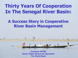
Senegal River Basin
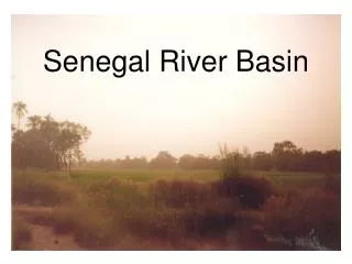
Senegal River Basin. Three main tributaries: Bafing Bakoye Faleme Basin divided into three areas: Upper Basin (mountains) Valley Delta (near mouth). Geographic Characteristics of Basin States. Country Profiles. Socio-Economic Characteristics.

Senegal River Basin
E N D
Presentation Transcript
Three main tributaries: Bafing Bakoye Faleme Basin divided into three areas: Upper Basin (mountains) Valley Delta (near mouth)
Socio-Economic Characteristics • Agriculture – “motor of development” in the basin especially in the valley and delta regions. Irrigation has led to improved technology and wider variety of crops that can be grown in the area. • Livestock – The raising of livestock and migration of herds is very important, especially for some ethnic groups • Fishing – Fishing is the largest economic activity in the basin after agriculture, especially in the delta and among the populations directly along the river. • Navigation – Navigation is currently very limited along the river. The basin states are eager to expand this area, especially by creating an access route to the Atlantic Ocean for Mali. • Industry – The industrial sector in the basin states is only slightly developed.
Water Resources Majority of the river’s flow originates in the Fouta Djallon Mountains in Guinea Natural flow is highly seasonable Two dams along Senegal River: Manantali (Mali) Diama (Senegal-Mauritania) Drinking water comes primarily from groundwater
Diama Dam – 1986, prevent dry season intrusion of saltwater, raise river level above dam for irrigation Manantali Dam – 1990, hydroelectric power (2001), storage of flood waters, augmentation of river flow during dry season
Milestones in Water Management • 1963 – Bamako Convention • 1968 – Labé Convention • 1970 – Dakar Convention • 1972 – Nuoakchott Convention: Organization for the Development of the Senegal River (OMVS)
Goals of OMVS • Food self-sufficiency in the basin • Reduced economic vulnerability to climatic fluctuations and external factors • Accelerate economic development • Conserve ecosystem balance in the basin • Secure and improve incomes of basin populations Principal interests of member states in OMVS • Mali – gain navigable access to ocean & energy production • Mauritania – power production & irrigation • Senegal – power production, irrigation & improving lives of local populations
Major OMVS Accomplishments • 1986 - Diama Dam • 1990 - Manantali Dam • 1997 - OMVS started to collaborate with the World Bank to develop a GEF project for the basin. • 1997 - Creation of two private companies to oversee management, operation, and maintenance of the dams. • 1998 – Environment Impact Mitigation and Monitoring Program created. • 2000 – Environmental Observatory established. • 2002 – OMVS created Senegal Water Charter • Current – A navigable channel is still under development
Dam Projects: Good & Bad • Changes in groundwater recharge patterns and amounts • Degradation of surface water quality and flood plain ecosystem • Provision of water during low-flow periods • Transition from saltwater to freshwater aquatic environments • Increase in prevalence of water-borne diseases • Decrease in productivity • Inaccessibility of irrigation systems/techniques by poorer populations
What are the benefits and constraints of allocating water on a use basis rather than a volume basis (fixed or percentage)? What factors should be included when prioritizing different uses? The OMVS is comprised of only 3 of the 4 basin states. What impact does Guinea’s absence have on the basin’s development? Should action be taken to mitigate the negative effects of the dams? How do you balance the positive and negative impacts?
Both the Manantali Dam and the Diama Dam are owned and controlled by all three basin states even though one of them is located entirely within one of the countries. What benefits does this have? What problems could it pose? What measures should be taken to help ensure successful projects in this basin in the future? What role should international aid and development organizations play in helping developing countries with regard to their shared water resources?