Download
1 / 81
890 likes | 1.28k Views
How to Analyze Maps & Atlases. How to Analyze Maps & Atlases. What is a map? As a class, try to agree on the word’s definition. Maps versus Globes. What is the difference between a globe. Maps versus Globes. ...and a map?. Maps versus Globes. Map Projections. Mercator projection.

E N D
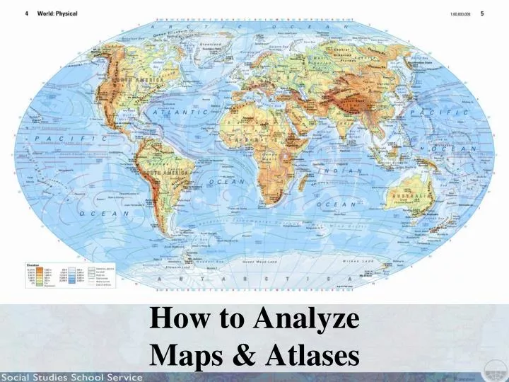
How to Analyze Maps & Atlases What is a map? As a class, try to agree on the word’s definition.
Maps versus Globes What is the difference between a globe...
Maps versus Globes ...and a map?
Map Projections Mercator projection
Map Projections Robinson projection
Map Projections Interrupted Goode homolosine projection
Map Projections What advantage does the Mercator map have, and what disadvantages?
Map Projections In a Mercator projection, directions and shapes are accurate near the equator, but shapes far from the equator grow increasingly distorted in size.
Map Projections A graphic representation of stretching in the Mercator projection
Map Projections In a Robinson projection, angles and areas do not conform to reality, but gently curving meridians avoid extreme distortion except close to the poles.
Map Projections Compare the above projections with the interrupted Goode homolosine projection to the right.
Atlases What is an atlas? What would you expect to find in an atlas?
Latitude and Longitude You may have studied latitude and longitude in other classes. Do you remember which is which?
Latitude and Longitude What is the black arrow pointing to? How many degrees of latitude is this line?
Latitude and Longitude What is the black arrow pointing to? How many degrees of longitude is this line?
Latitude and Longitude Which measurement—latitude or longitude—gives us more information about the climate and weather in a place? Why?
Latitude and Longitude Which place do you think would have a warmer climate: 10° south or 20° north?
Latitude and Longitude What does jet lag have to do with latitude and longitude?
Different Types of Maps What type of map is this? What kinds of information does this map provide?
Different Types of Maps What type of map is this? What kinds of information does this map provide?
Different Types of Maps What type of map is this? Who might find this map useful?
Different Types of Maps: Thematic Maps What are some of the first things you notice about this map? What do you think this map is telling you?
Map Legends Thematic maps generally have legends that explain what the maps show.
Map Legends According to this legend, what do the different colors on the map represent?
Map Legends What do you think this part of the legend means?
Map Legends What are the population densities of these regions?
Map Legends What factors might explain why northern India is so densely populated?
Map Legends How densely populated is Alaska?
Map Legends Discuss the world’s patterns of population density.
Map Scale What is the scale of this world map?
Map Scale What is the scale of this Soviet map of the Tora Bora region of Afghanistan?
Map Scale What is the scale of this CIA map of Iran?
Map Scale What is the scale of this map of New Orleans?
Deciphering Maps: Ecozones Look at another thematic map. This one shows Earth’s ecozones.
Deciphering Maps: Ecozones What patterns do you notice?
Deciphering Maps: Ecozones Ecozones map legend
Deciphering Maps: Ecozones Tundra
Deciphering Maps: Ecozones Where do you see the tundra ecozone? What do you think the tundra ecozone might look like? What clues do you see on the map to help answer this question?
Deciphering Maps: Ecozones Tundra
Deciphering Maps: Ecozones Deserts and xeric shrublands
Deciphering Maps: Ecozones Deserts and xeric shrublands
Deciphering Maps: Ecozones Deserts and xeric shrublands
Deciphering Maps: Ecozones Ecozones map legend
Deciphering Maps: Ecozones Tropical rain forest
Deciphering Maps: Ecozones Mediterranean zone
Deciphering Maps: Ecozones How do you think this map might be useful?
Deciphering Maps: Ecozones Tropical grasslands


![Making maps, many maps! [What is GIS?]](https://cdn1.slideserve.com/3592384/making-maps-many-maps-what-is-gis-dt.jpg)