Download

1 / 11
150 likes | 650 Views
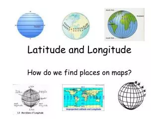
Latitude and Longitude. Using the Global Grid. Latitude and Longitude are imaginary lines that we use to identify places on a map or a globe. What are latitude and longitude?. What are latitude and longitude?.

E N D
Latitude and Longitude Using the Global Grid
Latitude and Longitude are imaginary lines that we use to identify places on a map or a globe. What are latitude and longitude?
What are latitude and longitude? You use latitude and longitude to say where something is, such as a city or a mountain. 090W 088W 086W 084W 082W 46N 44N 42N
Latitude measures angular distance North or South of the Earth’s Equator, in degrees, minutes, and seconds. • Latitude is represented by horizontal lines on a map. • The Earth’s Equator is zero (0°) degrees latitude, the North Pole is 90 degrees North latitude, and the South Pole is 90 degrees South latitude. North Pole: 90° North Parallels of Latitude Other parallels of latitude Equator: 0°
Longitude measures angular distance East and West, in degrees, minutes, and seconds. • Longitude is represented by vertical lines on a map. • Long ago, people agreed to use the line of longitude that runs through Greenwich, England, as zero degrees (0°). All other lines of longitude are either East or West of 0°, and go to 180° in each direction. • Lines of longitude are like sections ofan orange; they meet at the poles. Lines of Longitude Longitude lines meet at the North and South poles 0° longitude
What are the red lines on this map called? Latitude Longitude
What are the red lines on this map called? Latitude Longitude
What do we call 0° latitude? North Pole Equator South Pole
Through what city does 0° longitude pass? Tokyo, Japan New York, NY, USA Greenwich, England
132E 00’ 132E 30’ 133E 30’ 133E 00’ 134E 00’ 34°00’N 33°30’N On the map below, a mountain is located near 33°30’ North latitude and 133°00’ East longitude. The red dot shows where it is. 33°00’N
On the map below, draw dots at these locations: 34° North latitude and 133° East longitude 33° North latitude and 133° East longitude 33°30’ North latitude and 132°30’ East longitude 132E 00’ 132E 30’ 133E 30’ 133E 00’ 134E 00’ 34°00’N 33°30’N 33°00’N