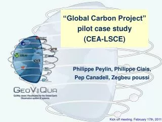
“Global Carbon Project” pilot case study (CEA-LSCE)
250 likes | 357 Views
This study, part of the Global Carbon Project, focuses on the development of quality-aware visualizations for assessing perturbations in the global carbon budget from 1850 to 2006. It examines fossil fuel emissions, deforestation impact, and atmospheric CO2 fluxes. The analysis incorporates land and ocean models, emphasizes data quality, and explores methodologies for improving carbon flux estimates. The project promotes better understanding of carbon sources and sinks while addressing uncertainties and facilitating enhanced product evaluation across various models.

“Global Carbon Project” pilot case study (CEA-LSCE)
E N D
Presentation Transcript
“Global Carbon Project”pilot case study(CEA-LSCE) Philippe Peylin, Philippe Ciais, Pep Canadell, Zegbeu poussi QUAlity aware VIsualisation for the Global Earth Observation system of systems
Perturbation of Global Carbon Budget (1850-2006) 2000-2006 fossil fuel emissions 7.6 ? Source deforestation 1.5 CO2 flux (Pg C y-1) atmospheric CO2 4.1 Sink land 2.8 ocean 2.2 Time (y) Canadell et al. 2007, PNAS Kick off meeting. February 17th, 2011
Global Carbon Project ? Kick off meeting. February 17th, 2011
Global Carbon Pilot case • Which products can we provide ? (based on models & data) • What are the associated Quality Data ? (still “poorly” developed) • What are the potential Metadata ? Kick off meeting. February 17th, 2011
Global carbon product Direct Model simulations Data – fusion approaches Meteo forcing & surface description Land surface & ocean models Estimated surfaceC fluxes
Direct estimates of Carbon fluxes Global land ecosystem model simulations Global ocean model simulations • Several Productwith different data Quality Kick off meeting. February 17th, 2011
Land ecosystem model simulations Estimated surfaceC fluxes Meteorological forcing Land surface model Land surface Description (Veg. soil,..) • Several model simulations (TRENDY / RECCAP project) • For each model possibly several simulations (different forcing) • Product: - Global annual/monthly C fluxes • - Derived quantities: Trend in land C-sinks • Quality data : - on the input data (forcing , land cover) • - derived from the multi-model realization • Metadata : - information on the protocol & models Kick off meeting. February 17th, 2011
Quality of product • usually arise from: • evaluation against other estimates/proxy • potentially error propagation • Assessment of model strength • How to use multimodel ?
Product Evaluation as a Quality measure Diagnose Trend in Land fluxes Evaluation against other products ? (i.e. EO data) How to facilitate the link with other products ? • Climate data • land cover changes/use • forestry data • biomass burning • soil data (moisture) • crop yields
Case of Data-Assimilation: atmospheric inversion… Prior flux information Transport model Atmospheric data Inverse optimization Optimized fluxes Several approaches • Flux resolution • Transport model • Level of prior inform. • Optimization algorithm key features • Combination of 2 sources of information ! • Only ~ 100 stations for many fluxes to solve for
Global carbon pilot case Data availability Surface flux Maps (3D) : - weekly to monthly resolution - common grid : 1x 1 degree - several variables (Net flux, Gross fluxes, …) Spatially integrated fluxes : - Time series for a set of regions - different temporal filtering (trend, smooth curve,..) Kick off meeting. February 17th, 2011
Global carbon pilot case Associated Quality Data (mainly uncertainties) Surface flux Maps (3D) : - uncertainties (in the form of std-dev) (often at lower temporal resolution) - use the spread between the different estimates Not yet completely defined ! Spatially integrated fluxes : - Uncertainties for each time step - error covariance matrix at low temp. resol. - use the spread btw estimates + individual errors Kick off meeting. February 17th, 2011
Global carbon pilot case Associated Metadata Input data : Text description of the input data Model (Data Assimilation system) flow chart, little text documentation…. description of the “uncertainty calculation” Estimated fluxes & uncertainties : possibly “qualitative description of accuracy” as a function of space & time aggregation. Kick off meeting. February 17th, 2011
Carbon fluxes interannual variations N. America N. Atlantic ? LSCE_var_v1. C13_MATCH CTracker_US LSCE_an_v2.1 JENA_s96_v3.2 CTracker_EU TRCOM_me RIGC_patra JMA_2010 C13_CCAM NCAM_Niwa How to associate a Quality Measure ? N. Asia Europe ? ? Kick off meeting. February 17th, 2011
RMSE estimate Mean flux estimate • Estimates are not independent ? • Uncertainty on the uncertainties is very large ! Quality indications from model spread ?
Summary …. • Carbon flux products : increasing number but no common visualization framework • As part of GCP we can provide a large set of fluxes & some associated errors, few metadata... • How to use the tools from GeoViQua ? • Incorporate them in our Portal Developments • or provide the datasets to GeoViQua ? • Large volume of netcdf files… • We need tools to derive overall quality measures from different estimates (with different uncertainties) and to display them.. • We are seeking for a Post-doc….
Carbon Cycle Web portals Kick off meeting. February 17th, 2011
Global Carbon Project Kick off meeting. February 17th, 2011
GCP: atmospheric data • In situ data • - very accurate but sparse • - spatial representativity ? • - Instrumental failure ? • - Quality Data exist..(visualisation under progress) • satellite data • - accuracy issues (biases) ! • - accuracy might vary with space • - cloud/aerosols… contamination Kick off meeting. February 17th, 2011
Carbon Tracker Web site (US) N. America ? Kick off meeting. February 17th, 2011
GEO carbon agenda….. • Record changes in atmospheric CO2 • Estimate fossil and land use derived emissions • Understand land and ocean carbon sinks • Measure fluxes/concentrations • Understand processes • Model time & space evolution in order to predict future of the Earth System Kick off meeting. February 17th, 2011
Model uncertainties (Baye’s theorem) Uncertainties Model – Data fusion(4D var scheme) Data uncertainties Data uncertainties Variational / Matrix / approaches Flux uncertainties difficult to estimate ! Model – Data Fusion for GCP Kick off meeting. February 17th, 2011
GCP: Land ecosystem data • satellite data • - accuracy vary with space.. • - saturation signal with veg. activity • - link to vegetation function ? • In situ data • - very accurate but sparse • - spatial representativity ? • - “Quality” not well quantified.. Kick off meeting. February 17th, 2011
Global Carbon Project Kick off meeting. February 17th, 2011
GCP: Ocean data • Ship data • - accurate but sparse • - spatial representativity ? • - Spatial coverage ? • satellite data • - accuracy issues (biases) ! • - link to ocean biogeochemistry ? Kick off meeting. February 17th, 2011