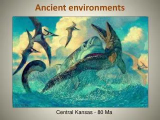
Interpreting Ancient Environments
Interpreting Ancient Environments. Lab # 3. Introduction. Stratigraphy – the bra nch of geology that deals with the study of layered rocks or strata The fundamental unit of rocks used in stratigraphy is the formation

Interpreting Ancient Environments
E N D
Presentation Transcript
Introduction • Stratigraphy – the branch of geology that deals with the study of layered rocks or strata • The fundamental unit of rocks used in stratigraphy is the formation • Formation– is a body of rock that has enough distinctive characteristics so that it may be mapped as a unit • Lithology – the rock type • Contacts – boundaries between formations • Stratigraphic section – a vertical sequence of rock units • Correlation – the determination of the equivalency of widely separated rock units
Correlation • Geologists may correlate formations based on: • Age – chronostratigraphic units • Rock Type – lithostratigraphic units or • Fossils – biostratigraphic units • From correlation of stratigraphic units we can obtain information on … • relative ages of the units • depositional environment • tectonic setting and • climate
Use of Fossils in Stratigraphy • Guide Fossils……. aka index fossils • Widely distributed • Existed for a short geologic time span • Especially useful as stratigraphic indicators
Biostratigraphic Correlation • Determining the equivalency of widely separated rock units by using fossils • Geologists use fossil assemblages, first occurrence and/or last occurrence of particular fossils to make this type of correlation • Usually the boundaries of these first and last occurrences and the overlapping ranges of fossil assemblages are shown to be of the same age worldwide • When this happens, the biostratigraphic correlation is also indicating a time correlation
Biozone • When a biostratigraphic correlation also shows a time (chronostratigraphic) correlation geologists refer to this as a biozone when they use fossils to indicate a restricted time interval.
Geologic ranges • Important points when doing biostratigraphic correlations: • Many organisms are only able to live in particular habitats • For this reason – these organisms may not appear in some rock units because they could not have survived the environment • Trace fossils (like burrows) or weathering may make it appear as if fossils are in rocks outside their geologic range
Correlating Stratigraphic sections • To correlate stratigraphic sections… • First determine which units are equivalent • Look at sequences of beds • Draw lines from contact to contact • When correlating unconformities - connecting lines should be wavy
Sedimentary facies • Stratigraphic sections are used to gain information of paleoenvironments • “Sedimentary facies” describes the characteristic sedimentary bodies or sedimentary rocks deposited in an environment • Example: near shore beach environment = sand facies • playa lake = evaporite facies • deep ocean = carbonate facies
Transgressive/regressive • Vertical sequences of rock that indicate a lowering of sea level are called regressive sequences • Vertical sequences of rock that indicate a rising sea level are called transgressive sequences • Both represent a change in sea level through time • Changes in sedimentary facies will also result in changing rock type BUT these change will occur laterally, representing a simultaneous deposition of rock in different environments.
Epeiric Sea • Throughout geologic time, sea level has risen and fallen many times. • When sea level rises and covers continental crust that sea is called an epeiric sea…. In order to distinguish it from ocean water that is above oceanic crust
Cratons • tSedimentaryrocks deposited by epeiric seas record he history of transgressions and regressions onto the stable part of a continent called a craton • There are six major epeiric seas that have transgressed onto the North American craton during the Phanerozoic. • Sedimentary rocks deposited by these epeiric seas are called cratonic sequences.