Download
1 / 40

E N D
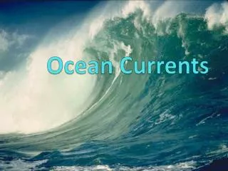
OCEAN CURRENTS
PHENOMENA How do these two places, even though they are both on the coast of the Atlantic Ocean and on the same latitude, have different climates? North Atlantic LISBON, PORTUGAL North Pacific North Pacific MARYLAND South Pacific South Atlantic Indian Ocean South Pacific
Ocean Currents A current is a stream of moving water that flows in one direction.
BrainPOP Ocean Currents https://www.brainpop.com/science/earthsystem/oceancurrents/
Glossary CLIMATE WEATHER prevailing (average) weather patterns for a particular region daily state of the atmosphere DENSITY CONVECTION SALINITY THERMOHALINE How much mass there is in a particular space- Warm water is less dense than cold water. Fresh water is less dense than salt water. heat transfer from rising, hotter, less dense fluids and falling, cooler, denser fluids The dissolved salt content of a substance controlled by both temperature and salinity - thermohaline circulation is a major, deep ocean current that moves energy from the tropics to the poles
Glossary OCEAN CURRENTS DEEP OCEAN CURRENTS SURFACE OCEAN CURRENTS Coriolis Effect Directional movement of water from one location to another in a predictable pattern Result from differences in density due to temperature and salinity differences Result from steady winds over the ocean surface Different areas of Earth’s surface absorb varied amounts of solar radiation, resulting in a series of convection cells that form at various latitudes on Earth. These wind cells spin clockwise north of the equator and counterclockwise south of the equator due to Earth's rotation in a process called the Coriolis effect. The blue lines in this image show the movement of cold ocean currents, and the red lines show the movement of warm ocean currents. This planetary current pattern is called the global or great ocean conveyor belt. OCEAN’S CONVEYOR BELT
OCEAN CURRENTS: Labeled ocean current movement NORTH POLE WARM CLOCKWISE COLD EQUATOR EQUATOR COUNTER- CLOCKWISE WARM COLD SOUTH POLE
2 El Niño & La Niña
OUTCOME ESSENTIAL QUESTION I Can: Describe what effect ocean currents have on weather and how shifts in ocean currents affects weather. What would happen if surface ocean currents were reversed? If the direction were to change, the wind would reverse the current, pulling it counterclockwise and releasing the water it has accumulated all at once.
PHENOMENA What is El Niño? • El Niño is a change in currents that results in warmer water along the West Coast of the United States. It’san abnormal weather pattern caused by the warming of the Pacific Ocean near the equator, off the coast of South America. The sun warms the water near the equator, which can make more clouds and, therefore, more rain. However, normally there are trade winds, which blow that warm water west. During El Niño, though, those trade winds weaken, or even reverse, which lets the warm water that is usually found in the western Pacific remain or flow east. This warm water displaces the cooler water that is normally found near the surface of the eastern Pacific, setting off atmospheric changes that affect weather patterns in many parts of the world.
A temperature increase of least 0.9 F (0.5 C) needs to occur in the waters of the eastern Pacific Ocean near the equator for it to be considered an El Niño year. Although El Niño does not occur in a perfectly regular pattern, it seems to happen every 2 to 7 years. Following an El Niño, an opposite phenomenon occurs, called La Niña. During La Niña, the eastern Pacific Ocean experiences cooler than normal temperatures around the equator. Along the Pacific coast of the Americas, El Niño can cause severe storms and flooding. Peru and Ecuador usually receive the brunt of the force of El Niño. During the months of April - October, this area experiences increased rain fall. El Niño's effects are not only felt through rain. In normal years, along the coast of Peru, cool, nutrient-rich water is pushed up from the deep waters off the Pacific coast, and this nutrient-rich water is a food source for marine life. However, during an El Niño year, this cold water is replaced by warmer water that lacks those important nutrients. The nutrient-deficient water starves the bottom of the food chain and the effects cause a die-off of larger fish. https://www.youtube.com/watch?v=ifGOjSTwbM8
Sea Lions https://app.acceleratelearning.com/media_assets/350
https://aacps.discoveryeducation.com/learn/player/32440eb0-1862-4a91-8306-1c5e3e420544https://aacps.discoveryeducation.com/learn/player/32440eb0-1862-4a91-8306-1c5e3e420544 DISCOVERY EDUCATION El Niño Pacific Wind & Current Changes Bring Warm, Wild Weather Directions: Read Discovery Education’s El Niño and complete an AVID One-Pager*
What is the cause and effect relationship between the water cycle and a hurricane? Hurricanes are severe storms with high-velocity winds that rotate around a central, low-pressure core. In order for a hurricane to form, two things must be present: a weather disturbance, such as a thunderstorm, that pulls in warm surface air from all directions water at the ocean’s surface that is at least 80° Fahrenheit (27° Celsius) Because it is the interaction of warm air and warm seawater that spawns these storms, they form over tropical oceans between about 5 and 20 degrees of latitude. At these latitudes, seawater is hot enough to give the storms strength and the rotation of the Earth makes them spin. Hurricanes start simply with the evaporation of warm seawater, which pumps water into the lower atmosphere. This humid air is then dragged aloft when converging winds collide and turn upwards. At higher altitudes, water vapor starts to condense into clouds and rain, releasing heat that warms the surrounding air, causing it to rise as well. As the air far above the sea rushes upward, even more warm moist air spirals in from along the surface to replace it.
As long as the base of this weather system remains over warm water and its top is not sheared apart by high-altitude winds, it will strengthen and grow. More and more heat and water will be pumped into the air. The pressure at its core will drop further and further, sucking in wind at ever increasing speeds. Over several hours to days, the storm will intensify, finally reaching hurricane status when the winds that swirl around it reach sustained speeds of 74 miles per hour or more. In simpler terms: The Sun's heat warms ocean water and creates water vapor through the process of evaporation. When water vapor condenses in the atmosphere, it releases heat that helps to fuel storms. https://mpt.pbslearningmedia.org/resource/nves.sci.earth.hurricane/water-vapor-fuels-hurricanes/