Download
1 / 48
480 likes | 495 Views
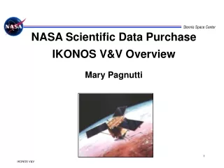
NASA Scientific Data Purchase IKONOS V&V Overview Mary Pagnutti. Stennis Space Center. NASA Scientific Data Purchase (SDP). Began with $50 Million appropriation for NASA purchase of scientific data sets for commercial sources Goal: Test new way of doing business; tap new sources of data

E N D
NASA Scientific Data PurchaseIKONOS V&V OverviewMary Pagnutti
Stennis Space Center NASA Scientific Data Purchase (SDP) • Began with $50 Million appropriation for NASA purchase of scientific data sets for commercial sources • Goal: Test new way of doing business; tap new sources of data • Managed by NASA Commercial Remote Sensing Program, Stennis Space Center, MS • Phased Approach • Phase I - simulated / prototypical data sets received and reviewed • Phase II - selection of products and data purchase over 3 years • Firm fixed price contracts - cash on delivery of data
IKONOS SDP V&V Philosophy • Perspective: SDP is an experiment • Can the commercial sector provide useful, cost effective data to the science community? • Only one satellite (no backup), buy data while we can • Assumptions • Space Imaging will attempt to provide high quality data • NASA Stennis will trust but verify • Releasing data in a timely fashion is important • Feedback from users is important • Competition is developing • Earth Watch, Orbital, Russian Spin Data, West Indian Aerospace • Methodologies developed will be used again.
IKONOS V&V Activities Performance Product V&V Characterization (Sample V&V data sets) • Shipment Verification • (All acquired data sets) • Data Format • Meta File • Location / Coverage • Cloud Cover • General Statistics • mean • standard deviation • pixel histogram • fraction of saturated • pixels • Auto Report generation • Thumbnail generation • Band-to-band registration • MODTRAN / radiance • intercomparison • NIIRS evaluation when • appropriate • Product Characterization • (Sample V&V data sets) • Image Quality • Spatial • SNR • Geometric Accuracy • Positional Accuracy • DEM evaluation • Radiometric • Performance • Spectral • Characterization • Applications Utility • (Sample V&V data sets) • University of Maryland • assessment • Obtain feedback from • ESE Researchers
Joint Agency Commercial Imagery Evaluation (JACIE) Team Formed • Joint NASA / NIMA / USGS team focused on characterizing commercial remote sensing system performances • Overall performance assessment to meet each agency’s mission requirements • NASA - System Characterization • NIMA- Photogrammetry • USGS - Cartographic Assessment • Improved communications with industry • More productive interchanges between industry and government • Minimize duplication of effort • Reduction in costs incurred by industry and government IKONOS one meter panchromatic image of Jefferson Memorial in Washington, D.C.
SCIENCE USERS EOS Validation Teams U of Maryland U of Arizona S.Dakota State U SDP IKONOS Characterization Team JACIE TEAM
IKONOS Validation Sites Stillman Creek SDSU USGS-EDC Lake Tahoe Morrison Quad. Konza Prairie Beltsville Railroad Valley Lunar Lake Kaintuck Hollow Quad Ivanpah Sevilleta U of A WSMR Big Springs Maricopa SSC
NASA Stennis Space Center, Mississippi Site: Scattered buildings within heavily wooded area, man-made reservoirs and canal. Elevation 5.5m - 10m. 30.388 degrees N, 89.61 degrees W Purpose: Spatial, geometric and radiometric characterization, BRDF evaluation. • Targets: • 2 orthogonal concrete edge targets (70x80m • oriented E-W, 80x80m oriented N-S) 130m • concrete radial target (96.4 deg arc, 0.08-5.0m • range), 4 step concrete grayscale target (35x40m • each) • over 40 known GPS markers known to within 2 cm • 4 step gray tarps (20mx20m each) IKONOS Image Area Concrete edge, radial and 4 step grayscale targets In-Situ Instrumentation: Cimel Sunphotometer, Shadowband Radiometer, ASD and GER Spectro- radiometers, SSC Weather Station, Radiosonde balloon launch,Pyronometer, Goniometer. Radiometric Tarp Coupons ATLAS image and showing known GPS points at SSC Coincident Collects: Landsat 7
Big Springs, TX Edge Target • Three 15 m x 15 m squares • Northing and easting edges allow MTF analyses in two directions • Edges are aligned approx 8 deg off true north and true east IKONOS Panchromatic Band
Uniform Sites Selection for SNR • Utilize NASA Scientific Data Purchase EarthSat Databuy • TM data for Africa • 30 meter GSD data • Develop algorithms to find most uniform scenes for Radiometry & SNR estimates African Map with Sites Libya TM Scene Tight Gaussian Histogram Indicate Uniform Scenes
Geometric Accuracy Characterization * 90% circular error
Geometric Accuracy Assessment • USGS EROS Data Center • Brookings, South Dakota (SDSU) • Sioux Falls, South Dakota (EDC) • Each site surveyed 50+ points throughout 11x11 km scene • USGS • Morrison Quad • Kaintuck Hollow Quad • Utilize USGS database for both sites • NASA CRSP • Stennis Space Center • Utilize site survey & Geodetic Targets Brookings South Dakota Fast Static Survey Checked to less than five cm. horizontal using two Trimble 4000ssi units over B Ordermonuments.
Radiometric Vicarious Calibration Approaches • Reflectance Method • Measurement of ground reflectance and atmospheric properties allows prediction of Top-of-the-Atmosphere (TOA) radiance estimates • Typically require ground teams and a great deal of coordination • Radiance Method • Coincident collect with well characterized airborne or satellite system
Commercial Satellite Reflectance Method Radiosonde Balloon Spectroradiometer Sun Photometer Method: Utilize ground reflectance measurements (Spectroradiometer) and atmospheric measurements (Sun Photometer & Radiosonde) to determine radiometric accuracy of new commercial satellite systems (IKONOS)
Commercial Satellite Radiance Method Well Characterized System (Aircraft or Satellite) Method: Utilize coincident airborne or spaceborne calibrated imagery (e.g. Landsat 7) to determine radiometric accuracy of new commercial satellite systems (IKONOS)
IKONOS Characterization Status • Spatial Characterization • Three acquisitions have been made (received std original imagery only) • Four SI archive images have been acquired • Two acquisitions are pending collection • Awaiting two precision original images • All but one image has been evaluated • Geometric Characterization • Three acquisitions have been made (received std original imagery only) • Two acquisitions are pending collection (same as above) • Two DEM acquisitions scheduled for spring 2001 • Two have been evaluated • Radiometric Characterization • Six acquisitions have been made and evaluated (received std original imagery only) • Two acquisitions are pending collection (same as above)
IKONOS Characterization Summary Preliminary Findings: • Geometric Characterizations show imagery is well within specification • Spatial Characterizations indicate imagery meets MTF and SNR specifications • Radiometric Characterizations indicate potential concerns with the red and NIR bands • No serious issues associated with on-board compression have been found
Stennis Target Set Positive Systems Image Expanded View of Target EdgeTarget: 70x80 meters and 70x70 meters 8:1 contrast ratio
Edge Response Focal plane array undersamples edge with classical cross section sampling Solution: Sample tilted edge to improve sampling Foot Print
Modulation Transfer Function • MTF is a measure of an imaging system’s ability to recreate the spatial frequency content of scene MTF is the magnitude of the Fourier Transform of the Point Spread Function / Line Spread Function. 1.0 MTF Cut-off Spatial frequency
SNR Estimate Example Results Histograms of Mean/Std of 5x5 Pixel Blocks TM data Location of Histogram Peak is a measure of the SNR
GPS Accuracies • Trimble Pathfinder or Geo Explorer • Raw - 10 meters • Coarse mode corrected - 5 meters per measurement reading • Coarse mode corrected - averaging data 2 meter • Fine mode corrected - averaging 10 minutes of differentially corrected data gives sub-meter Pathfinder Geo Explorer
Radiometric Error Associated with Finite Size Tarp Finite Size of Tarp will limit Radiometric Accuracy Simulated 20 m Tarp Image with 4 m GSD with MTF @ Nyquist of 0.1 Insert Measured Reflectances Figures Cross Sectional Plot of Response For typical background/tarp reflectances, the error at the center pixels will be less than a few percent
CRSP Tarp Sample Data Tarp Sample Data Reflectance Data Tarp Samples are Spectrally Flat Over Region of Interest
GPS Accuracies • Trimble 4000ssi Survey grade GPS units • Static survey- 5mm + 1ppm in base line distance. • Fast Static - Based on conditions and Satellite geometry • Real Time Kinematic (RTK) - less than five centimeters horizontal and vertical Brookings South Dakota Fast Static Survey Checked to less than five cm. horizontal using two Trimble 4000ssi units over B Ordermonuments.
Radiometric Vicarious Calibration Background • Radiometric stability of remote sensing data is critical for long term studies • On-orbit calibration sources are not always stable or reliable • Methods which independently verify the radiometric calibration of remote sensing data are essential • Vicarious calibrations use natural well characterized scenes
CRSP Radiometric Tarp Sample Examination <5% 20% Samples were obtained of the 4 grayscale radiometric tarps procured by CRSP. These samples were tested in the laboratory under conditions similar to those encountered in the field. These tests were performed to evaluate specified reflectivity values. 30% 50% 4” tarp Samples
Desired Calibration Site Characteristics • Bright and Uniform • High reflectance minimizes atmospheric uncertainties • Uniformity allows statistically meaningful results • Stable • Long term studies are facilitated with stability • Low Precipitation and Cloud Cover • Maintains stability and increases chance of acquisition • Large • Several swath widths in extent or more to avoid adjacency effects
SDP Shipment Verification • Shipment content and media count • Mission document review • Approximate geographic coverage • Comparison with original task order • File readability • General image quality • 100% visual inspection of JPEG quicklooks • Discrepancy report (As Needed) • Shipment tracking database • Shipment verification report
NASA IKONOS V&V Focus IKONOS Data Product Characterization 1m GSD PAN 4m GSD MS • MTF and spatial resolution • SNR estimates • Geometric accuracies of imagery • Radiometric accuracies of products • Band-to-band registration of multispectral products • Intercomparison of IKONOS, Landsat 7 and other • satellite imagery Quantitative System Characterizations:
IKONOS Spectral Bandpasses Provided by Space Imaging
Calibrated Satellite Commercial Satellite Well Characterized Site Method Method: Utilize well characterized satellite systems (Landsat-7), not necessarily coincident, and well characterized sites (African deserts) to determine the radiometric accuracy of new commercial satellite systems (IKONOS)
NASA CRSP Tarps • Portable radiometric characterization of 4 m class GSD systems and smaller • MTF characterization of 1 m class GSD systems and smaller • SNR estimation on 1 m class GSD systems • Fiducial markers for remote uniform sites
CRSP Tarp Specifications • Spectral Uniformity • <10% variation/100 nm band • Deployability • Less than 2 hours with 2 people in less than 3m/s wind • Maintainability • Meet Specifications for 60 Deployments or two years which ever comes first • Size and Shape • 20 m x 20 m • Reflectivity • Spectral Range 400-1000 nm • Tarp 1 < 5 % • Tarp 2 20-25 % • Tarp 3 30-40 % • Tarp 4 50-55 % • Spatial Uniformity • Standard deviation of 9 equally space reflectivity measurements <1% of absolute reflectance