Download
1 / 10
120 likes | 327 Views
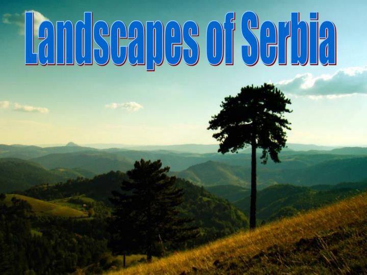
Landscapes of Serbia. Introduction. Located at the crossroads between Central and Southern Europe, Serbia is found in the Balkan peninsula and the Pannonian Plain. The Danube passes through Serbia with 21% of its overall length, joined by its biggest tributaries, the Sava and Tisza rivers.

E N D
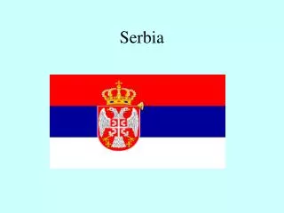
Introduction • Located at the crossroads between Central and Southern Europe, Serbia is found in the Balkan peninsula and the Pannonian Plain. The Danube passes through Serbia with 21% of its overall length, joined by its biggest tributaries, the Sava and Tisza rivers. • The province of Vojvodina covers the northern third of the country, and is entirely located within the Central European Pannonian Plain. • Serbia is a landlock country ( it has no exits on sea) , although access to the Adriatic is available through Montenegro, and the Danube provides shipping access to theBlack Sea.
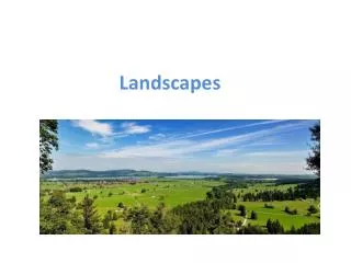
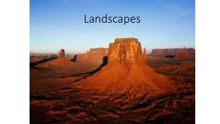
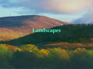
Terrain • Serbia's terrain ranges from rich, fertile plains of the northern Vojvodina region, limestone ranges and basins in the east, and in the southeast ancient mountains and hills. • In Central Serbia, the terrain consists chiefly of hills, low and medium-high mountains, interspersed with numerous rivers and creeks. • In the East of it, the terrain quickly rises to limestone ranges of Stara Planina (" Old Mountain") and Serbian Carpathians, relatively sparsely populated. • In the West, the height of mountains slowly rises towards southwest, but they do not form real ridges. The highest mountains of that area are Zlatibor and Kopaonik. Vojvodina Šumadija [ʃumǎdija] Zlatibor Stara planina (" Old Mountain")
Mountains • Mountains cover the largest parts of the country. Four mountain systems meet in Serbia: Dinaric Alps (Prokletije, Šara Mountain, Tara, Kopaonik...) in the west cover the greatest territory, and stretch from northwest to southeast. • Carpathian ( Miroč, Deli Jovan) and Balkan Mountains ( Old mountain, Ozren...) stretch in the northsouth direction in eastern Serbia, west of the Morava valley. • Ancient mountains along the South Morava belong to Rilorhodope Mountain system (Jastrebac, Ruj Mountain...). Tara Prokletije
Rivers • Serbia is rich in all kinds of rivers. There are small and fast, emerald green mountain rivers, and big and slow plain rivers, like the Danube, which is las arge as the sea near Golubac fort... • Down the beautiful rivers of Drina, Uvac, Lim and Ibar you can enjoy rafting. There are organized regional sailing races along some rivers and the international one along the Danube. • Serbian part of the Danube is navigable and sailing on the Danube is like sailing through the history because a lot of remains of old civilizations can be seen along the river . Jerma River Great Morava Uvac
Zlatibor • Zlatibor is a mountain region situated in the western part of Serbia, a part of the Dinaric Alps. • The highest peak is Tornik at 1496m. • Zlatibor is administratively divided into three municipalities within Serbia: Čajetina, Užice and Nova Varoš. • Flattened surfaces without higher elevations on Zlatibor are called pastures. • Zlatibor Hills are mostly cone shaped, spreading in a brow like way and very sharply descending down to creeks and rivers, from where they again rise, making narrow gulches. • In Ribnica there is an artifical lake from which supplies Zlatibor with water. Lake Ribničko
Đetinja • Đetinja (pronounced [d͡ʑě̞tiɲa]) is a river in western Serbia, a 75 km long natural but shorter headstream of the Zapadna Morava River. • According to the legend, the Ottoman Turks in the times when they ruled these lands, once punished the local n people by taking their children and brutally throwing them into the river. Because of that the river was named Đetinja (meaning of the children). • The Đetinja River originates from the northern slopes of Mount Zlatibor, in western Serbia. From the source to its mouth, the river flows in the eastern direction. First, it runs through the small Kremna depression, between the Tara and Zlatibor mountains, following the northern border of Mt. Zlatibor.
Šumadija • Šumadija (pronunciation: [ʃumǎdija]) is a geographical region in Serbia. The area is heavily covered with forest(šuma), hence the name Šumadija. • Mountains in Šumadija are beautiful in the summer when they show green, but also in the autumn because of the leaves that make contrasts of various colours. • It has a special place in Serbian history because the first Serbian uprising against the Turks started here(in Topola). • Two curvy rivers pass through this region (Uvac and Gradac), they make amazing gulches that won’t leave you indifferent. Gradac River
Vojvodina • Just a couple of hours driving from Belgrade towards the north of Serbia brings us to the heart of Vojvodina,picturesque lowland known by fertile soil and pleasant, calm people. • Vojvodina is mostly covered by plains that were formed after the flowing of the Panonian sea, but its landscapes aren’t monotonous. This monotony is broken with two mountains, whose highest peaks bearly cross the top limit of hills, give special look to the southeast Banat (Vrsacke mountains) and north part of the Syrmia (Fruska gora). • Fruška Gora (pronounced [frûʃka ɡǒra]) is a mountain in north Syrmia (Srem). Most of the territory is located within Vojvodina, Serbia, but a smaller part on its western side overlaps the territory of Croatia. Sometimes, it is also referred to as the jewel of Serbia , due to its beautiful landscape protection area, nature and its picturesque countryside. Fruška gora
HVALA NA PAZNJI THANK YOU FOR YOUR ATTENTION