Download
1 / 55
550 likes | 667 Views
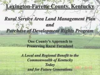
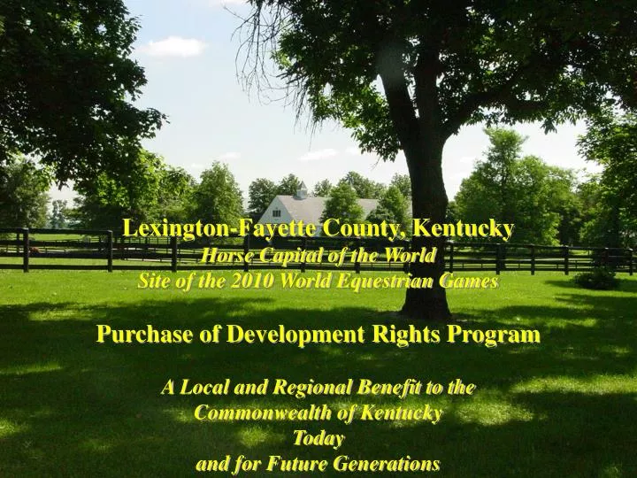
Lexington-Fayette County, Kentucky Horse Capital of the World Site of the 2010 World Equestrian Games Purchase of Development Rights Program A Local and Regional Benefit to the Commonwealth of Kentucky Today and for Future Generations.

E N D
Lexington-Fayette County, Kentucky Horse Capital of the World Site of the 2010 World Equestrian Games Purchase of Development Rights Program A Local and Regional Benefit to the Commonwealth of Kentucky Today and for Future Generations
Urban/Rural Service AreasThe Cornerstone of Our Community Planning Program since 1958Urban = 85 Square Miles (30% of County)Rural = 200 Square Miles (70% of County)
1996 Urban Service Area Expansion - 5400 Acres At average density, will result in over 13,000 dwellings
Why preserve Rural Farmland in Fayette County? • Agricultural Economic Benefits and Concerns • Development Pressure on Farmland • High Cost of Infrastructure as Development Moves Away From Urban Areas • To Protect Cultural, Environmental and Historic Resources • Maintain International Identity and a “Sense of Place” • To Protect a thriving Tourism Industry
Development pressure on Farmland 1996 Expansion of the Urban Service Area- 5,400 acres 10-Acre Estate Lot Development • Between 1990-1998, loss over 4,700 acres of Rural Service Area Land • Suburban intrusions on Farms (dogs, children, trespassing, etc.)
4,700 ACRES FOR 429 HOMES... 4,700 Acres superimposed on the Urban Service Area is greater than 25% of the Land Inside New Circle Road At average density in the Urban Service Area 4,700 Acres would typically result in over 20,000 residential dwellings
Agricultural Economic Benefits And Concerns • Fayette County ranked #2 in Kentucky farm products and generated $354,000,000 in cash farm receipts in 2005 • Fayette County Agriculture supports a significant tax base • Rural Fayette County has significant related infrastructure and services • Farming is an industry, incompatible with suburban development • The land is the farmer’s 401 K plan
High cost of infrastructure as development moves away from urban areas * *From Study by American Farmland Trust and sponsored by the Bluegrass Conservancy and the Land & Nature Trust in 1999. A similar study is being done in Shelby County.
PDR Protects Environmental Resources-soil quality, water quality, mature trees, etc. and International recognition- ‘Bluegrass Region’ ‘Sense of Place’ and ‘Brand Identity’ of A World renowned landscape
PDR Protects Cultural Heritage-Rural Hamlets Historic Resources-Historic homes, farm buildings, stone fences, etc.
Planning the Solution... Rural Service Area Land Management Plan Adopted April 1999
Rural Service Area • Land Management Plan • Analysis: • Land Capability • Soils • Traffic • Scenic Areas • Environmental Areas • Transportation • Agricultural Patterns • Historic Areas • Rural Settlements • Aquifer Protection • Future Sewerability
Rural Service Area Land Management Plan Land Use Categories
Rural Service Area Land Management Plan Core Ag & Rural Land • 40 Acre Minimum (Existing Smaller Tracts to Remain) • PDR Eligible • Agricultural Use and Supporting Uses Only
Rural Service Area Land Management Plan Natural Areas • 40 Acre Minimum (Existing Smaller Tracts to Remain) • PDR Eligible • Agricultural Use and Supporting Uses • Environmental Protection • Goal of Acquiring1000-2000 Acres
Rural Service Area Land Management Plan Rural Settlements • Stabilize and Enhance Housing • Additional Studies for Redevelopment and Infill Potential • Design Guidelines
Rural Service Area Land Management Plan Buffer Areas • Retain 10-Acre Minimum Lot Size • Not PDR Eligible • Uses Compatible with Agriculture • Physical Buffering from Adjoining Agriculture • Development Design Standards
Rural Service Area Land Management Plan Existing Rural Residential • No Further Development Beyond Original pre-1964 Approvals • No Re-subdivision • Physical Buffering From Adjoining Agriculture
Rural Service Area Land Management Plan Special Plan Element: Historic Areas
Rural Service Area Land Management Plan Special Plan Element: Environmentally Sensitive Areas
Rural Service Area Land Management Plan Special Plan Element: Georgetown Wellhead Protection Area
Rural Service Area Land Management Plan Special Plan Element: • Rural Roadways/ • Traffic Management: • Traffic Volumes • Level Of Service (LOS) • Capacity at LOS
Rural Service Area Land Management Plan Special Plan Element: Rural Roadways/Aesthetics-roads with scenic views of countryside, tree lined roads with stone fences, etc. Fayette CountyScenic Byway information can be found at- www.kytc.state.ky.us/planning/scenic_byways/scenicbyways.pdf
Rural Service Area Land Management Plan Special Plan Element: Rural Settlements
Rural Service Area Land Management PlanSpecial Plan Element: Natural Protection Areas
Rural Service Area Land Management Plan Special Plan Element: Greenway Focus Areas
Rural Service Area Land Management Plan Special Plan Element: Business & Industrial Zoning
Rural Service Area Land Management Plan Special Plan Element: Future Sewerability
Zoning Ordinance Changes: August 1998 • Increased Minimum Lot Size in Most of Rural Area from 10 to 40 Acres • Create “Buffer Category” Zone for Areas Designated on Plan • Create “Natural Areas” Zone for Areas Designated on Plan • Special Rural Subdivision Standards to Protect Agricultural • Operations
Implementing the Plan Increase in Minimum Lot Sizes in the Rural Service Area Linked with Purchase of Development Rights (PDR) Program
PDR Protects Farms • All of the $15,000,000.00 Granted by the Agricultural Development Board has been used for conservation easement acquisition. • Every State Dollar matched at least 1:1 with a Local Dollar • $6,888,570 also matched with Federal grant dollars at 2:1 (local, state and federal) or 1:1 (local and federal) • Federal match grants to date are $8,649,454.00 • 141 Farms Protected with over 16,286 acres
PDR Helps Horse Farmers across the Commonwealth • Protects ‘Factory Floor’ • $5 Billion dollar a year industry in Kentucky • $650 Million dollars of horses sold at Keeneland and Fasig-Tipton in Fayette County in 2004 • Fayette County is the breeding capitol and sales center in the State. • 80,000-100,000 jobs
PDR protects the Tourism Industry • Tourism in Fayette County generated a $880,190,000.00 economic impact and supported 13,130 related jobs in 2004. • Local tax receipts from Tourism were $14,650,000.00 in 2004. • Fayette County is within one day driving distance of 75% of the U.S. population • Fayette County draws visitors to the State and the region as a whole • Perpetuates unique international recognition as the Bluegrass State
Goals of the PDR Program: • Purchase Conservation Easements to Protect 50,000 acres (out of 128,267 acres in the Rural Service Area) over the next 20 years. • Protect the Agricultural and Horse economies of Fayette County by conserving large areas of farm land. • Conserve and protect the Natural, Scenic, Open Space and the Historic and Agricultural resources of Rural Fayette County. • Protect the Tourism Economy of Fayette County by preserving the Unique Character and ‘Sense of Place’ that attracts visitors from all over the world. • 50,000 acres represents only 27% of all the land in Fayette County.
What is a PDR and how do you determine it’s value? Future Development Value $$$$$$$$ P urchased D evelopment R ights- Landowner sells off their development rights in perpetuity
PDR Program - Major Principles • Applied on a Voluntary Basis Only • All Rural Landowners with 20 or more acres, subject to the 40-acre rule, are eligible • Priority Order of Acquisition to be Based Upon Fair and Objective Point Ranking System • Preservation in Perpetuity (rare exceptions permitted) • Not Anti-Growth, Pro-Infill and Downtown Redevelopment, Pro-Agriculture and Rural Preservation
PDR Program - Major Components • PDR Ordinance • PDR Board • Land Evaluation & Site Assessment (LESA) Point System • Funding
PDR Ordinance • Definitions • PDR Board Membership and Duties • Land Evaluation & Site Assessment (LESA) Point System • Negotiation & Acquisition Procedures • Donations of Easements • Release/Transfer Provisions • Coordination with Comprehensive Planning
Rural Land Management Board Members • Farm Bureau (2 members) • KY Thoroughbred Association (2) • Land Conservation groups (1) • Realtors Association (1) • Homebuilders Association (1) • Neighborhood Council (1) • Historic Preservation (1) • Convention & Visitors Bureau (1) • Chamber of Commerce (1) • At-Large County Ag Agent (1) • At-Large NRCS representative (1)
Rural Land Management Board Duties • Duties as a Non-profit, Non-stock Corporation • Solicit, Acquire & Hold Conservation Easements • Prioritize Acquisitions • Expend Funds for Acquisitions • Public Information & Forums • Solicit Contributions • Establish Administrative Procedures • Release/Terminate (perpetuity)
Land Evaluation & Site Assessment (LESA) - Establishing Priorities • Agricultural Factors: • Farm Size • Road Frontage • Batch Applications • Soil Quality • Farm Activities • Agricultural Improvements
Land Evaluation & Site Assessment (LESA) - Establishing Priorities • Environmental/Other: • Environmentally Sensitive Areas • Greenway Potential • Natural Protection Areas • Links to Parks, Etc. • Historic/Cultural Resources • Scenic Resources • Re-consolidation of Subdivided Farms
Land Evaluation & Site Assessment (LESA) - Establishing Priorities • Future Urban Factors: • “Minus” Points Applied • Proximity to Urban Service Area • High Probability of Sewerability • Proximity to Federal Highways and Interstate Interchanges • Exceptions for “Community Icons” and Other Major Protection Priorities
Land Evaluation & Site Assessment (LESA) - Desired Effect: THIS...
Land Evaluation & Site Assessment (LESA) - Rather than..
Types of Farms Under Conservation Easement: 141 farms including 13 Donated Easements of 464 acres with a total of over 16,286 acres 79 farms are Equine 51 farms are General Agriculture 11 farms are ‘Other’ - (historic, sod, trees, etc)
PDR is pro-growth and development • Encourages planned growth within and along the Urban Service Area by establishing critical land masses in The Rural Service Area. • LESA ranking is lower for properties adjacent • to the Urban Service Area. • High standard of living and unique sense of place are attractive to prospective businesses and • residents.
Results of Rural Land Management Plan and PDR Program • Maintain Urban & Rural Distinctions
Results of Rural Land Management Plan and PDR Program • Economic Development Tool by Preserving a Critical Mass of Rural Land in Perpetuity for Agricultural, Horse and Tourism Industries
Results of Rural Land Management Plan and PDR Program • Protect Sensitive Environmental Areas in • Rural Fayette County