Download
1 / 19
230 likes | 456 Views
Application of Lidar for Assessment of the Wind Resource in Complex Terrain. Matthieu Boquet , LEOSPHERE Daniel Ortiz, BARLOVENTO Recursos Naturales Xabier Comas, ACCIONA Energia. Agenda. The application of remote sensors in the framework of a wind farm project

E N D
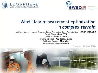
Application of Lidar for Assessment of the Wind Resource in Complex Terrain Matthieu Boquet, LEOSPHERE Daniel Ortiz, BARLOVENTO RecursosNaturales Xabier Comas, ACCIONA Energia
Agenda • The application of remote sensors in the framework of a wind farm project • Assessment of the remote sensor accuracy on flat and complex terrains • Application in a real business case in Spain: lidar validation and reductions of uncertainties
Lidar - uncertainties reduction Horizontal data cross the site Vertical data at hub height ?
Application of remote sensor • Reduce uncertainty in the • On vertical extrapolation of the wind profile • On the horizontal extrapolation to turbines location • Other uncertainties reduction: power curve, wake losses… They allow a more secure assessment of the wind resource... …but only if the remote sensor technology used has a known accuracy and uncertainty
Accuracy needs to be thoroughly assessed • By technological knowledge: • Technology used: radio, acoustic, light… • Device configuration: emission, reception… • Device conception: material, electronic… • Signal processing: algorithms… • By empirical analysis: • Considered as a black box • Accuracy assessed under a wide (exhaustive?) variety of conditions • Approach of IEC 61400-12-1* standard for wind turbine power curve measurements * Currently under revision
WINDCUBE™ lidars accuracy and uncertainty understood and estimated on simple terrains • The most influential parameters are understood to be wind shear, wind veer, turbulence intensity • On a rather large variety of climatic conditions: • Accuracy (mean deviation rmse) of ~1% • Uncertainty (standard deviation of the deviation) of ~2% WINCUBE™7 v2 vs. Cup anemometer at 135m height. Provided by Deutsche Windguard GmbH
Influence of topography complexity • Variation of flow inclination cross the RS beams is the main source of bias during the wind speed conversion when flow homogeneity assumption is used
Using CFD calculation to estimate bias - Synthetic site and wind speeds box • Using CFD calculations and modeling the remote sensor measurement process
Getting rid of flow homogeneity assumption FCR™ Flow Complexity Recognition Normal mode FCR™ mode Entire Profile Direct Measurement No Assumption on flow homogeneity Independent Heights Measurement Assumption : homogenous wind flow
FCR™ simulation • Using CFD calculations and modeling the FCR™ measurement process
FCR™ validation campaign at CRES test facility • WINDCUBE v1, operated by CRES • WINDCUBE v2, equipped with FCR™ • Guyed triangular 100m lattice tower • Vector cup anemometers mounted at 54m, 78m, and 100m; MEASNET calibrated. Gill WindMaster Pro ultrasonic anemometers at 78m and 98m WINDCUBE™ v1 WINDCUBE™ v2 + FCR™
Application on a real business case in Spain • Forested complex terrain: a mountain with the presence of high vegetation (bushes, ..) and high trees (pine trees mainly) • ARCISECO13 metmast and WINDCUBE™7 v2 are located according to IEC and MEASNET recommendations ([1], [5] and [6]).
Data availability high and constant according to measurementheight, time of the day, temperature, wind speed: consistent data set • Lidar measurement period: from 20/09/2011 until 11/11/2011 Availability vs. Hour of the day Availability vs. Height 4983 validwind speed values at 80m
FCR™ measurement validation Wind direction 76m Wind speed 80m Vertical wind speed Turbulence Intensity Shear 40/60 Shear 60/80
Impact of additional information provided by the lidar: change in shear value • The use of Windcube V2 lidar has revealed a site-specific features in the site, which may affect the theoretical behaviour of a wind turbine: • The shear is lower at higher levels than would be expected from metmastmeasurements.
Impact of additional information provided by the lidar: change in wind direction • The use of Windcube V2 lidar has revealed a site-specific features in the site, which may affect the theoretical behaviour of a wind turbine: • There is a change in wind direction with height Power (MW) Wind Speed (m/s) Measured Power Curve
Conclusion • Beforeapplying a remote sensor technology, itsaccuracy and uncertaintyneedto be assessed and quantified qualification (following IEC, IEA, expertconsultantsguidelines) • Only a qualifiedremote sensor technology has thepotentialto reduce uncertaintyontheprediction of thefuturewindfarmenergyproduction • Methodologiesavailabletoallowtheapplication of remote sensor in complexsite, post-processingflowmodelingorbuilt-in FCR™
Special thanks to Daniel Ortiz, BARLOVENTO & Xabier Comas, ACCIONA Energia Tutorial Masque PPT - Confidential