Download

1 / 19
190 likes | 303 Views
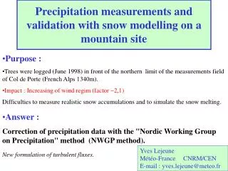
Precipitation measurements and validation with snow modelling on a mountain site. Purpose : Trees were logged (June 1998) in front of the northern limit of the measurements field of Col de Porte (French Alps 1340m). Impact : Increasing of wind regim (factor ~2,1)

E N D
Precipitation measurements and validation with snow modelling on a mountain site • Purpose : • Trees were logged (June 1998) in front of the northern limit of the measurements field of Col de Porte (French Alps 1340m). • Impact : Increasing of wind regim (factor ~2,1) • Difficulties to measure realistic snow accumulations and to simulate the snow melting. • Answer : • Correction of precipitation data with the "Nordic Working Group on Precipitation" method (NWGP method). • New formulation of turbulent fluxes. Yves Lejeune Météo-France CNRM/CEN E-mail : yves.lejeune@meteo.fr
Plan • The laboratory at Col de Porte • Deforestation and consequences • Snow modelling with CROCUS (before and after deforestation) • Improvement of NWGP precipitation estimation • Conclusions and Outlooks
The Laboratory at Col de Porte (1340 m) Measurements • Snow parameters • Hourly measurements • Occasional measurements • Hourly meteorological parameters
Anemometer Geonor rain gauge Ultrasonic snow depth sensor Tipping bucket (heated) gauge Lysimeter Settlementdisks Defrosting box Snow boards Pyrgeometer and Radiometer Measurements Field (View 1)
Shelter (Air temperature and humidity) Laboratory Tipping bucket gauge Measurements Field (View 2) Snow pits field
NORTH Logged forest The site before June 1998 Laboratory Measurements field Road The site after June 1998 Deforestation of the area in the north of the measurement Field
Consequence :Wind speed regim increasing • Increasing • Multiplicative factor • mean wind speed = 2 • max wind speed = 2,2
Impact of wind speed increasing • Precipitation quantity evaluation Particularly snowfalls quantity. • Snowdrift. • Heterogeneity of spatial snow distribution. • Problems for measurements of fresh snow : depth and snow water equivalent.
Snowpack Modelling atCol de Porte with CROCUS • Purpose • validation for CROCUS laws. • tests for meteorological and snow measurements. • Build-up of annual data base for snow pack models (ex:SNOWMIP).
Snow depth (HTN) • Corrective method "CDP" • (before season 1998-1999) • RRcor = RRmeas x coeffRR • where: RRmeas = measured quantity by geonor gauge. ( Not affected by evaporation problems due to heating) coeffRR : fixed yearly coefficient defined by SWE measurements of fresh snow carrots (coeffRR CDP) coeffRR9394 to coeffRR9798 lies between 1,10 and 1,15. • Before deforestation, with the corrective factor coeffRR, measurements and simulations of snow depth were consistent. Simulation for previous seasons
period2 Lower increasing snow depth period1 • Underestimated increasing of the snow depth during windy snowfalls ; problems during • 2 typical periods : Period 1: 1999/01/26-1999/01/29 Period 2 : 1999/02/05-1999/02/10 First Simulation for the Season 1998/1999 • coeffRR CDP : no more valid for windy snowfalls.
RRmeas (mm/h) If phase = rain : krain= f (wind speed , rain intensity) If phase = snow : ksnow = f (wind speed , Tair) Improvement of precipitation estimation • Correction of Precipitation Data with the NWGP Method • Method due to the NWGP report • (Oslo, July 1996) • Formulation : RRcor = k RRmeas NB : Installation of an anemometer at the gauge level
Season 1998-1999 period 1 : 1999/01/26 to 1999/01/29 period 2 : 1999/02/05 to 1999/02/10 Snowfall distribution as a function of wind speed
Accurate snow depth increasing Too efficient melting • The result of this corrective method allows an accuratesnow increasing during the windy snowfall periods. RMSerror = 18,7 cm RMSerror = 33,0 cm with coeffRR = 1,10) • Another problem : snow melting deficiency New formulation of turbulent fluxes Effect of the NWGP Correction
Accurate melting • With this formulation, the model improves melting simulation. • RMSerror = 7,1 cm New formulation of turbulent fluxes
Mean seasonal Snowfalls (SWE) • With NGWP corrections, global SWE increasing is more important for seasons after deforestation (~ +15%) than before (~ +7%) Seasonal Snow Water Equivalent Comparison • Difficulties to compare seasonal precipitation amount with snowpack bottom runoff (problems with spatial snow distribution)
Season 1996-1997 Season 2000-2001 No consistent improvement for season before deforestation (low wind regim) Efficient method during the windy snowfall periods (high wind regim) Effect of the NGWP corrective method on two other seasons
Problems with snow data set validation • Installation of wind fences and plantation of trees. Conclusions and Outlooks • Conclusions • The NGWP corrective precipitation factor improves (increases) the amount of precipitation (in particular during windy snowfall periods). • The use of a physical scheme for the modelling of the turbulent fluxes appears to be very efficient to simulate the melting. • Outlooks • Use of both methods in other sites. • Interest for operational snow monitoring