Download
1 / 60
600 likes | 728 Views
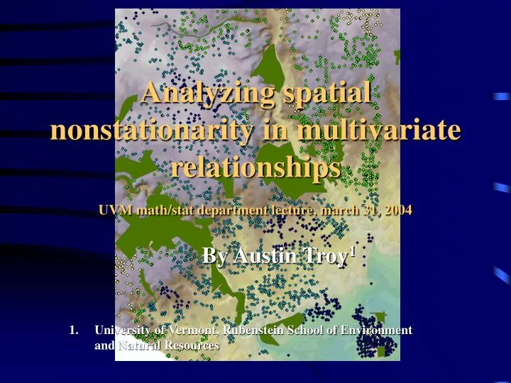
Analyzing spatial nonstationarity in multivariate relationships UVM math/stat department lecture, march 31, 2004. By Austin Troy 1. University of Vermont, Rubenstein School of Environment and Natural Resources. Spatial Nonstationarity. The notion that relationships change across space.

E N D
Analyzing spatial nonstationarity in multivariate relationships UVM math/stat department lecture, march 31, 2004 By Austin Troy1 • University of Vermont, Rubenstein School of Environment and Natural Resources
Spatial Nonstationarity • The notion that relationships change across space. • That is, the relationship between y and (x1,x2....xn ) is non constant from one location to the next. • Can a variable be included in a model that proxies for space? • Sometimes this is possible, but very often the factors that make one location different from another are non-quantifiable, or involve extremely complex interactions that cannot be parsimoniously modeled. Especially in social research
Approaches to nonstationarity • There are several approaches to dealing with this problem. Among them are: • Create zones of homogeneity and stratify • Allow parameters to vary constantly
First Approach • Parameterize a global model and look at the residuals to detect patterns
First Approach • Use patterns in residuals to define patches • Specify a separate equation for each patch, or stratum
Second Approach 2. Continuous variation: Create measures of statistical relationships that are continuously varying across space, such as GWR ’s vary continuously as a function of location (u,v) at each point i (Fotheringham 2002)
GWR • Weighted moving window regression method developed by Foterhingham and Brundson (2000, 2002), building on works of Hastie and Tibshirani (1990) and Loader (1999) • Expanded form of simple multiple regression equation • Coefficients are deterministic functions of location in space • Uses weighted least squares approach • Fully unbiased estimate of local coefficient is impossible, but estimates with only slight bias are possible
GWR estimation • Separate regression is run for each observation, using a spatial kernel that centers on a given point and weights observations subject to a distance decay function. • Can used fixed size kernel or adaptive kernel to determine number of local points that will be included in each local regression • Adaptive kernels used when data is not evenly distributed
GWR kernel GWR with fixed kernel GWR with adaptive kernel From Fotheringham, Brundson and Charlton. 2002. Geographically Weighted Regression Points are weighted based on distance from center of kernel e.g. Gaussian kernel where weighting is given by: wi(g) = exp[-1/2(dij/b)2 where b is bandwidth
GWR kernel Adaptive kernel width is determined through minimization of the Akaike Information Criterion wheretr(S) is the trace of the hat matrix and n is the number of observations
Bias and variance tradeoff • Tradeoff between bias and standard error • The smaller the bandwidth, the more variance but the lower the bias, the larger the bandwidth, the more bias but the more variance is reduced • This is because we assume there are many betas over space and the more it is like a global regression, the more biased it is. • AIC minimization provides a way of choosing bandwidth that makes optimal tradeoff between bias and variance.
GWR outputs • The result is a statistical output showing global summary stats and parameters estimates, local model summary stats and non-stationarity stats for each parameter • Also produces a map output of points with parameter estimates, standard errors and “pseudo t statistics” for each variable for each point
A simple (?) question we can address with this approach • How is proximity to trees and other “green assets” reflected in property values?
We can ask this with hedonic analysis • Econometric method for disaggregating observed housing prices into a series of unobserved “implicit” prices, reflective of WTP for a given marginal change in attribute • Price= fn(structure, lot, location) • Has been used extensively for valuing environmental amenities and disamenities
Hedonics and space • Hedonic analysis is generally taken to be spatially stationary; that is, it is assumed that marginal WTP for an attribute is fixed within a housing market. • Usually these markets are assumed to be quite big and tools for determining these market boundaries are poorly developed (see approach 1, earlier)
Case Study:Two Scales of analysis • Block group level analysis of median housing price as fn of tree cover, controlling for many other factors • Property level analysis of housing prices as a function of tree cover and parks, controlling for structural, locational and environmental attributes (hedonics) Research is part of the Baltimore Ecosystem Study, an NSF-LTER
Block group analysis Initial pattern of housing values tells us what we know intuitively: suburbs are more valuable than central city, but value goes down again as you get too far from city center
Block group analysis Average canopy cover by block group, as derived from 2000 USGS 30 m canopy cover analysis
Running GWR at the BG level • Given the spatial dependence in the data, it is likely that the coefficients of a multivariate relationship will be related to the spatial processes underlying the spatial dependence. Hence, we choose to run GWR and compare it to global regression.
Equation Predictor variables= • Median age • Percent with income greater than $100k • Median household income • Percent owner occupied housing • Percent vacant buildings • Percent single family detached homes • Mean tree canopy percentage • Median number of rooms per house • Median age of housing • Percent with mortgage • Percent high school educated • Percent African American • Percent Protected Land
Data • This was run using census block group data from 2000 for the five counties in the Baltimore Metro Area • Observational problem: while population of BGs is relatively constant, size is not, hence may be some form of Modifiable Areal Unit Problem; may be varying levels of heterogeneity within block groups
Results: Global Model • Global model: highly significant • Canopy is significant at α = .05, while percent protected land is not • All other control variables are
Comparison of Local and Global • The ANOVA tests the null hypothesis that the GWR model represents no improvement over a global model and rejects the null • Notice also that Coefficient of Determination increases significantly and AIC decreases
Local Parameter variabilty • We also conduct a Monte Carlo Significance test which finds that almost all variables are spatially non-stationary, although protected land is not
How does this testing work? • We expect all parameters to have slight spatial variations; is that variation sufficient to reject the null hypothesis that it is globally fixed? • If so, then any permutation of regression variable against locations is equally likely, allowing us to model a null distribution of the variance • A Monte Carlo approach is adopted to create this distribution in which the geographical coordinates of the observations are randomly permuted aginst the variables n times; results in n values of the variance of the coefficient of interest which we use as an experimental distribution • We can then compare the actual value of the variance against these values to obtain the experimental significance level
Notice also how under GWR, there is no pattern to the residuals because it accounts for spatial effects
Results show that the city center is where tree canopy cover is valued highest on the margin; this might be because trees are scarcest there
However, the pseudo t statistic reveals that not all areas are significant
When we blank out the non-significant observations, we see that trees are only significantly reflected in property values in some areas, and it’s negative in Howard County
Interpretation • In some areas, canopy cover is valued more highly than in others. The degree to which canopy is valued may relate to the scarcity or spatial distribution of trees at multiple scales. It may be negative in Howard county because trees are associated with some other factor, like “ruralness,” which is not properly quantified by the census and which exerts downward influence on housing prices
Other variables • We’ll ignore protected land, since it’s not non-stationary. However, some of the other control variables are telling. Let’s look at median house age.
Pattern makes sense: older homes yield a positive premium in the more affluent suburb, but a negative premium in the poorer central city
When we do a cluster analysis (PAM) based on 3 parameter values (canopy, house age and number of rooms), we get something looking like markets
Here’s what it looked like with 6 Note that the silhouette score for the PAM was .55 for the 4 class and .5 for the 6 class—strong structuring
Problems with this approach • Using block group level data is not ideal for a number of reasons • Modifiable Areal Unit Problem • BG obscures significant within unit heterogeneity • Level of heterogeneity (variance) varies between observations • There may be spatial clustering within BGs • Data is not very accurate at this level • Attribution not great either
Property Level Analysis • Property level analysis is way of dealing with the local spatial heterogeneity and of getting much better attribution • Used Maryland Property View data set for half of Baltimore City • Regressed log price against 22 variables, including structural, neighborhood and locational variables, including several environmental variables
Simple plot of log price shows that while there are slight patterns, there is still considerable heterogeneity over space and no clear patches are emergent • Moreover, price is only one factor and social patches are defined on a number of factors
Plotting out log price normalized by square footage gives a similarly heterogeneous result • Other plots of other variables also show similar heterogeneity
Overall results • Local model was a considerable improvement over the global model
Non-stationarity of parameters • Monte Carlo significance test used to determine whether parameters are significantly non-stationary • All but 4 were at the = .05 significance level
T value on tree dummy variable The only real significant relationship is on east side of study area Note that 1458 out of 2350 observations had a “1” for this value. A better approach for future would be tree density index
Areas where parks are highly valued in the real estate market T value on Distance to nearest park
Here an additional bathroom adds 6-9% to home value Here it adds 1.5 to 3% Number of Baths Parameter values show clear patchiness
T value of parameter on number of bathrooms shows that number of bathrooms only significantly related to price in northern neighborhoods (small dots are observations where parameter estimate is insignificant)