Comprehensive Overview of the Global Forecast System (GFS) Model and Its Advances
The Global Forecast System (GFS) model, originally known as Aviation (AVN) and Medium Range Forecast (MRF), is a sophisticated spectral global model operating at 64 levels. With improvements in microphysics and surface physics, it runs four times daily up to 384 hours, achieving significant accuracy through advanced satellite data integration. Key enhancements include hybrid sigma-pressure coordinates and a state-of-the-art 3DVAR analysis scheme. Although GFS is not the only global model, its continuous development reflects major strides in forecasting capabilities, especially in the Southern Hemisphere.

Comprehensive Overview of the Global Forecast System (GFS) Model and Its Advances
E N D
Presentation Transcript
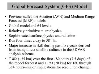
Global Forecast System (GFS) Model • Previous called the Aviation (AVN) and Medium Range Forecast (MRF) models. • Spectral global model and 64 levels • Relatively primitive microphysics. • Sophisticated surface physics and radiation • Run four times a day to 384 hr (16 days!). • Major increase in skill during past decades derived from using direct satellite radiance in the 3DVAR analysis scheme and other satellite assets. • T574 (~27 km) over the first 192 hours (8 days) of the model forecast and T190 (70 km) for 180 through 384 hours--major implications for resolution change!
GFS • Vertical coordinates are hybrid sigma/pressure… sigma at low levels to pressure aloft.
GFS Data Assimilation (GDAS) • Has a later data cut-off time than the mesoscale models…and thus can get a higher percentage of data. • Uses much more satellite assets..thus improve global analysis and forecasts. • Major gains in southern hemisphere • Hybrid Data assimilation based on 3DVAR (they call it GSI) and GFE ensemble (next slide) • Every 6 hr.
Next Generation Global Models Under Development! • Will use different geometries