Download
1 / 39
390 likes | 503 Views
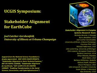
UCGIS Symposium: Stakeholder Alignment for EarthCube Joel Cutcher-Gershenfeld, University of Illinois at Urbana-Champaign. Stakeholder Alignment in Complex Systems Research Team: Nicholas Berente, U Georgia Burcu Bolukbasi, UIUC Joel Cutcher-Gershenfeld,

E N D
UCGIS Symposium:Stakeholder Alignment for EarthCube Joel Cutcher-Gershenfeld, University of Illinois at Urbana-Champaign Stakeholder Alignment in Complex Systems Research Team: Nicholas Berente, U Georgia Burcu Bolukbasi, UIUC Joel Cutcher-Gershenfeld, University of Illinois, Urbana-Champaign Courtney Flint, UIUC Michael Haberman, UIUC John Leslie King, University of Michigan Chris Lawson, Aerospace Corporation Barbara Lawrence, UCLA Ethan Masella, Brandeis Mark Nolan, UIUC Barbara Mittleman, Nodality Melanie Radik, Brandeis Cheryl Thompson, UIUC John Unsworth, Brandeis University Susan Winter, U Maryland Illya Zaslavsky, UCSD Support from the National Science Foundation is deeply appreciated (NSF-VOSS EAGER 0956472, “Stakeholder Alignment in Socio-Technical Systems,” NSF OCI RAPID 1229928, “Stakeholder Alignment for EarthCube,” NSF SciSPR-STS-OCI-INSPIRE 1249607, “Enabling Transformation in the Social Sciences, Geosciences, and Cyberinfrastructure”)
“Over the next decade, the geosciences community commits to developing a framework to understand and predict responses of the Earth as a system—from the space-atmosphere boundary to the core, including the influences of humans and ecosystems.” • GEO Vision report of NSF Geoscience Directorate Advisory Committee, 2009 What social and technical investments and innovations are needed to deliver on this vision?
Lewin’s force field analysis Interdisciplinary Innovation in the Geosciences Urgency of geoscience research Technical barriers to interoperability Engaging research questions Career development complications Pos. signals from funding agencies Publication/translation challenges Strategic priorities of universities “Birds of a feather” tendencies Colleagues open to collaboration Risk aversion tendencies
Forms of alignment Internet Protocols and Standards Unidata, IRIS, IEDA,CUASHI. . . INSPIRE (EU), GeoSUR (SA), ANDS (AU). . . NCAR, iPlant. . . Current EarthCube Communities
Assume accelerating rates of technological change. . .The Babysitter of the Future (courtesy of Steve Diggs, Scripps Institution)
Caution – construction ahead • Primarily descriptive statistics • Advances in visual representation and instrumentation • Much work to be done testing/refining propositions, models, methods, and analytics
Specify Stakeholders and Identify Interests • Atmospheric or Space Weather scientist • Oceanographer • Geologist • Geophysicist • Hydrologist • Critical zone scientist • Climate scientist • Biologist or Ecosystems scientist • Geographers • Computer or Cyberinfrastructure scientist • Social scientist (Anthropologist, Economist, Psychologist, Sociologist, etc.) • Other scientist • Data manager • High performance computing expert • Software engineer • IT user support personnel • K-12 educator • Designer/developer of geoscience instrumentation • Environmental resource manager (e.g. local, state, or federal) • Other • 50+ interest questions, covering: • Access and Utilization of Data, Observations, Visualizations, and Models – Current State and Desired State • Increasing Uniformity and Interoperability through the EarthCube Process • The Scope of the EarthCube Mission • Stakeholder Relations and Governance • Your Potential Engagement with EarthCube
Data collection n=1,211 • EarthCube Website (n=127) Mar.-June, 2012 • Data Centers (n=578) Mar.-June 2012 • Early Career (n=37) Oct. 17-18, 2012 • Structure and Tectonics (n=24) Nov. 19-20, 2012 • EarthScope (n=22) Nov. 29-30, 2012 • Experimental Stratigraphy (n=21) Dec. 11-12, 2012 • Atmospheric Modeling (n=29) Dec. 19, 2012 • OGC (n=14) Jan. 13, 2013 • Data Assimilation & Ensemble Prediction Jan. 18, 2013 • Critical Zone (n=39) Jan. 21-23, 2013 • Envisioning a Digital Crust (n=23) Jan. 29-31, 2013 • Paleogeoscience (n=40) Feb. 3-5, 2013 • Education & Workforce Training (n=33)Mar. 3-5, 2013 • Petrology & Geochemistry (n=59) Mar. 6-7, 2013 • Sedimentary Geology (n=50) Mar. 25-27, 2013 • Community Geodynamic Modeling (n=42) Apr. 22-24, 2013 • Integrating Inland Waters, Geochemistry, Biogeochem and Fluvial Sedimentology Communities (n=35) Apr. 24-26, 2013 Note: Some additional respondents from EC website after June are in overall totals.
Hundreds of specific areas of expertise. . . • Air Sea Interaction • Atmospheric Radiation • Basalt geochemistry • Biodiversity Information Networks • Carbonate Stratigraphy • Chemical Oceanography • Coastal Geomorphology • Computational Geodynamics • Cryosphere-Climate Interaction • Disaster Assessment • Ensemble data assimilation • Geochronology • Geoinformatics • Geomicrobiology • Glaciology • Heliophysics • Isotope Geochemistry • “It’s complicated” • MagnetosphericPhysics • Mesoscale Meteorology • Multibeam Bathymetric Data • Nearshore Coastal Modeling • Paleoceanography • Paleomagnetism • Permafrost Geophysics • Planetology • Riverine carbon and nutrient biogeochemistry • Satellite gravity and altimetry data processing • Tectonophysics • ThermosphericPhysics • Watershed Management
IMPORTANCE of integrating multiple datasets, observations, visualization tools, and/or models in your field or discipline Early Career EarthCube Active All Others
EASE of integrating multiple datasets, observations, visualization tools, and/or models in your field or discipline? Early Career EarthCube Active All Others
IMPORTANCE integrating multiple datasets, observations, visualization tools, and/or models spanning fields/disciplines? Early Career EarthCube Active All Others
EASE of integrating multiple datasets, observations, visualization tools, and/or models that span different fields or disciplines? Early Career EarthCube Active All Others
Integrating multiple datasets, observations, visualization tools, and/or models – within
Integrating multiple datasets, observations, visualization tools, and/or models – across
Specifying guidelines regarding geoscience data Early Career EarthCube Active All Others
Adequacy of current suite of tools and modeling software Early Career EarthCube Active All Others
View on current suite of tools and methods compared with views on need for guidelines on interoperability
Cooperation and sharing of data, software among Geo Early Career EarthCube Active All Others
Cooperation and sharing of data, software within Cyber community Early Career EarthCube Active All Others
Communication and Collaboration: Geo and Cyber Early Career EarthCube Active All Others
Geo and Cyber – End-user training Early Career EarthCube Active All Others
Top Ten Barriers to Sharing Data (categories): • No time/Needs too much QA/QC • No repository/No known repository • Inadequate standards/No standardized formats • Want to publish first/Don't want to be scooped • File size too large/Server size too small • Classified/proprietary/Agency or company restrictions • No credit/No incentive to share • Cost • Not sure what to do • Not sure anyone wants it Note: Approximately 45% of respondents did not respond to the open ended question “It is difficult to share my data because. . . “ and another 6% said it was easy to share their data. The balance of responses were organized into the above categories; some individuals cited more than one reason (all of which were tabulated).
Organizational/professional support Early Career EarthCube Active All Others
Top twenty-five cited sources of data • NOAA (NODC, NGDC, NDBC, NCEP, etc.)) (17%) • NASA (JPL, ESA, etc.) (11%) • Colleagues/Clients (10%) • The web (unspecified) (9%) • NCAR, UCAR, Unidata(8%) • Publications (8%) • USGS (8%) • IEDA (GeoRock, EarthChem, MGDS, etc.) (8%) • State and local government (3%) • International (PANGEA, etc.) (2%) • DOE(2%) • EPA (1%) • Google/Google Earth (1%) • NSIDC, NIC (1%) • USDA (1%) • IRIS, EarthScope (1%) • Neotoma, PBDB, Macrostrat(1%) • BCO-DMO, JGOFS, WOCE, CLIVAAR, Geotraces(1%) • IODP (1%) • DOD (Navy, Army, Army Corps of Engineers) (1%) • Open topography, NCALM (1%) • LTER (1%) • UNAVCO (1%) • MagIC(under 1%) • Private sector companies (IRI, ESRI) (under 1%) Note: All percentages rounded to the nearest whole number
Transformation potential of EarthCube Early Career EarthCube Active All Others
Selected elements of success from Early Career workshop Access/Uploading: • Google earth style interface • Accessible data submission interface • Standardized meta data on data type, data context, data provenance, etc. for field scientists (with and without internet access) • Data security • Public accessibility; empower non-specialists Utilization/Operations: • Community mechanisms to build tools • Large data manipulation, visualization, and animation • Searchable access by space, time, and context • Pull up data and conduct analysis with voice commands • Open source workflow management for data processing and user-contributed algorithms in order to facilitate reproducible research • Cross-system comparisons; ontology crosswalks for different vocabs in different disciplines • Easy integration of analytic tools (R, Matlab, etc.) • NSF support for data management Output/Impact: • Mechanisms to provide credit for work done (data, models, software, etc.); ease of citations; quantify impact • Promote new connections between data producers and data consumers • Interactive publications from text to data • Recommendations system (like Amazon) for data, literature, etc.; Flickr for data (collaborative tagging) • Educational tutorials for key geoscience topics (plate tectonics, ice ages, population history, etc.) • Gaming scenarios for planet management • EarthCube app store; ecosystem of apps
Today’s most troubling and daunting problems have common features: some of them arise from human numbers and resource exploitation; they require long-term commitments from separate sectors of society and diverse disciplines to solve; simple, unidimensional solutions are unlikely; and failure to solve them can lead to disasters. In some ways, the scales and complexities of our current and future problems are unprecedented, and it is likely that solutions will have to be iterative . . . Institutions can enable the ideas and energies of individuals to have more impact and to sustain efforts in ways that individuals cannot. From “Science to Sustain Society,” by Ralph J. Cicerone, President, National Academy of Sciences, 149th Annual Meeting of the Academy (2012)
Stabilize before you improve Which player did better in this round? Who will do better in the long run?