Hurricane Principles
420 likes | 437 Views
Learn about the formation and conditions needed for hurricanes, the stages of their development, the structure of a hurricane, and the damage they can cause. Discover how hurricanes are measured and forecasted.

Hurricane Principles
E N D
Presentation Transcript
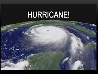
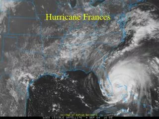
Hurricane Principles Hurricane Isabel, 2003
Outline • Definitions • Formation and Conditions Needed • Growth and Structure of a Hurricane • Where do They Form? • Measurement • Damage • Forecasting
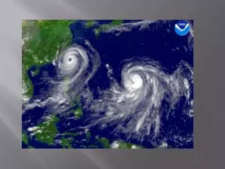
What are hurricanes? • Intense storm of tropical origin • Typhoon in North Pacific • Cyclone in India, Australia • Winds sustained at 75+ mph • ~80 form every year • Usually only few hit land/U.S. • Average ~30-40 fatalities/year
Formation Requirements • Shallow ocean water 80°F or more • Warm humid air above water • Weak upper level winds, blowing in direction of developing storm • Timing: Summer, early Fall • Season in U.S. is June-November
Beginnings • Low pressure with cluster of thunderstorms • Important for circulation • Tropical disturbance stage • Thunderstorms grow, winds strengthen
Rotation • Surface winds converge, thunderstorms become more organized • Converge in CCW fashion due to Coriolis force • Only form ~5-20° latitude, not at equator (Coriolis force = 0)
Strengthening • Organization - means more warm moist air rising • Cools, releases massive amount of latent heat during condensation • Warms surrounding air, causes more updrafts, brings more air from below • FUEL for more t-storms
Into a Hurricane • More fuel, more rotation, more speed • Tropical storm: surface wind speeds between 39-74 mph • Hurricane: surface winds sustained at 74+ mph • Also development of eye
Eye of Hurricane • Develops at ~74 mph wind speed • Why? Harder for rotating winds to reach surface • Calm area, clear and cloud free • Why? Cold air sinking in eye, as descends, warms and absorbs moisture
Eye Wall • Cylinder of upward winds • Strongest winds • Heaviest precipitation
Conditions in Storm from West to East • Approach: overcast sky, pressure begins to drop • Towards eye: increasing wind speeds, huge waves (up to 30 ft), heavy rain • In eye: air temperature increases, low wind, no rain, bright sky, lowest pressure • East of eye: heavy rain, strong winds • Move away from eye: pressure rises, winds and rain decrease
Intensity • Controlling factors: • Temperature of water • Release of latent heat • Why? Higher temperature water can drive more t-storms
Duration of Storm • Most last ~1 week • Longer if they stay over warm water • Shorter if they move over cold water or land • Why? • Energy source gone • More friction for winds
Where do they form? • Not at equator (no Coriolis force) • Subtropics ~5-20° latitude • Then move to higher latitudes • Path can vary based on details of high/low pressure systems it encounters • Majority form SE Asia, India, Australia
Measuring Size • Saffir-Simpson scale • Based on wind speed, pressure • Expected storm surge, possible damage • Category 1-5
Identification Atlantic List 2005 Arlene Bret Cindy Dennis Emily Franklin Gert Harvey Irene Jose Katrina Lee Maria Nate Ophelia Philippe Rita Stan Tammy Vince Wilma • Names assigned at tropical storm strength • Currently alternate male and female names alphabetically • System started in 1979 • 6 lists are repeated • Names retired if storm is very costly/deadly
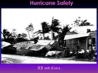
Damage from Hurricanes • High winds • Storm surge • Heavy rain • Mudslides
Winds • Can be over 155 mph (Category 5) • Impact can depend on which side of storm hits • Wind speed can be additive in direction of storm • Can also generate large (10-15 m) waves that hit shorelines in advance of hurricane
Storm Surge • Produce much of damage, fatalities • Abnormal rise in water level of few meters
Storm surge is a big problem for low-lying areas Deep water coastlines not as much of a problem
Storm Surge • Why? • Eye is low pressure zone, local sea level rises • Winds near eye push water into mound, leads to big surge of water hit shore, move far inland • Surge can be 20-30 ft • Think about New Orleans, much below sea level
Heavy Rain • After moving inland, no more water vapor to add fuel • But there is a lot in the cloud already! • Will fall as rain • Can be significant (measured in ft) • Leads to flooding
Mudslides • Many examples of rain soaked hillslopes failing after hurricanes
Forecasting: Seasonal • General observations for Atlantic hurricanes • More frequent if: • Wet summer in west Africa • Warmer sea temperatures • Low atmospheric pressure in Caribbean • No El Nino • Weather phenomena of high level east-blowing winds in Pacific
Why? West Africa wet summer: more t-storms, more hurricane potential Warm sea temps: more energy for storms Low pressure in Caribbean: requirement for storms No El Nino: weaker upper level winds (also condition for formation)
General Path of Storms Probabilities of hurricanes hitting U.S. coastlines in any given year
Short term prediction • Location, movement, intensity closely monitored • Ship reports • Satellites • Radar • Buoys • Aircraft
Warnings and Watches • Watch: issued for large areas that might be affected • Usually issued a few days before landfall • Warning: usually issued within 24 hours of storm striking area (+probability of striking) • Usually issued for large area (over 300 miles) to compensate for wide swath, variations in landfall
Example of watches and warnings posted for Hurricane Erin, 1995
Warnings and Watches • Significantly reduced loss of life from hurricanes • Not amount of damage
Evacuation • Can be a problem as more people move into coastal areas • Evacuation time estimates for areas • 72 hours New Orleans • 50-60 hours Ft. Myers, FL • 30-39 hours Miami • Problem: usually don’t have detailed knowledge of landfall during these periods
Mitigating Damage • Similar to earthquake planning • Building codes • Withstand winds • Keep roofs on • Protecting windows • Land use • Low-lying areas for parks, golf courses, not houses
Next Time • Hurricanes Part 2