Download
1 / 26
260 likes | 469 Views
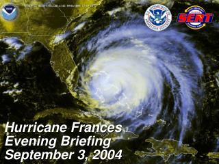
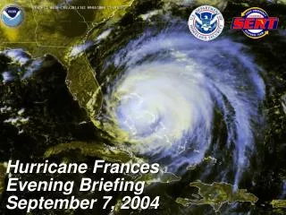
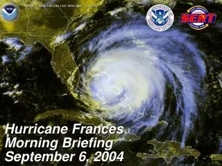
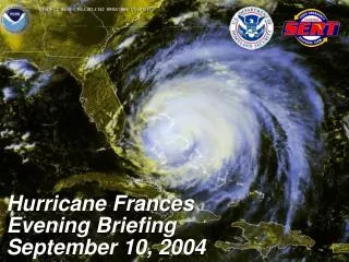
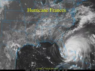
Hurricane Frances. MODIS view of Hurricane Frances (Note that eye is present but clouds at base of eye make it look cloudy throughout). FRANCES TRACK. Hurricane frequency. Frances. Hurricane Structure. Major Components Eye Eyewall(s) Rainbands (primary, secondary, outer) Regions

E N D
MODIS view of Hurricane Frances (Note that eye is present but clouds at base of eye make it look cloudy throughout)
Hurricane frequency Frances
Hurricane Structure • Major Components • Eye • Eyewall(s) • Rainbands (primary, secondary, outer) • Regions • Core region • Outer region • Other Components (not always present) • Eyewall mesovortices and swirls • Fine-scale rainbands
Structure of a hurricane: View from the top From Willoughby (1988)
Theta-e from Simulation (Liu et al 1997) Conceptual
Light-shading: cloud and precipitation Dark regions: convective eyewall and spiral rainbands EIL: : Eye inversion layer (slash- hatched areas) OEA: occluded eye air with low qe (cross-hatched regions) MTD: moist downdrafts between the convective bands SR: Spiral rainband updrafts RO: Return outflow SU: Sloping updraft of eyewall MI: Main inflow MO: Main outflow RI: Return inflow DF: Divergent flow VC: Forced vertical circulation LX: Lateral mixing GO: Gravity wave oscillations MD: Mean decent in eye Dashed line: Freezing level Schematic (radial–height) conceptual model of a mature hurricane in the inner-core region
Types of eyewall structure observed in hurricanes with radar Symmetric single ring eyewall
The double eyewall of Hurricane Gilbert (1988) (most intense Category 5 storm in western hemisphere)
Inner Core Region: PGF balances Centrifugal acceleration Inside eye, Rankine vortex Approx. (v(r) = VoR/r). Outside gradient wind approx. is valid: (v2/r + fv –fvg = 0) Parcels orbit eye inside core region From Willoughby et al. (1984)
Outside Core Region: Coriolis force Important Air passes around hurricane without orbiting Convergent airflow along the right flank relative to direction of motion (motion here to top of page) From Willoughby et al. (1984)
Principal Band: primary band of precipitation - typically extending southeast from eyewall toward perimeter of hurricane
Connecting Band: Sometimes connects Eyewall to Principal Band
Principal band Inner core of Frances
The inner core winds of Hurricane Frances Conceptual diagram Radial velocity from Hurricane Frances
Eyewall Mesovortices Isabel 2003 Bertha 1996 Wright and Bennett (1997)
Hurricanes also contain many fine scale bands Hurricane Andrew (1992) Gall et al. (1998)
Hurricanes also contain many fine scale bands Hurricane Hugo (1989) Gall et al. (1998)