Case study
Hallam, Nebraska 22 May, 2004 Brian Smith National Weather Service Valley, NE. Case study. Tornado damage path. Aerial Photo over Hallam. 1. 4. 2. 5. 3. One or Two Family Residence: (FR12, DI2). DODs 1 2 3 4 5 6 7 8 9 10. Return to the aerial photo.

Case study
E N D
Presentation Transcript
Hallam, Nebraska 22 May, 2004 Brian Smith National Weather Service Valley, NE Case study
Aerial Photo over Hallam. 1 4 2 5 3
One or Two Family Residence: (FR12, DI2) • DODs • 1 • 2 • 3 • 4 • 5 • 6 • 7 • 8 • 9 • 10 Return to the aerial photo
Metal Building System (MBS/DI21) • DODs • 1 • 2 • 3 • 4 • 5 • 6 • 7 • 8 Return to the aerial photo
One or Two Family Residence (FR12, DI2) Return to the aerial photo
One or Two Family Residence (FR12, DI2) • DODs • 1 • 2 • 3 • 4 • 5 • 6 • 7 • 8 • 9 • 10 Return to the aerial photo
One or Two Family Residences (FR12, DI2) Return to the aerial photo
One or Two Family Residences (FR12, DI2)You make the call. • DODs • 1 • 2 • 3 • 4 • 5 • 6 • 7 • 8 • 9 • 10 Return to the aerial photo
One or Two Family Residences (FR12, DI2) • DODs • 1 • 2 • 3 • 4 • 5 • 6 • 7 • 8 • 9 • 10 Return to the aerial photo
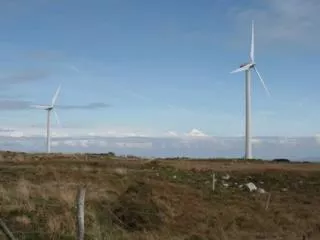
Hardwood Trees (TH, DI27) Return to the aerial photo
Hardwood Trees (TH, DI27) • DODs • 1 • 2 • 3 • 4 • 5 Return to the aerial photo
You make the call • DODs • 1 • 2 • 3 • 4 • 5 • 6 • 7 • 8 • 9 Damage Indicator Return to the aerial photo
Manufactured Home Single Wide • DODs • 1 • 2 • 3 • 4 • 5 • 6 • 7 • 8 • 9 Mobile Home Frame Return to the aerial photo
Closeup of the Home • DODs • 1 • 2 • 3 • 4 • 5 • 6 • 7 • 8 • 9 • 10 Return to the aerial photo
Track over the Norris School Norris School
Junior or Senior High School (JHSH, DI16) Roof off classrooms Large Span Roofs Collapsed
Junior or Senior High School(JHSH, DI16) • DODs • 1 • 2 • 3 • 4 • 5 • 6 • 7 • 8 • 9 • 10 • 11
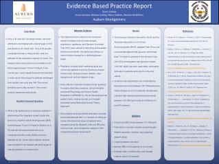
Case Summary • Case Study of the Tornado that struck Hallam, Nebraska on May 22, 2004 • Identify the Appropriate Damage Indicator • Assess the Degree of Damage • Identify Construction Quality variances and adjust DOD or wind speeds accordingly • Assign a final EF-Scale Rating (EF4)
Storms Prediction Center EF-Scale Website: http://www.spc.noaa.gov/efscale Texas Tech Wind Science Engineering Center: http://www.depts.ttu.edu/nwi/Pubs/FScale/EFScale.pdf A Guide to F-Scale Damage Assessment http://www.wdtb.noaa.gov/courses/EF-scale/lesson2/FinalNWSF-scaleAssessmentGuide.pdf Additional Information
If you have any questions about this lesson, contact Jim LaDue, James.G.LaDue@noaa.gov Contacts