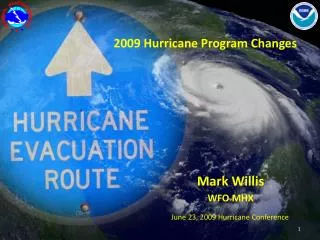
2009 Hurricane Program Changes Overview
Summary of 2009 NHC product changes including tropical weather outlook, cone graphic modifications, wind field graphics, text product changes, and the introduction of P-Surge for storm surge probabilities. Also covers HLS changes and various tools and resources added to the NHC website.

2009 Hurricane Program Changes Overview
E N D
Presentation Transcript
2009 Hurricane Program Changes Mark Willis WFO MHX June 23, 2009 Hurricane Conference
2009 NHC Product ChangesTropical Weather Outlook • Graphical tropical weather outlook (TWO) becomes operational • Text TWO will include three-tiered categorical genesis forecast (low, medium, high) • New probability categories: • Low: < 30% • Medium: 30–50% • High: > 50% • “Special” TWOs to be issued in lieu of Special Tropical Disturbance Statements (DSA) • Same product header as regular TWO • Updated section will be highlighted THERE IS A HIGH CHANCE...GREATER THAN 50 PERCENT...OF THIS SYSTEM BECOMING A TROPICAL CYCLONE DURING THE NEXT 48 HOURS.
2009 NHC Product ChangesCone Graphic • Default cone graphic will NOT show the “skinny black line” • Graphic with line still accessible on NHC website • Circles on cone graphic for Atlantic only slightly smaller this year (based on 2004-2008 error statistics) • Cone radii for 2009 (n mi):12h: 3624h: 62 36h: 8948h: 111 72h: 16796h: 230120h: 302
2009 NHC Product ChangesWind Field Graphic • TC wind field graphic becomes operational • Depicts: • Current coastal watches and warnings • Smoothed representation of analyzed tropical storm and hurricane force wind fields • Current location • Past track • Updated only on full advisory package issuance…NOT on intermediates
2009 NHC Product ChangesText Product Changes “Repeat” section of Public Advisory will change to a more parse-able format: • ...SUMMARY OF 1100 PM EDT INFORMATION... • LOCATION...23.7N 72.2W • MAXIMUM WINDS...40 MPH • PRESENT MOVEMENT...WEST OR 275 DEGREES AT 8 MPH • MINIMUM CENTRAL PRESSURE...1001 MB • “Z” time will be referenced as “UTC” in all advisory products • Time zone referenced in the tropical cyclone discussion (TCD) will now be the same time zone that is used in the public advisory (TCP) • Monthly Tropical Weather Summaries shortened to tabular summary of cyclones during the month and short narrative of records of interest
Recent Additions to NHC Web Graphical tropical weather outlook (TWO) RSS/XML feed Improved version of website for PDAs and smart phones Experimental PODCAST available when NHC media pool activated Usually when Hurricane watch or warning in effect for U.S.
NHC Changes for 2009 Storm Surge
Storm Surge Storm Intensity and Size Stronger = Higher Surge Larger = Larger impact area and higher surge Storm Speed Slower Often Means Higher Surge Angle to Coast at Landfall Perpendicular Maximizes Surge (Katrina) What does Surge depend on? • Bathymetry • Shallow = worse Slight deviations in these factors can mean large differences in storm surge!
Rmax=25 mi (forecast) Surge Based on NHC - 12 hr. Advisory
ACTUAL TRACK TRACK FORECAST 133 mph, 933 mb. Actual Hurricane Track 30 mi. E of 12 hr. Advisory Forecast Track
Rmax=40 mi Surge Based on NHC Storm Best Track
What product can take all of this potential error into account? • PSURGE – or storm surge probabilities.
P Surge: Alternative to Single Runs Use an ensemble of SLOSH runs to create probabilistic storm surge (p-surge) Atlas of pre-computed surge maps based on: Different directions of motion Different landfall locations Different intensities Different storm sizes Different forward speeds Based on statistics of NHC error including: along track error (timing), cross track (location), intensity, and Rmax error.
Beginning when the NHC issues a hurricane watch or warning for the continental US Available approx. 1-2 hours after the advisory release time When is P-Surge Available? http://www.weather.gov/mdl/psurge/active.php
Deterministic Runschanges this year SLOSH will be run approximately 36 hours prior to arrival of TS winds Why only 36 hours? NHC track/intensity errors Run every 6 hours coinciding with full advisory package Animated gifs Still images of Envelope of High Water (EOHW) Rexfiles Shapefiles (GIS) Output placed on FTP site: ftp.nhc.noaa.gov www.nhc.noaa.gov/ftp
HLS Changes • Main change is that the HLS will include an overview section that will contain all of the main information on the storm. Site specific information, such as storm surge and winds, will be in the segments below the overview.
Thank you… Questions? Comments? Mark.Willis@noaa.gov