Bellringer
Bellringer. What is it called when the air cannot hold any more moister? What weather instrument is used to measure wind speed? What weather instrument measures humidity? What biome has trees that lose their leaves in the fall?. Bellringer. What weather instrument measures wind direction?

Bellringer
E N D
Presentation Transcript
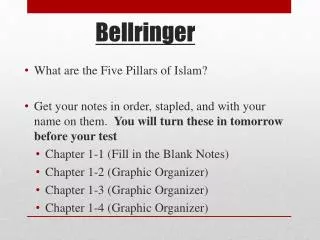
Bellringer • What is it called when the air cannot hold any more moister? • What weather instrument is used to measure wind speed? • What weather instrument measures humidity? • What biome has trees that lose their leaves in the fall?
Bellringer • What weather instrument measures wind direction? • What biome has a frozen layer of soil called permafrost? • When the air is saturated, relative humidity is _________%. • What type of weather does high pressure systems bring?
What are clouds? • A cloud is made up of tiny water droplets and/or ice crystals, a snowflake is a collection of many ice crystals, and rain is just liquid water.
CONDENSATION Sunlight causes water to evaporate into the atmosphere. This air containing the water vapor is heated at the surface of the earth and rises. As the air rises, it cools and the water vapor condenses on some form of particulate matter such as dust, ash, or smoke to form clouds. The particulate matter are called Condensation Nuclei. Condensation on spider webs. Views of early morning fog in Indiana
Importance of Clouds • So, what is a cloud? ~ A cloud is a thick mass of suspended water drops or ice crystals. • What do clouds tell us? ~ The presence of clouds in the sky is one type of signal to meteorologists that there will be changes in the weather. Predicting the weather requires the understanding of the different types of clouds
Identifying CloudsTo better communicate and understand the many cloud forms in the sky, meteorologists identify clouds based on five basic cloud characteristics: 1. The altitude at which they occur 2. Color3. Density 4. Shape5. Degree of cover. From this information, we can identify three basic cloud types and seven other common cloud types.
Cloud Names • Names of specific types of clouds are created by combining the name of the cloud's shape with the name of the cloud's height.
Cumulus Stratus Cirrus Clouds There are 3 main types of clouds: • Cumulus or fluffy clouds • Stratus or layered clouds • Cirrus or thin feathery clouds
Cirrus • The word cirrus comes from a Latin word and means a tuft or curl of hair. Cirrus clouds are very wispy and feathery looking.
Cirrus • The long stringy cirrus clouds are called "mares' tails."
Cirrus Clouds • Cirrus generally occur in fair weather and point in the direction of air movement at their elevation.
Cirrus Clouds • Cirrus clouds are thin, white clouds with a feathery appearance. • They are the highest of all clouds forming at heights of 30,000 feet or more above the earth's surface. • Cirrus clouds are formed by ice crystals. • Cirrus clouds are usually the first sign of an approaching storm.
Low Clouds = Stratus • Stratus • Stratocumulus • Nimbostratus
Stratus Clouds Low clouds are made of water droplets. However, when temperatures are cold enough, these clouds may also contain ice particles and snow.
Stratus Clouds Stratus clouds are thin, sheet-like clouds. They are layered with some rippling, and cover large portions of the sky. They are frequently gray and thick. Stratus clouds are formed when air is forced up slowly.
Stratus The word stratus comes from the Latin word that means "to spread out." Stratus clouds are horizontal, layered clouds that stretch out across the sky like a blanket.
Stratus Clouds • Stratus Clouds stretch across the sky in low, large flat layers. They resemble fog, but they do not reach the ground. They often produce mist or drizzle.
Cumulus Clouds: • Cumulus clouds are flat-based, billowing clouds with vertical doming. Often the top of cumulus clouds have a "cauliflower-like" appearance. Cumulus clouds are most prominent during the summer months. • Cumulus or fluffy clouds form when air is forced up rapidly and therefore rises higher.
Vertically Developed CumulusClouds • Fair weather cumulus have the appearance of floating cotton and have a lifetime of 5-40 minutes. The word cumulus comes from the Latin word for a heap or a pile. Cumulus clouds are puffy in appearance. They look like large cotton balls.
Cumulus Clouds • Harmless fair weather cumulus clouds can later develop into towering cumulonimbus clouds associated with powerful thunderstorms.
Cumulus • The clouds that produce heavy thunderstorms in summer are a form of cumulus clouds called cumulonimbus. Cumulonimbus clouds may extend upward for hundreds of meters.
Cloud Type by Altitude-01Clouds can also be classified based on their altitudeThere are three categories of cloud heights:High Clouds = Cirrus Middle Clouds = Alto Low Clouds = Stratus
Cirro • High clouds: 7-18km Cold: less than 25oC & made up of ice crystals Cirrostratus: high, wispy clouds. They give the sky a milky white appearance. Cirrocumulus: delicate clouds appearing in bands or ripples across the sky. They are one of the least common of the cloud types.
Alto Theseclouds usually form from the gradual lifting of air in advance of a cold front. Middle level clouds: 2-7 km 0-25oC & composed of both water and ice crystals The presence of altocumulus clouds on a warm and humid summer morning is commonly followed by thunderstorms later in the day. Altostratus:thin, layered clouds that are blue-gray or whitish in color and often cover large portions of the sky. They are thinner if formed at higher altitudes but are heavier and more dense if closer to the ground. * Picture of altocumulus clouds taken by satellite Altocumulus:oval or eliptical in shape, and can have gray undersides. They often have a "cottonball-like" appearance.
Strato • Low level clouds: 0 - 4 km • Greater than 5oC & composed of water • Stratus: Dense, uniform dark gray layers. Stratocumulus: groups of dense, puffy clouds that cover the sky in dark heavy masses, long and gray. The often form in bandsacross the sky.
Fog • Fog : Clouds at ground level • Radiation fog: forms at night when cold ground cools the air above it (in valleys) • Advection fog:forms when warm, moist air moves over colder surface and cools (in coastal areas)
In this fog, off the coast of Oregon, a cold ocean current cools the air to the air’s dew point temperature. This cooling of the air created the fog. This is called: Advection Fog
For the development of this fog, warm water is evaporating into cool air. The cool air becomes saturated (its relative humidity becomes 100%) and condensation creates the fog. This is called: Evaporation Radiation Fog Cold Air Condensation Warm Water
Cloud Type by Rain • Finally, we can classify them based on the presence of rain • Nimbus:any cloud that rains Nimbostratus: low, flat clouds that are often associated with steady precipitation and occur in thick, continuous layers and are often dark gray in color. Cumulonimbus:taller, towering versions of cumulus clouds. Their height can be from two to five miles. These clouds often form thunderstorms.
Watch for Cumulus CloudsSteps:1. Think "puffy" when you want to identify cumulus clouds. 2. Make a comparison to masses of cotton balls or piles of whipped cream. 3. Remember, cumulus clouds are the clouds we used to look at and imagine they were people, shapes, animals, etc.
Watch for Nimbus CloudsSteps:1. Think "rain" when you see nimbus clouds. 2. Remember, nimbus clouds can be stratus or cumulus. 3. Watch for stratus clouds to evolve into nimbostratus formations when low-level clouds shed rain. 4. Look for cumulonimbus clouds when thunderstorms begin to build.
Watch for Stratus and Cirrus CloudsSteps:1. Think "flat" when you're identifying stratus clouds. 2. Remember, high altitude cirrostratus clouds appear as thin, wispy sheets. 3. Look for stratus clouds at any altitude. 4. Look high into the sky for cirrus clouds. 5. Remember, cirrus clouds consist of moisture thrown up by distant storms and turned to ice. 6. Watch for thin, hair-like, disconnected wisps of clouds at altitudes above 18,000 feet. 7. Remember, stratus and cumulus clouds can occur at those same altitudes; these clouds are correctly identified as cirrostratus and cirrocumulus clouds.
Writing Activity: • Write a paragraph about one type of cloud. Include 3 or more facts about the cloud.