Download
1 / 24
240 likes | 381 Views
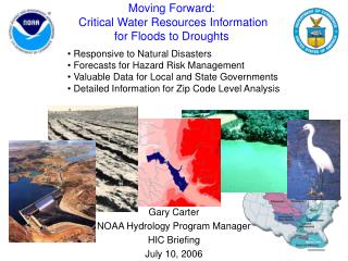
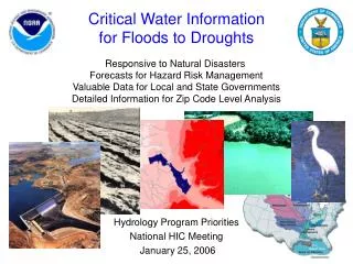
Critical Water Information for Floods to Droughts. Responsive to Natural Disasters Forecasts for Hazard Risk Management Valuable Data for Local and State Governments Detailed Information for Zip Code Level Analysis. Hydrology Program Priorities National HIC Meeting January 25, 2006.

E N D
Critical Water Informationfor Floods to Droughts Responsive to Natural Disasters Forecasts for Hazard Risk Management Valuable Data for Local and State Governments Detailed Information for Zip Code Level Analysis Hydrology Program Priorities National HIC Meeting January 25, 2006
River channel Developed Shrubs/Grass Agriculture Wetlands Forecast Point Forecast Basin Protecting Life, Livelihood, and Way of Life River Services (600 miles per forecast point) Water Resource Services (6 square mile forecast basins) River Conditions Soil Conditions
NOAA Hydrology Program • Program Team Composition • River Forecast Centers • National Operational Hydrologic Remote Sensing Center • Office of Climate, Water, and Weather Services, Hydrologic Services Division • Office of Hydrologic Development • Program Customers • Federal Water Agencies • Commercial Waterway Navigation • Emergency and Water Resource Managers • General Public • Councils associated with the Hydrology Program • Research, Platform Allocation, Observing Systems, CIO, Education, International Affairs
Office of Hydrologic Development Organization Chart45 Full Time Equivalent (FTE) Positions
Algorithm Services Control Services Data Services Security Services Display Services Community Hydrologic Prediction System (CHPS) Federal agencies State, regional, and local cooperators Universities Private sector International organizations Point Information (Stations, Grid Cells) Near-Surface Deep Soil Moisture Runoff Snow Water Equivalent Precipitation Evapotranspiration Vector Information (River Segments) River Stage & Flow Surface Water Storage Water Supply Availability Hydrology XML Consortium Evolving to become “pulse” of CHPS http://www.weather.gov/oh/hydroxc/index.html Flood Potential Water Quality
Collaborative ResearchAreas of Emphasis Observations Community Observations Data Assimilation Analysis Community Models Model Forecasts Post-processed Model Data Forecast System Forecaster User (public, industry…)
Long-term Vision: Integrated Water Science Coupled ocean/atmospheric/ land-surface model (global) WEATHER & CLIMATE FOCUS Coupled atmospheric/land-surface model (regional) Observing Systems Common Hydrologic Land-Surface Modeling System (Uncoupled) Research Labs WATER FOCUS Land Surface Hydrology & Water Resources Modeling Interface with Estuary Models, Water Quality Models
Hydrology Testbed: RTO Process Validation & Verification Prototype Operational Algorithms Operational Implementation “Test” Environment R&D Algorithms Users & Customers (RFCs, WFOs, Other Agencies) New Science Feedback Collaborative R&D Partners (NOAA Labs, Universities)
Long-term Vision:Hydrology Testbed • Enable Full Utilization of Existing Observing Systems • Development of data processing and assimilation capabilities • Science-to-Operations • Test new stream flow prediction models and forecasting techniques for time scales of hours to months NOAA EPA DOD New observing systems In-Situ Radar Water Resources Data Assimilation and CHPS AHPS Infrastructure USGS NASA Airborne Satellite New physiographic data physiographic Experimental River Forecast Center DOE USDA OTHERS
From Weather and Climate Predictions to Water Management Water Management Hydrology and Water Resources Modeling, Data Assimilation Drought Mitigation Flood Management Flash Flood Prediction Water Supply Transportation Emergency Management Agriculture Ecosystem Stewardship Weather and Climate Predictions: Temperature Precipitation Wind, … Water Prediction Hydrologic Ensemble Prediction Decision Support Tools
Hydrologic Modeling • Meteorological inputs • Physical, Institutional, • & Legal Features • Topography • Vegetation, land use • Lakes, glaciers • Soil properties • Ground water • River channel shape • River depth/flow • Dams, locks, levees • Reservoir operations • Irrigation, drains • Water rights
High Resolution Soil Moisture Forecasts – near term activities Test prototype version of soil moisture products from CONUS runs of HL-RMS and compare with other models Conduct economic impact analyses and case studies to identify the potential benefits of soil moisture forecasts
Community Hydrologic Prediction System (CHPS) – next steps NWSRFS Data Service – deliver, via AWIPS Operational Build 7.2, first increment of distributed hydrologic modeling capability integrated into NWSRFS using CHPS Data Services components proven in River, Reservoir, & Snow (RRS) pre-processor proof-of-concept. Hydrology XML Consortium – build schema-compliant XML read/write adapters, develop SHEF-XML translators, develop common dictionary, move Consortium beyond just OHD. Future NWSRFS Enhancements – Reservoir model: provide RFCs with a CHPS service to run the USACE Hydrologic Engineering Center’s Reservoir System Simulation program (HEC-ResSim) as an integral part of NWS operations Additional Hydraulic Models: identify the potential applications and feasibility for operational use of the USACE River Analysis System (HEC-RAS) Rapid Prototype Opportunity: examine WL/Delft Flood Early Warning System (FEWS) infrastructure to expedite migration to CHPS
Debris Flow Pilot Project • Interagency team chartered in December 2004 • Team activities • Two day meeting (Jan. 31 - Feb. 1, 2005) • Focus areas: • Customer identification/pilot project area • Models and modifications • Communications protocols/data acquisition mechanisms • Requirements for budget, personnel, operation and maintenance costs, etc. • Plan delivered in July 2005 • Prototype for Southern California during Winter 2005-6
Terrain • Land use/cover • Soil type • Precipitation Analyses • Precipitation and Soil Moisture Forecasts • Debris Flow Analyses • Service Delivery Long-term Vision: Debris Flow Watches and Warnings NOAA/USGS
Working Together: NOAA’s Science and Technology Infusion and Hydrology Programs
Stage1: Hydrology Testbed Core Project and NASA grant AHPS Water Resources “Development Test” Environment NIDIS Science Manager Cluster Computing IT/Software Manager
Stage 1: Hydrology Testbed • Development System for Water Resource Models • Structured software compatible with the Community Hydrologic Prediction System • Open platform for collaborative R&D and RTO, including objective and transparent testing • One-stop storehouse for new and emerging capabilities and experimental products • Laboratory for prototyping the next-generation hydrologic forecasting system and its computational and communications infrastructure • “Operational” Environment • National domain • Full domain modeled, focus on RFC test basins • Develop/test new science, demonstrate pathway to operations, conduct retrospective analyses • Requires modest cluster computing resources • Staff • Science Coordinator • Software Development/Architecture Specialist • Synergism with Other NOAA Testbeds • Climate Testbed • Hydromet Testbed • Hydrologic Ensemble Prediction Experiment (HEPEX) Testbeds • Oversight -HOSIP/OSIP
Hydrology Program Objectives • Outcomes • Improved Ecosystem Management • Contribute mercury concentration predictions for the Gulf of Mexico Mercury Contamination Project (collaborating NOAA Programs: ER, EO, FM, AQ, EM) • Increased Economic Benefits using Water Forecasts and Information • Contribute gridded forecasts of soil moisture and temperature for the National • Integrated Drought Information System (STI, LFW, EM, RDS, COA, CPP, CE) • Reduced Losses due to Floods • Contribute more accurate flood forecasts and warnings via the Advanced Hydrologic Prediction Service (LFW, CEO, STI)
Hydrology Program Assessment Water Resource Services • Watershed and soil condition forecasts for hazard resilient communities • Run-off or River flow • Soil moisture • Soil temperature • Precipitation • Snowpack • Surface storage • Ground water • Water temperature • Water quality • Short- to long-term water risk forecasts support hazard resistant businesses (including agriculture) and local ecosystem stewardship • Program Priorities • Extend Hydrologic Forecasting Service to Include: • Community Hydrologic Prediction System (CHPS) • Data Assimilation • Meet Customer Needs, e.g., National Integrated Drought Information System (NIDIS) • Provide Infrastructure for Water Quality Forecasts
Hydrology Program: Enhancement Process AHPS Program Plan Science and Technology Vision Water Resources Vision Current Operational Environment Future Environment HOSIP/OSIP
Requirement Drivers Advanced Hydrologic Prediction Service (AHPS) River Flow (short to long term) Graphical Dissemination Flash Flood HOSIP/OSIP Water Quality Forecasts** Water Resources Services* AHPS Review Committee Theme Teams National Integrated Drought Information System** NOAA Program Managers Hydrologists in Charge DOH Science Steering Team *Resources in FY06 Budget **Potential capability currently being considered
Water Predictions for LifeDecisions Hydrology Program: Proposed Oversight Group • Objective: Introduce a process to ensure high priority requirements are being addressed in an effective manner • Hydrology Program Manager • OHD Representative • HSD Representative • HIC Representative