Download
1 / 24
240 likes | 260 Views
Explore the findings from historic Mars robotic missions, including Mariner 4, USSR Mars 3, NASA Mariner 9, and Viking missions, revealing Mars' characteristics like craters, atmosphere, and geologic features.

E N D
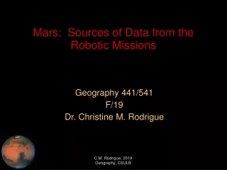
Geography 441/541 F/19 Dr. Christine M. Rodrigue Mars: Sources of Data from the Robotic Missions C.M. Rodrigue, 2019 Geography, CSULB
Mars: Data from Robotic Missions • Mariner 4: 1964 flyby mission, flyby on 14 July 1965 • So much for a nice, Earthlike planet • Magnetometer showed no magnetic field (team thought instrument buggy) • Occultation of spacecraft by Mars showed a really thin atmosphere • First image showed a cloud, thought impossible (maybe a lens crack) C.M. Rodrigue, 2019 Geography, CSULB
Mars: Data from Robotic Missions • Mariner 4: 1965 flyby • So much for a nice, Earthlike planet • Craters up the wazoo: Mars looked like the Moon • First topographic maps • One dead, bleak, battered planet C.M. Rodrigue, 2019 Geography, CSULB
Mars: Data from Robotic Missions • Mariner 6 and 7: 1969 flyby mission and first successful dual mission • Again, Mars is pretty disappointing • Both S/C flew over heavily cratered terrain over equator and South Polar area • They both missed the big volcanoes and Valles Marineris! • Dark areas were no canals • Dead, dry Mars C.M. Rodrigue, 2019 Geography, CSULB
Mars: Data from Robotic Missions • USSR Mars 3 orbiter/lander/rover • First successful orbiter/lander combination • Orbiter achieved unintended very elliptical orbit but survived • Active 8 months (12/71 – 8/72): 60 images, many discoveries • Lander worked for 15”: sent 1 image • Rover died with lander • Again, Mars is pretty disappointing • Dead, dry Mars C.M. Rodrigue, 2019 Geography, CSULB
Mars: Data from Robotic Missions • USSR Mars 3 orbiter/lander/rover • First-ever image from the surface of Mars C.M. Rodrigue, 2019 Geography, CSULB
Mars: Data from Robotic Missions • USSR Mars 4 • S/C fails orbit insertion and becomes unintended flyby • It does return some pictures • Dead, dry Mars C.M. Rodrigue, 2019 Geography, CSULB
Mars: Data from Robotic Missions • NASA Mariner 9 • First successful NASA orbiter (11/71 – 10/72) • Active for ~1 year • Arrived during huge global dust storm • Saw Olympus Mons emerge from the dust • Photomapped 100% of Mars • Still basis of Mars maps (MDIM) C.M. Rodrigue, 2019 Geography, CSULB
Mars: Data from Robotic Missions • NASA Mariner 9 • First successful NASA orbiter • First glimpse of possible river valleys C.M. Rodrigue, 2019 Geography, CSULB
Mars: Data from Robotic Missions • NASA Mariner 9 • First successful NASA orbiter • First image of Valles Marineris C.M. Rodrigue, 2019 Geography, CSULB
Mars: Data from Robotic Missions • NASA Mariner 9 • First successful NASA orbiter • Imaged Phobos and Deimos C.M. Rodrigue, 2019 Geography, CSULB
Mars: Data from Robotic Missions • USSR Mars 5 orbiter • Failure in orbit insertion • It did send back several images C.M. Rodrigue, 2019 Geography, CSULB
Mars: Data from Robotic Missions • USSR Mars 5 orbiter • Failure in orbit insertion • It did send back several images C.M. Rodrigue, 2019 Geography, CSULB
Mars: Data from Robotic Missions • NASA Viking 1976-1982 • Two orbiter/lander combinations: Viking 1 and 2 • Orbiter C.M. Rodrigue, 2019 Geography, CSULB
Mars: Data from Robotic Missions • NASA Viking 1976-1982 • Two orbiter/lander combinations: Viking 1 and 2 • Color image of Olympus Mons C.M. Rodrigue, 2019 Geography, CSULB
Mars: Data from Robotic Missions • NASA Viking 1976-1982 • Two orbiter/lander combinations: Viking 1 and 2 • Water flow from Maja Valles into Chryse flows around Dromore Crater (19.9° x -49.6°), breaking into the crater and through it C.M. Rodrigue, 2019 Geography, CSULB
Mars: Data from Robotic Missions • NASA Viking 1976-1982 • Two orbiter/lander combinations: Viking 1 and 2 • Fractured terrain in northern plains, similar to terrestrial polygon processes only much larger • These are about 5-10 km apart C.M. Rodrigue, 2019 Geography, CSULB
Mars: Data from Robotic Missions • NASA Viking 1976-1982 • Two orbiter/lander combinations: Viking 1 and 2 • Pedestal craters C.M. Rodrigue, 2019 Geography, CSULB
Mars: Data from Robotic Missions • NASA Viking 1976-1982 • Two orbiter/lander combinations: Viking 1 and 2 • Lava flow from Arsia Mons 1500 km away floods older cratered landscape • Pickering Crater (-33.9° x -134.4°) in Dædalia Planum • Illustrates “crater-rating” method of relative chronology C.M. Rodrigue, 2019 Geography, CSULB
Mars: Data from Robotic Missions • NASA Viking 1976-1982 • Two orbiter/lander combinations: Viking 1 and 2 • Cirrus clouds, bigger’n beans! C.M. Rodrigue, 2019 Geography, CSULB
Mars: Data from Robotic Missions • NASA Viking 1976-1982 • Two orbiter/lander combinations: Viking 1 and 2 • Cyclone in northern plains C.M. Rodrigue, 2019 Geography, CSULB
Mars: Data from Robotic Missions • NASA Viking 1976-1982 • Two orbiter/lander combinations: Viking 1 and 2 • Stereo pairs as one way to estimate elevation C.M. Rodrigue, 2019 Geography, CSULB
Mars: Data from Robotic Missions • NASA Viking 1976-1982 • Two orbiter/lander combinations: Viking 1 and 2 • Paraná Valles in Margaritifer Sinus (-22.9° x 10.2°) • Check out the dendritic drainage! C.M. Rodrigue, 2019 Geography, CSULB
Mars: Data from Robotic Missions • NASA Viking 1976-1982 • Two orbiter/lander combinations: Viking 1 and 2 • Dust trapped in Kaiser Crater, in Noachis Terra (-47.2° x -19.1°) • Creates a dune field C.M. Rodrigue, 2019 Geography, CSULB