Download
1 / 19
190 likes | 326 Views
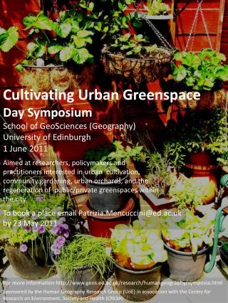
The Salisbury Greenspace Partnership aims to create a thriving environment for people and wildlife in the Salisbury area. By collaborating with local communities, environmental organizations, and authorities, the partnership emphasizes the importance of green infrastructure for sustainability, biodiversity, and community well-being. Our goals include mapping and managing local greenspaces, raising awareness about their value, and fostering connections among various stakeholders. Together, we strive to enhance the quality of life, mitigate climate change, and promote appreciation for nature in our urban environment.

E N D
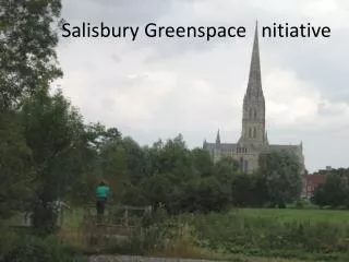
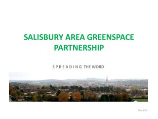
SALISBURY AREA GREENSPACE PARTNERSHIP S P R E A D I N G THE WORD Nov 2013
Salisbury Greenspace Partnership https://salisburygreenspace.wordpress.com/ Wiltshire Council’s Green Infrastructure Strategy http://www.wiltshire.gov.uk/communityandliving/countryside/environmentalpartnerships/greenspaces National Ecosystem Assessment 2009-11 http://uknea.unep-cmc.org/Home/tabid/38/Default.aspx Government White Paper ‘The Natural Choice: securing the value of nature’ June 2011 http://sd.defra.gov.uk/2011/06/the-natural-choice-securing-the-value-of-nature/ Defra’sNatural Capital Committee http://www.defra.gov.uk/naturalcapitalcommittee/natural-capital/what-is-natural-capital-2/ Local Nature Partnerships & Local Enterprise Partnerships www.archive.defra.gov.uk/.../natural/.../local-nature-partnerships-overview A recent report from the Government think-tank Policy Exchange about importance of greenspace mapping http://www.landscapeinstitute.org/news/Online-map-could-crowd-source-information-for-improving-urban-green-space Links to background information
The Vision for the Partnership • Working together: • To create a better environment for people and wildlife in the Salisbury area • To provide a strong local voice for greenspace and raise awareness of its value • To plan and manage the green infrastructure (GI) for the • longer term
What is greenspace/green infrastructure? Playing fields Urban Parks Cemeteries Children’s play areas Allotments Street trees Street trees Water meadows Cycle ways Urban woodlands River corridors Railway embankments
Why is GI so important? It plays a vital part in providing the natural resources we need to survive: biodiversity, and many and varied habitats clean air and water helps to mitigate climate change fertile soils flood protection food fuel
Why is GI so important? It enhances our quality of life: provides inspiring places places that are rich in wildlife places to play and excercise places to relax and enjoy places to experience the natural world
Why is GI so important? It helps create attractive and distinctive places in which to live: adds value to property, provides educational resources, attracts businesses to invest in an area brings local communities together
Area covered by the Partnership Wilton Laverstock and Ford Salisbury City
Current Partners Local Specialist Groups South Wilts Agenda 21 South Wilts Agenda 21 Biodiversity Group Salisbury Natural History Society River Bourne Community Farm CPRE South Wiltshire Group Salisbury Civic Society COGS (Cycling Opportunities Group Salisbury) Bemerton Activity Trails Salisbury Beekeepers Wiltshire Bat Group Five Rivers Association Bat Group Wiltshire Botanical Group Wilton Community Land Trust Local Authority Wiltshire Council – officers concerned with public open space, public rights of way, green infrastructure strategy, spatial planning, landscape, ecology, countryside Salisbury Vision Parish Councils Salisbury City Laverstock & Ford Wilton Town Council Community/ Volunteers Salisbury City Community Area Partnership Friends of HarnhamWatermeadows Dean & Chapter, Salisbury Cathedral Friends of Harnham Slope Friends of Churchill Gardens Sarum Academy Salisbury Wildlife Group TCV – The Conservation Volunteers Wiltshire NHS Walking for Health Wiessex Community Action Environmental Agencies Natural England Link2Nature (Wiltshire & Swindon Local Nature Partnership) Forestry Commission Environment Agency RSPB Wiltshire Wildlife Trust English Heritage
What are the local issues? Country Park at Hampton Park 2 Durnford Woodford South Newton Avon Valley Nature Reserve Laverstock & Ford River Bourne Community Farm Quidhampton Wilton Salisbury Clarendon Park Netherhampton Harnham Slope Woodland Britford Fragmented Ownerships
What are the local issues? Durnford Woodford South Newton Laverstock & Ford Quidhampton Wilton Salisbury Clarendon Park Netherhampton Britford Different Jurisdictions – Wiltshire Council + 10 Parishes
What are the local issues? Amesbury Area Board Southern Area Board Salisbury Area Board South West Area Board Different Jurisdictions – 4 Area Boards
What are the local issues? Longhedge Old Sarum Airfield Durnford Woodford South Newton Fugglestone Red Laverstock & Ford Erskine Barracks Hampton Park Quidhampton Salisbury Wilton Clarendon Park The Maltings Netherhampton Southampton Road Gateway Britford Development Pressures
Other local issues? • Poor connections between existing green spaces • Current management regimes that tend not to benefit wildlife • Problems of overuse and misuse especially on the urban fringes • Lack of knowledge and interest in local green spaces • Lack of resources • Lack of vision for the planning and management of greenspace and green infrastructure
Current focus? • Mapping local greenspace to find out what is out there and where it is. This includes updating Salisbury District Council’s 2007 Public Open Space Survey • Carrying out Phase 1 Habitat Mapping to provide baseline information initially for priority sites • Parish Council footpath surveys, and hedgerow surveys as part of the CPRE’s Hedgerow Initiative 2010
Greenspace mapping • Typology: • Readily accessible community greenspace • Restricted/controlled access greenspace • Natural/semi-natural greenspace • Productive greenspace • Strategic greenspace • Linear features Sample Map Sample Survey Sheets
Phase 1 Habitat Mapping Parish Surveys Neutral grassland Small swamp area Improved grassland Broadleaved, mixed & yew woodland River Bourne Community Farm Detailed habitat information is recorded in additional Target Notes Residents of Laverstock & Ford Parish training for their hedgerow surveys
Resources for Partners • Comprehensive mapping and data on local greenspace to support more wildlife friendly management • A regular greenspace forum to ensure a stronger voice for greenspace • Improved community support with greater resources for local green infrastructure