Download
1 / 27
270 likes | 373 Views
Rob Fletcher, Head of Geospatial Platforms & Solutions, envisions our company as a world-leading technology and innovation partner for businesses of all sizes, unlocking the potential of space-based applications. Through our Satellite Applications Catapult, Government Services, CEMS concept, and DSI initiative, we provide cutting-edge services like data collection, consolidation, processing, integration, and repatriation. Additionally, the UKCGS boasts advanced capabilities with high-resolution data and international partnerships, driving impactful projects worldwide. Our Earth and Sea Observation System (EASOS) offers transformative solutions for flood prediction, disaster management, and marine pollution detection, delivering actionable insights for environmental resilience. Join us in shaping a sustainable future through space technology applications.

E N D
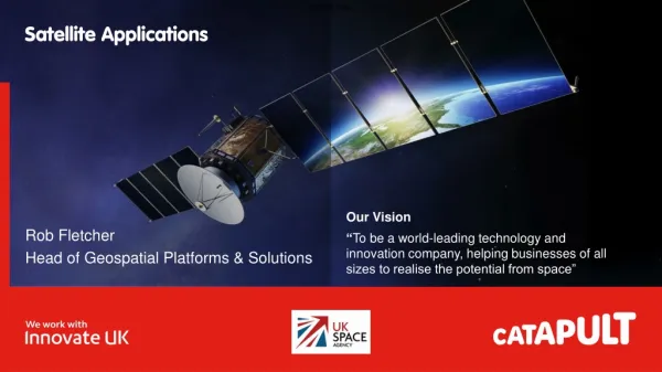
Rob Fletcher • Head of Geospatial Platforms & Solutions Our Vision “Tobe a world-leading technology and innovation company, helping businesses of all sizes to realise the potential from space”
Satellite Applications Catapult Government Services
CEMS Concept Established 2013 Current usage: 48 live environments Projects & SMEs 450+ VMs 1100 Ghz CPU 6.2TB RAM 80% Utilised Confidentiality Status: Catapult Open
CEMS – Cloud Computing for the Space Community Confidentiality Status: Catapult Open
DSI - ESA Data Consolidation and Bulk Processing Service Initiative ATSR AATSR Aeolus Cryosat Meris Data Collection: Reception of media from ESA, uploading of the data into storage, assessment of the contents and production of an inventory Data Consolidation: different stages covering data cleansing (removal of corrupted data and exact duplicates, merging data of same instrument from different sources into a single dataset and assessment of data completeness) Processing system Integration: where the processing system is installed, integrated and tested in the operational environment, ready for operational processing Reprocessing / Bulk processing / Format Conversion execution of the processing itself Data Repatriation / delivery: Deliver data to ESA or other centres (PACs or future LTDP centres) upon request and to provide on‐line access to data for specific purposes Confidentiality Status: Catapult Open
http://sedas.satapps.org/ Confidentiality Status: Catapult Open
UKCGS – The Catapult’s Role 10Gbit/Sec Launched October 2016: Number of registered users: 800+ Countries of registration: 70+ Number of ingested products: 6.7 Million+ Totalling 5.6PB of data UKSA High resolution UK Data NovaSAR data coming Summer 2019 10Gbit/Sec 10Gbit/Sec Confidentiality Status: Catapult Open
SEDAS Portal Confidentiality Status: Catapult Open
UKSA International Partnership Programme The International Partnership Programme (IPP) is a multi million pound programme run by the UK Space Agency. IPP focuses on using the UK space sector’s research and innovation strengths to deliver a space enabled Official Development Assistance (ODA) compliant programme, that provides a measurable and sustainable economic or societal benefit to emerging and developing economies around the world. • EASOS Malaysia – Illegal deforestation, Coastal pollution & Flood prediction • CommonSensing Fiji, Vanuatu & Solomon Islands - Improve national resilience towards climate change • SEMDAC Chile - Illegal, Unregulated and Unreported (IUU) fishing • Illegal Gold Mining Colombia - Detection of illegal gold mining activity in remote forested areas • Space-based dam monitoring Peru - remotely measuring displacements of tailing dams and other mining infrastructure. Confidentiality Status: Catapult Open
EASOS – Earth and Sea Observation System Confidentiality Status: Catapult Open
EASOS: FLOOD WATCH Reducing the human and economic cost from flood disasters Benefits • Provide warning of flooding up to 7 days in advance • Enable preventative action to be taken prior to a disaster event • Enable the Disaster Management committee to coordinate all agencies, and take preventative measures acting on consistent, reliable information • Achieve over 90% accuracy for flood alerts with a 12 hour lead time Capabilities • Forecast the impact of rainfall • Continuously monitor river and rain gauge state • Locate and visualise forecasted flood impact on key infrastructure such as roads, evacuation centres, medicinal facilities • Assess human and financial impact of forecasted flooding • Flood planning for 1 in 5 to 1 in 10000 year scenarios
EASOS – Earth and Sea Observation System Confidentiality Status: Catapult Open
EASOS – Earth and Sea Observation System Confidentiality Status: Catapult Open
EASOS: MARINE WATCH Reduce the financial and environmental impact of marine pollution Benefits • Reduction in financial impact of marine pollution • Early warning of impact to environmentally sensitive coastline • Decision support for containment and cleaning efforts • Reduce loss of habitat and damage to marine life by deterring ships from pumping bilges off the coastline • Detect potential oil pollution incidents on the surface of the ocean • Forecast pollution dispersal for the next 84 hours • Automatic alerts based on areas of interest, oil detection size and forecasted coastal impact • AIS data integration to help identify vessels which could be responsible • Model what-if scenarios for oil spills and model the impact of boom deployment • Rapidly identify nearby vessels which can assist with oil slick assessment Capabilities
EASOS – Earth and Sea Observation System Confidentiality Status: Catapult Open
EASOS – Earth and Sea Observation System Confidentiality Status: Catapult Open
EASOS – Earth and Sea Observation System Confidentiality Status: Catapult Open
EASOS – Earth and Sea Observation System Confidentiality Status: Catapult Open
EASOS: FOREST WATCH Reduce the social and environmental impact of illegal logging Benefits • Regional level detection and monitoring of logging activities • Enables enforcement of forestry legislation and management practices • Help protect the endangered species threatened by their diminishing habitat • Identify change to the forest canopy in protected areas • Automatic alerts based on areas of interest, detection size and trends • Hotspot monitoring using high resolution Radar data Capabilities
EASOS – Earth and Sea Observation System Confidentiality Status: Catapult Open
EASOS – Earth and Sea Observation System Confidentiality Status: Catapult Open
EASOS – Earth and Sea Observation System Confidentiality Status: Catapult Open
EASOS – Earth and Sea Observation System Confidentiality Status: Catapult Open
EASOS – Earth and Sea Observation System Confidentiality Status: Catapult Open
EASOS – Earth and Sea Observation System Confidentiality Status: Catapult Open
Links and Contacts • UKSA - https://www.gov.uk/government/organisations/uk-space-agency Satellite Applications Catapult - https://sa.catapult.org.uk/ CEMS - https://sa.catapult.org.uk/facilities/cems/ SEDAS - http://sedas.satapps.org/ Me – Robert.Fletcher@SA.Catapult.org.uk Confidentiality Status: Catapult Open


