Download
1 / 28
280 likes | 358 Views
Explore the evolution and benefits of using XML and style sheets in meteorology, providing multi-language support and multiple output formats including paper and online databases. Learn how the conversion to XML streamlined processes and improved data accessibility.

E N D
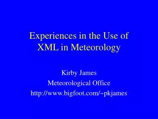
Experiences in the Use of XML in Meteorology Kirby James Meteorological Office http://www.bigfoot.com/~pkjames
WMO - World Meteorological Organization • Agency of the United Nations • Global Responsibilities (180+ countries) • Co-ordination of Observations, Standards, Reference and Training • Six Official Languages - English, French, Spanish, Russian, Arabic & Chinese
Reference Material Dictionaries & Glossaries • ideal application for XML & style sheets • multi-language support • single source - multiple outputs in different formats • paper (RTF) • Web (HTML) • on-line database (XML)
Oxford English Dictionaryhttp://algonquin.uwaterloo.ca/OED/ <E> ; ENTRY <HG> ; HEADWORD GROUP <HL>slate</HL> ; HEADWORD LEMMA <MPR>sl<i>e&mac.</i><su></su>t</MPR> ; M PRONOUNCIATION (<IPR> ; IPA PRONOUNCIATION <IPH>sle&shti.t</IPH>) </IPR>, <PS>v.</PS> ; PART OF SPEECH <HO>3</HO> ; HOMONYM NUMBER </HG> <LB>north.</LB> and<LB>Sc.</LB> ; USAGE GEOGRAPHIC
WMO - International Meteorological Vocabulary • 800 pages • 3,000 entries (keywords) • four languages (English, French, Spanish, Russian) • cost $100
WMO - International Meteorological Vocabulary A3310 automatic picture transmission syn. APT Direct broadcast of low resolution pictures taken from a satellite to ground stations equipped with appropriate receiving devices (B1200). transmission automatique d'images syn. APT Mode de diffusion directe d'images satellitaires à basse résolution aux stations terrestres dotées de l'équipement de réception nécessaire (B1200).
International Meteorological Vocabulary - Conversion to XML • original document was available in machineable form (.RTF) • document had high level of structure • conversion to XML was relatively straightforward (custom Perl scripts)
International Meteorological Vocabulary - Output • primary requirement for Web output, in a number of different formats (e.g. single language, two language, etc.) • requirement to minimise size of HTML files • used James Clark’s Jade parser • used DSSSL style sheets
UK Meteorological Glossary • already in machineable form (Quark Express) • already highly structured • single language (few foreign terms) • requirement to output to Web format • requirement for topic groupings • requirement for mathematical formulae
Classification - Topics • Existing Classification of Glossaries • Thermometer • BT = broader term (meteorological instrument) • NT = narrower term (Wet-bulb thermometer) • RT = related term (Thermograph) • tree-like structure with cross-links
Glossary - Mathematics • standards not widely accepted by users and vendors • poor support of maths by browsers • often in-line GIFs used • used TeX embedded in <M> tags • <M>$$ A = \pi r^2 $$</M>
Issues? • American Meteorological Society Glossary • 4 years work by involving 35 individuals • 18 months over schedule • cost in excess of $360,000
Meteorological Codes • Code (noun) • a system of words, letters, figures or symbols, used to represent others for secrecy or brevity, • a system of prearranged signals used in transmitting messages, • a set of rules on any subject
Surface Observations • SYNOP Code • 03772 11583 72314 10182 20119 40032 51031 69901 70282 868/1 81825 86645 90710 91125 • 0377203 UK; 772 Heathrow • 72314 7 octas cloud 230° 14 knot wind • 10182 18.2°C air temperature • 20119 11.9°C dew point • 40032 1003.2 hPa QFF
XML (Synop) Code <!DOCTYPE OMF SYSTEM "http://zowie.metnet.navy.mil/~spawar/JMV-TNG/XML/OMF.dtd"> <Reports TStamp="914456730"> <SYN Title='AAXX' TStamp='908539200' LatLon='37.483, 130.900’ BId='471150' SName='ULLUNGDO ISLAND’ Elev='223'> <SYID WS='4'>16124 47115</SYID> <SYG Ceiling='3000' Vis='5000' Wind='50, 8' T='17.6' TD='14.1' P='984.4' P0='1010.4' Pd='2 2.0' Prec='9, 12' WX='1022' Tmm=', 18.9' Clouds='8552/'> 11650 80516 10176 20141 39844 40104 52020 60092 71022 8552/ 333 10189 31017 55000 70126 92064</SYG> </SYN> </Reports>
Meteorological Code Tables <BUFR-TABLE ID="001003"> <TITLE>WMO Region or Geographical Area</TITLE> <BODY> <BN> 0 </BN> <BNAME> Antarctica </BNAME> <BN> 1 </BN> <BNAME> Africa </BNAME> <BN> 2 </BN> <BNAME> Asia </BNAME> <BN> 3 </BN> <BNAME> America </BNAME> <BN> 4 </BN> <BNAME> N America </BNAME> <BN> 5 </BN> <BNAME> SW Pacific </BNAME> <BN> 6 </BN> <BNAME> Europe </BNAME> </BODY> </BUFR-TABLE>
Logical Data Model for Meteorological Data • map projection: • projection type, • projection orientation, • size and shape of the earth or other body. • projection type: • latitude/longitude or • instantaneous space view or • polar orbiter or • polar stereo-graphic or • other.
Unexpanded SGML <!ENTITY MAP-PROJECTION ' <node><and> &PROJECTION-TYPE; </and> </node> <node><and> &PROJECTION-ORIENTATION; </and> </node> <node><and>size and shape of the earth </and></node> ' > <!ENTITY PROJECTION-TYPE ' <node><or>lat-long</or></node> <node><or>instantaneous space view</or></node> <node><or>polar orbiter</or></node> <node><or>polar stereo-graphic</or></node> <node><or>other</or></node> ' >
Expanded SGML <N><A>Co-ordinate system</A> <N><A>map projection</A> <N><A>projection type</A> <N><O>lat-long</O></N> <N><O>instantaneous space view</O></N> <N><O>polar orbiter</O></N> <N><O>polar stereo-graphic</O></N> <N><O>other</O></N> </N> <N><A>projection orientation</A> <N><O>normal</O></N> <N><O>transverse</O></N> . . . . . etc.
Documentation & Interface to Legacy Database • Custom databases used to give acceptable performance for access to multi-dimensional data-sets • XML used to document database calls (presented in HTML) • same XML source used to drive Web-based ad-hoc query interface
Summary • benefits greatest when ‘data’ well structured • cost of organising poorly structured data can be exceptionally high • until recently lack of effective tools for preparation editing of XML source • diminishing requirement for paper output reduces benefits of multiple output formats http://www.bigfoot.com/~pkjames