Access to green areas
330 likes | 470 Views
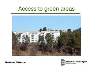
Access to green areas. Marianne Eriksson. Environmental objectives: A Good Built Environment. Interim target 1, 2010 By 2010 land use and community planning will be based on programmes and strategies for :

Access to green areas
E N D
Presentation Transcript
Access to green areas Marianne Eriksson
Environmental objectives: A Good Built Environment Interim target 1, 2010 By 2010 land use and community planning will be based on programmes and strategies for: ’preserving, maintaining and enhancing green spaces and water bodies in urban and suburban areas for nature conservation, cultural and recreational purposes, and ensuring that the proportion of hard-surface areas in these environments does not increase
Definition of locality/urban area • A locality consists of a group of buildings • normally not more than 200 meters apart from each other • and • has to fulfil a minimum criterion of having at least 200 inhabitants
Localities/Urban areas • 1940 Localities • 84 % of the population • 1,3 % of landarea • 776 localities with less than 500 inhabitants • 113 localities with more than 10 000 inhabitants • 5 localities with more than 100 000 inhabitantas
Pilot study : Green areas in localities • Project group: Metria/Environment and SCB • A reference group consisting of • the National Board of Housing and Planning, • the Swedish Environmental Protection Agency, • the Swedish Forest Agency, • the Swedish Association of Local Authorities and Regions • The project was mainly financed by the Swedish Space Board
Objective • Delimitation of green areas in localities and the surroundings • Trace changes in extension of green areas
Pilot areas • Västerås, satellite images from 30 July 1999 and 10 July 2005 • Stockholm, satellitdata from 4 Sept. 1999 and 29 June 2006 • Gislaved, satellitdata from10 July 1999 and 6 September 2005
Stockholm 29 June 2006 SPOT-5 Upplösning 10 m RGB = (NIR, SWIR, Rött) Tätortsgräns från 2005 i vitt
Västerås 10 July 2005 SPOT-5 Upplösning 10 m RGB = (NIR, SWIR, Rött) Tätortsgräns från 2005 i vitt
Gislaved 6 September 2005 SPOT-5 Upplösning 10 m RGB = (NIR, SWIR, Rött) Tätortsgräns från 2005 i vitt
Basic data input • Satellite imagery data SPOT, (METRIA) • National road database, (the Swedish Road Administration) • Locality borders from 2000 to 2005, (Statistics Sweden) • Real estate and building register (National Land Survey Office) • Land block database, (the Swedish Board of Agriculture) • Topographical Map's Forest and Water Strata, (National Land Survey Office) • Swedish Land Cover Database, (National Land Survey Office)
Method Two main objectives • Make a base map • Mapping of changes Split the picture into five layers • Forest land • Agricultural land • Water • Roads • Other land (Urban land)
Segmentation Program: Definiens Satellite image is split up in segments Segmentgränser i blått
Vegetationindex Vegetationindex NIR – Rött NIR + Rött Ljusa ytor = större andel ”grönt” Mörka ytor = vegetation saknas
One-family houses with vegetation One-family houses with some vegetation One-family houses without vegetation Multi-store buildings with vegetation Multi-store buildings with some vegetation Multi-store buildings without vegetation Industry with vegetation Industry with some vegetation Industry without vegetation Other buildings with vegetation Other buildings with some vegetation Other buildings without vegetation No buildings, vegetation No buildings, some vegetation No buildings, no vegetation Water Roads
Stockholm 1999 Basic classification of Urban land Skogsmark = mörkgrönt Öppen mark = ljusgrönt Flerbostadshus = rött Villaområden = gult/brunt Industrier = grått Övriga byggnader = brunt Vatten = blått
Västerås 30 juli 1999 Basic classification of Urban land Skogsmask = mörkgrönt Öppen mark = ljusgrönt Flerbostadshus = rött Villaområden = gult/brunt Industrier = grått Övriga byggnader = brunt Vatten = blått
Part of Västerås Point data, Real Estate with info. on number of inhabitants
Develop indicators Buffers 300 m around points for Real Estate
Percent of the population with hectars of green areas within 300 meters
Stockholm change between 1999 och 2006 Changes in Urban land Difference in NVDI 1999 och 2006 Rött = ytor som har minskat vegetationsindex Grönt = ytor som har ökat vegetationsindex
Report in Swedish http://www.scb.se/templates/Product____12895.asp
Future work at SCB • Develop methods for handling satellite images • Develop indicators • Present statistics for localities with 10 000 or more inhabitants