Download
1 / 20
200 likes | 336 Views
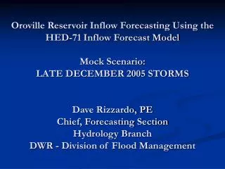
Oroville Reservoir Inflow Forecasting Using the HED-71 Inflow Forecast Model Mock Scenario: LATE DECEMBER 2005 STORMS Dave Rizzardo, PE Chief, Forecasting Section Hydrology Branch DWR - Division of Flood Management. HED-71 Inflow Forecast Model Facts.

E N D
Oroville Reservoir Inflow Forecasting Using the HED-71 Inflow Forecast ModelMock Scenario:LATE DECEMBER 2005 STORMSDave Rizzardo, PEChief, Forecasting SectionHydrology BranchDWR - Division of Flood Management
HED-71 Inflow Forecast Model Facts • Originally Developed in early 1970s (1971 perhaps?) by DWR and NWS Forecasters • (Bob Burnash and Larry Ferral) • Converted to current FORTRAN “interactive” format by Gary Hester and Jack Grewal • Late 1980s added feature of simulating soil infiltration capacity recovery during dry periods
HED-71’s Strengths • Simple and easy to use and learn • Provides relatively quick results • Simple input (precipitation, freezing elevations, etc) and principles (unit hydrograph for each basin) • Can be used on almost any headwater basin within California (53 total basins are configured) • In the hands of a skilled forecaster, HED71 will yield excellent results over a wide range of storm conditions
HED-71’s Weaknesses • Does not handle long dry periods well (Must “start a new storm”) • FORTRAN code is old and limited • Interface is DOS based – not easy to navigate to make corrections • Tends to melt existing snow pack too quickly requiring savvy modeler to “tame” springtime heat spells • Anticedence Index input (soil moisture) is a bit ambiguous
HED-71’s Input Base Conditions: • Current Date, time • Antecedence Index • Base Flow (tcfs) • Snow Pack (swc - in.) per elevation band 6-Hourly Input: • Observed or Forecasted Precipitation (inches) • Observed Flow (if known) (tcfs) • Observed or Forecasted Freezing Elev. (ft)
HED-71’s Input Feather River Precipitation and Temperature Forecast: Provided daily by State or NWS Meteorologists
HED-71’s Interface Antecedence Index and Base Flow Parameters are entered after date and time. Both are estimates. Snow Water Content (SWC) is then added for every elevation band from 1000’ to 14000’ if applicable. SWC is estimated for the Feather Basin from snow pillows at: Rattlesnake Four Trees Bucks Lake Humbug Summit
HED-71’s Interface Once Base conditions are in… ..it is time to update the model with the forecasted values from the meteorologists. First – a few days of observed precipitation, inflow, and temperatures are put into the model to “warm up” the model Next – 6-hourly precipitation and freezing elevations are put into the model (4 inputs per day) for the 10-day forecast period.
HED-71’s Interface Then the model is executed and results are printed on the screen for quick review.. Verify SWC Input Verify Precipitation and Elevation Input Now Evaluate Model results.. Does forecasted inflow make sense? Does forecast agree with other models (RFC 5-Day Forecast, ESP Snow Melt Model, etc)?
HED-71’s Interface Problems noted?!? • Re-examine Input • Too Much or Too Little Precipitation? • Melting too fast – moderate temperatures • Antecedence conditions too wet or dry? Raise or lower A.I. • Too much or too little snow pack? Adjust amounts as needed.
December 2005 Inflow Scenario • Four warm winter storms laden with tropical moisture • December Northern Sierra 8-Stations total precipitation: 26” • 310% of average • 4th wettest December on record
December 15, 2005 Very Little Precipitation forecast for next 10-days! Merry Christmas indeed! Dec. precip. by 12/15: 4.5” for 54% of Dec. Avg.
December 27, 2005 Conditions changed quickly – after two wet storms had already passed, we were now expecting at least two more by New Year’s! Dec. precip. by 12/27: 16.4” for 195% of Dec. Avg.
January 1, 2006 Happy New Year’s! When it was all said and done…. The last hurrah came on New Year’s day Total December ’05 Precip: 25.8” for 307% of Dec. Avg. .. or over 21” in two weeks!!
How did HED-71 Do? Not bad at all! • Predicted a peak inflow of almost 122,000 cfs into Lake Oroville • Observed was 127,000 cfs Overall HED71 missed peak daily values, but modeled the trend of the inflow fairly well. Much credit to the meteorologists on this!
HYDROLOGY – Reservoirs - Oroville • Storage before: 2,795 TAF • Storage after: 2,849 TAF • Inflow: 483 TAF • Outflow: 431 TAF • Lake elevation: +10 feet • Peak inflow: 166,540 cfs • Peak inflow ’97: 302,000 cfs (TAF = thousand acre feet)
HYDROLOGY–Rivers–Sacramento - Stage Sacramento Weir - Jan 3, 2006
HYDROLOGY– Rivers – Feather - Stage • 3-day precipitation data return periods (yrs): • Upper Sacramento River 1 in 5 • Feather River 1 in 5 • Yuba River 1 in 5 • American River 1 in 5
RESPONSE • December 27, 2005 – DWR Flood Alert • Extended hours at the State-Federal Flood Operations Center (FOC) • Increased flood information processing • High water notification calls made to pertinent agencies • Increased readiness to facilitate flood fight efforts if needed • December 29, 2005 – DWR Flood Mobilization • FOC staffed 24/7 • DWR in conjunction with the NWS produced river forecast bulletins every six hours • DWR levee inspectors patrolled 24/7 in State Maintenance Areas • State funds were made available for materials, emergency equipment, and for personnel working on flood operations • About 200 DWR staff, 4 CDF crews, and * CCC crews were ultimately involved in the event