Cloud Development and Stability
Stability. Probably the hardest chapter for studentsSo read!!!Ask questions if anything is unclearIn general, clouds form as a result of warm air rising, cooling, and expandingSo the questions are:Why do we have clouds sometimes and not others?Thunderstorms?Different cloud types (shapes/size


Cloud Development and Stability
E N D
Presentation Transcript
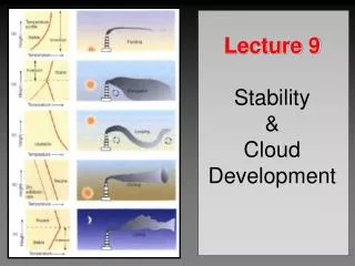
1. Cloud Development and Stability Chapter 5
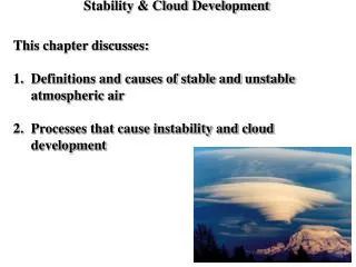
2. Stability Probably the hardest chapter for students
So read!!!
Ask questions if anything is unclear
In general, clouds form as a result of warm air rising, cooling, and expanding
So the questions are:
Why do we have clouds sometimes and not others?
Thunderstorms?
Different cloud types (shapes/sizes)?
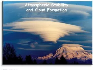
3. Stability All of these questions can be answered by examining the concept of atmospheric stability
Stable Equilibrium - Something (air) pushed away from its original position wants to return
Unstable Equilibrium - Something (air) pushed away from its original position wants to keep moving away
For our purposes, we�re talking about air being pushed up or down (vertical air motions)
4. Equilibrium
5. Stability
In the atmosphere, these �pushes� of air include:
Heating
Fronts
Terrain
6. Air Parcel We used the term �parcel� when talking about moving air up or down in the atmosphere
Just a balloon-like volume of air that does not mix with the surrounding air
Defn. - Adiabatic - a process in which no heat is exchanged between an air parcel and the surrounding environment.
If it rises, the air inside expands and cools
If it sinks, the air inside compresses and warms
Same amount of air, just at different pressures
7. Adiabatic Process The rate at which a parcel cools as it rises or warms as it sinks depends on whether or not the air is saturated (Avg. = 6.5� C per 1000 meters)
If the air is unsaturated (RH<100%), this rate is 10� C per 1000 meters is is called the dry adiabatic lapse rate
8. Dry Adiabatic Lapse Rate
9. Moist Adiabatic Lapse Rate If an unsaturated parcel of air rises and cools, it will eventually cool to its dew point where it will be saturated (RH=100%)
Further cooling results in condensation
This is when a cloud begins to form
Also, condensation represents a phase change of water from a gas to a liquid. Latent heat is released
So if the air still continues to rise, will it still cool at the dry adiabatic rate?
10. Moist Adiabatic Lapse Rate No, the rate will be less due to the release of latent heat
So, rising saturated air does not cool as quickly as rising unsaturated air
In fact, it cools at an average rate of 6�C per 1000 meters which is called the moist adiabatic lapse rate
Same rate for warming if air is sinking
11. Lapse Rates
12. Determining Stability Now we know how air temperature will change as air rises or descends
All we need to know is the air parcel�s temperature and moisture at some level (like at the surface)
And we also know what mechanisms start air moving vertically (hot surface, fronts, terrain)
We need to know one more thing in order to determine whether or not air will continue to rise on its own once started
????
13. Determining Stability Need to know if the air parcel is warmer or cooler than its environment if lifted
So we need to know the temperature of the environment
Defn. - environmental lapse rate - the actual rate of temperature change w/ height
How do we do this?
Radiosonde
Once we know this, we can figure out what the stability properties of the atmosphere are
14. Determining Stability If a parcel rises and cools, and is then colder than the surrounding air, it will sink back to its original position - stable
If the parcel is warmer than the surrounding air, it will continue to rise - unstable
15. A Stable Atmosphere Example 1
Environmental lapse rate is 4�C/1000 m
If air is unsaturated, it will cool at the dry adiabatic rate if lifted and will always be cooler than environment
So, its tendency is to sink back to its original position
16. A Stable Atmosphere Example 1
If air is saturated, it will cool at the moist adiabatic rate if lifted and will always be cooler than environment
So, its tendency is to sink back to its original position
17. A Stable Atmosphere So in the previous example, it didn�t matter whether or not the parcel was saturated
It would always have been cooler than the surrounding environment if lifted
This is called an absolutely stable atmosphere
If air were to be forced to rise (mountains) in this type of situation, it would tend to spread our horizontally and result in thin, layered clouds - stratus, altostratus, etc.
18. A Stable Atmosphere The atmosphere is stable when the environmental lapse rate is small (or negative)
Absolutely stable if less than moist adiabatic rate
So, the atmosphere becomes more stable as the air aloft warms and/or the surface air cools
Surface air cools by radiation (night), cold fronts, air moving over cold surfaces
This is why thunderstorms usually die at night - surface cools
19. An Unstable Atmosphere Example 2
Environmental lapse rate is 11�C/1000 m
If air is unsaturated, it will cool at the dry adiabatic rate if lifted and will always be warmer than environment
So, its tendency is to keep rising on its own
20. An Unstable Atmosphere Example 2
If air is saturated, it will cool at the moist adiabatic rate if lifted and will always be warmer than environment
So, its tendency is to keep rising on its own
21. An Unstable Atmosphere So in example 2, again it didn�t matter whether or not the parcel was saturated
It would always have been warmer than the surrounding environment if lifted
This is called an absolutely unstable atmosphere
If air is forced to rise in this type of situation, it would tend to keep rising on its own
22. An Unstable Atmosphere The atmosphere becomes unstable when the environmental lapse rate becomes large (cools quickly with height)
Absolutely unstable if greater than dry adiabatic rate
So, the atmosphere becomes more unstable when air aloft cools and/or air near the surface warms
Surface air warms during the day, when a warm front passes, air moving over warm surfaces
Almost never find absolutely unstable layers except near the surface on hot days
23. A Conditionally Unstable Atmosphere Example 3
Environmental lapse rate is 7�C/1000 m
Lies between the moist and dry lapse rates
If an unsaturated parcel is lifted, it will always be cooler than the surrounding air and will tend to sink back to its original position
Stable with respect to unsaturated air
24. A Conditionally Unstable Atmosphere Example 3
If a saturated parcel is lifted, it will always be warmer than the surrounding air and will tend to rise on its own
Unstable with respect to saturated air
25. A Conditionally Unstable Atmosphere In example 3, stability is dependent upon whether or not rising air is saturated or unsaturated
If unsaturated - stable
If saturated - unstable
This is called a conditionally unstable atmosphere
Condition??
Whether or not the air becomes saturated
26. Environmental Lapse Rate of 9�C
27. Stability Absolutely stable if the environmental lapse rate < moist adiabatic rate
Absolutely unstable if the environmental lapse rate > dry adiabatic rate
Conditionally unstable if the environmental lapse rate is between the dry and moist adiabatic rates
28. Cloud Development and Stability Touched on this briefly already
4 major ways air is forced to rise and produce clouds
1) Heating at the surface (convection)
2) Topography (mountains, hills, etc.)
3) Convergence of surface air (air flows come together)
4) Uplift along fronts
1st two for now, 3 & 4 later on
29. Cloud Development and Stability
30. Convection Talked about this already
Hot surface heats air
Warm air rises
Cooler air from above sinks to replace it
If the condensation level is low:
One thermal may cause a cumulus cloud
If high:
May take several thermals
31. Convection on a Summer Day
32. �Cloud Streets�
33. Convection How much vertically a cumulus cloud grow will depend on stability
If stable near cloud top - difficult time growing
probably stay small
If unstable or conditionally unstable through a deep layer - good chance for much vertical growth
towering cumulus clouds
If unstable over a very deep layer (several miles) - possible thunderstorm growth
34. Convection in an Unstable Atmosphere
35. Topography Basically, surface air must rise over a mountain range if the wind is coming from a certain direction
This forced ascent over mountains is called orographic uplift
Has a MAJOR effect on precipitation and temperature
Rain shadows
36. Hawaii Rain Shadows
37. Precipitation We know some clouds produce rain, right?
But why do some clouds precipitate but not others?
And how do cloud droplets grow large enough to fall to the earth?
From earlier, what do all cloud droplets need in order to form?
Condensation nuclei
Water vapor condenses on them
38. Precipitation Based on the sizes of CN, cloud droplets, and rain drops�.do you think rain drops form just due to condensation???
It would take about 3 days for that to happen
How long does it take for storms to pop up in the summer?
1 hour or less
39. Precipitation So, the process of condensation is not quick enough to produce raindrops
How do they form then??
2 processes
40. Collision and Coalescence 1) Collision and Coalescence
Also called the �warm rain process� because it only involves liquid water
Main thing needed for this process to work is droplets of different sizes
How might that happen?
1) Simply random collisions
2) Different size CN
Ex. Salt is larger than dust so its cloud drop will be larger too
41. Collision and Coalescence Since larger drops are heavier, they fall faster than smaller drops
As they fall they collide and merge with smaller drops - coalescence
42. Collision and Coalescence The absolute most important factor in this process is liquid water content
Must have water!!
Other important factors include
Range of droplet sizes
some larger than others
Cloud thickness
Updrafts in a cloud
Electric charge of droplets
opposites attract
43. Collision and Coalescence This cumulus cloud has a good chance of becoming a thunderstorm and producing rain:
It has lots of water
It�s thick
It has updrafts
What about nimbostratus clouds??
Thin - means small if any updraft and not much water
Drizzle at best
44. Ice Crystal Process 2) Ice Crystal Process
Occurs in clouds comprised of both liquid water and ice crystals - like thunderstorms
45. Ice Crystal Process All water at low levels
All ice at very high levels
In between - both water and ice
How does this happen if temp is below freezing?
Two reasons
1) Small cloud droplets freeze at lower temps
2) Ice crystals need �ice nuclei� on which to form
Not many of these things
Clay, bacteria, etc.
46. Ice Crystal Process Remember saturation?
In the middle of the cloud (ice and water), the air is saturated
But, since water is warmer, it takes more water vapor molecules to saturate the air around it
So, is the saturation vapor pressure greater around the drop or the ice??
47. Ice Crystal Process Around the water since there are more molecules
Things are out of balance now and vapor molecules will move toward the ice to equalize the pressure
But if they move into already saturated air over the ice, what happens???
48. Ice Crystal Process Molecules must condense out of the air onto the ice
Ice grows
Also, now the air is unsaturated over the water
So more molecules evaporate from the drop to replace those lost to the ice
49. Ice Crystal Process Bottom line:
The ice crystals grow in size at the expense of the water drops
Ice crystals get heavy and fall
50. Ice Crystal Process Falling crystals collect super-cooled water droplets - accretion
The icy product is called �graupel�
melts to form rain
51. Icy Crystal Process Falling crystals can also fracture as they collide with other crystals
Happens in colder clouds
If the pieces stick together�..
52. Ice Crystal Process Snowflakes
This process of ice crystals forming snow is called �aggregation�
So the thunderstorms we see around here have all kinds of things going on in them
ice, water, snow, graupel, hail, etc
Does a snowflake really look like this?
53. By the way, what shape is the correct one for a rain drop??
54. Types of Precipitation I�m not going into all of the types (maybe too boring)
We�ll concentrate on rain, snow, sleet, and freezing rain
How do these differ and why do we get each type?
Has to do with the vertical profile of temperature
55. Snow and Sleet Snow is easy - freezing from cloud down to the surface
Sleet - happens when there is a deep freezing layer near the surface and an above-freezing layer below the cloud
56. Freezing Rain and Rain Freezing rain - a lot like sleet except the sub-freezing layer near the surface is shallow - so rain stays in liquid form until it hits the surface
Rain - occurs when there is a deep above-freezing layer from the surface upward
57. More Frozen Precipitation Occurs mostly in the spring and summer??
Hail
Lethal stuff
Can damage crops, cars, property
$2K to my car a couple of years ago
Even responsible for killing livestock
Big hail is pretty heavy (1/2 lb or so) and falls quickly
58. Hail Forms in T-storms w/ strong updrafts
Begin as �embryos�
usually ice particles but sometimes bugs too
updrafts cause embryo to come in contact with super-cooled water which freezes on it
5-10 minutes to become golf ball size
59. Measuring Precipitation 2 primary methods
1) Gauges
2) Radar
60. Rain Gauge Old fashioned gauge
Funnel on top channels water into a tube
How can a person possible measure rain with this thing if only .05 of an inch fell?
Top of funnel is 20 cm wide (10X width of tube)
So rainfall is amplified 10X in the tube allowing for precision
61. Tipping Bucket Rain Gauge Bucket holds .01 inches of rain before it tips
Need to have at least .01 inches to use the term �rainfall�
If less - �trace�
62. RADAR Stands for RAdio Detection And Ranging
How it works:
Transmitter sends out a microwave pulse
If the pulse hits something (rain), some of it is reflected back toward the radar
How much comes back indicates the intensity of the rain
Advantage:
We can �see� and estimate rainfall in previously inaccessible regions
63. Doppler Storm Total Rainfall Estimates total rainfall over a period of time based on intensity during that period