Download
1 / 16
160 likes | 281 Views
This comprehensive guide focuses on the influence of terrain and bodies of water, particularly the Great Salt Lake, on weather modeling and simulation using the Weather Research and Forecasting (WRF) model. It outlines the methods for accurately simulating real conditions and creating realistic fictitious scenarios, emphasizing the complex synergistic interactions between lakes and orographic processes. Specific modeling techniques, configurations, and adjustments for lake temperature, snow cover, and terrain elevation are explored, providing a framework for conducting sensitivity studies in meteorological applications.

E N D
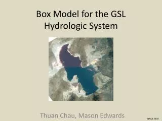
GSL Model Sensitivity Studies A Guide to Removing Unwanted Mountain Ranges and Water Bodies
Goals • Analyze the respective roles of the lake and surrounding terrain in Great Salt Lake-Effect events. • Simulate the real conditions as accurately as possible • Create fictitious scenarios as realistically as possible • Remember that there are synergistic interactions between lake and orographic processes, and complete factor separation is impossible.
Basic Model Configuration ADVERTISEMENT Modelers hate him Salt Lake City man discovers new trick to remove terrain in WRF. Click here to find out more and download a virus.
Gory Details • WRF Version: 3.1.1 • One-way nesting • Cumulus: KFv2 (12- and 4-km domains only) • PBL: YSU • Microphysics: Thompson • LSM: Noah • Radiation: RRTM – SW and LW
Model Initialization • Boundary conditions: 12-km, 6-h NAM analysis • General problem: this is the NAM analysis • Specifically: • Moist bias at low levels • Salt Lake is not “salty” • Snow cover analysis is poor • Lake temperature is off by at least 10°C • USGS land use has permanent ice on the salt flats
A pinch of salt ! (FROM: module_sf_sfclay.F) ! MODIFIED 30 MAR 2011 BY TREVOR ALCOTT ! TO REDUCE SATURATION VAPOR PRESSURE OVER GSL ! FOLLOWING ONTON AND STEENBURGH 2001 ! WATER POINTS IN THE INNERMOST DOMAIN if (( ite .GT. 185.00 ) .and. ( xland(i) .GT. 1.5 )) then ! GREAT SALT LAKE POINTS if ((i .gt. 100.00) .and. (i .lt. 180.00) .and. & (j .gt. 120.00) .and. (j .lt. 215.00)) then if (j .gt. 168.00) then ! NORTH ARM – Es reduced by 33% SVP1=0.67*SVP1 else ! SOUTH ARM – Es reduced by 8% SVP1=0.92*SVP1 endif endif else ! ALL OTHER POINTS SVP1=SVP1 end if E1=SVP1*EXP(SVP2*(TGDSA(I)-SVPT0)/(TGDSA(I)-SVP3))
Model Initialization: Snow Cover • Adjusted based on SNOTel and satellite imagery: • snowc: binary snow cover (1=snow, 0=no snow) • snow: mm of snow-water equivalent • snowh: snow depth in m ! (FROM: module_initialize_real.f) ! Set snow depth, SWE and cover ! if ( ( grid%xlat(i,j) .GT. 39.5 ) .and. & ( grid%xlat(i,j) .LT. 43.5 ) .and. & ( grid%xlong(i,j) .GT. -115.5 ) .and. & ( grid%xlong(i,j) .LT. -108.0 ) ) then if ( grid%ht(i,j) .LT. 1900 ) then grid%snowc(i,j) = 0.0 grid%snow(i,j) = 0.0 grid%snowh(i,j) = 0.0 else if (( grid%ht(i,j) .GE. 1900 ) .and. & ( grid%ht(i,j) .LE. 2900 )) then grid%snowc(i,j) = 1.0 grid%snow(i,j) = ( grid%ht(i,j) - 1900. ) / 20. grid%snowh(i,j) = ( grid%snow(i,j) * ( grid%ht(i,j) - 900. )) / 200000. else if ( grid%ht(i,j) .GT. 2900 ) then grid%snowc(i,j) = 1.0 grid%snow(i,j) = 50.0 grid%snowh(i,j) = 0.5 endif endif
Model Initialization: Lake Temperature NAM Analysis: Modified based on MODIS: 285.3 K in met_em files 286.5 K in first wrfout file ! (FROM: module_initialize_real.f) ! Set GSL Temp ! if ( ( grid%xlat(i,j) .gt. 38.0 ) .and. & ( grid%xlat(i,j) .lt. 43.0 ) .and. & ( grid%xlong(i,j) .gt. -120.0 ) .and. & ( grid%xlong(i,j) .lt. -110.0 ) .and. & ( grid%ivgtyp(i,j) .eq. 16 ) ) then ! print*,'at ijk ',i,' ',j,' ',k ! print*,'sst changed from ',grid%tsk(i,j) grid%tsk(i,j) = 286.5 grid%sst(i,j) = 286.5 ! print*,'to ',grid%tsk(i,j) endif
The Salt Flats Glacier ! (FROM: module_initialize_real.f) ! Fix stupid Salt Flats glacier... seriously, WTF?? ! if ( ( grid%xlat(i,j) .gt. 39.0 ) .and. & ( grid%xlat(i,j) .lt. 42.0 ) .and. & ( grid%xlong(i,j) .gt. -115.0 ) .and. & ( grid%xlong(i,j) .lt. -112.0 ) .and. & ( grid%ivgtyp(i,j) .eq. 24 ) ) then print*,'at ijk ',i,' ',j,' ',k print*,'ice changed to playa' grid%ivgtyp(i,j) = 19 grid%lu_index(i,j) = 19 endif
Removing terrain ! (FROM: smooth_module.F) if ((ix .GT. 20) .AND. ( ix .LT. 155) .AND. & (iy .GT. 175) .AND. (iy .LT. 310)) then if ( array(ix,iy,iz) .GT. 1300.00 ) then array(ix,iy,iz)=array(ix,iy,iz)-0.99*(array(ix,iy,iz)-1300.0) END if END if Flatten to near lake level Smooth the reduction over 10 grid points to avoid steep slopes Smooth the corner to avoid steep slopes or narrow valleys
Removing terrain: caveats • Loss of snow cover (if elevation dependent) • Void is filled in with standard atmosphere • Is the volume small enough to not matter? • Is this airmassadvected away? • Changes in soil temperature and land use? • Bottom line: perform additional sensitivity studies to examine the effects of these changes • Change the soil temperature, snow cover, etc. without adjusting terrain height
Removing a lake • Not as simple as it sounds • Adjustments were made to the met_emnetCDF input files, not in any fortran code • Key fields: • soil type (scbdom/sctdom/soilcbot/soilctop) • land use (lu/landusef) • land/sea mask (landsea/landmask) • soil moisture (sm/sm100200/sm040100 etc.) • soil temperature (st/st100200/st040100 etc.) • albedo (albedo12m) • green fraction (greenfrac)
Removing a lake • Matlab used to adjust values in netCDF files • Method was not elegant • values from adjacent land pixels were smoothed across the lake area • lake surface changed to lu=8 (barren/sparse veg)
Removing a lake: caveats • Is the new land use realistic? • For deep lakes, is the new atmosphere realistic? • Without the lake, initial thermodynamic structure could be much different at low levels • Snow cover in place of water? • Possible effects: • higher wind speeds due to reduced friction • changes to sensible and latent heat fluxes • lake-effect precipitation, lake/land breezes, downstream effects due to airmass modification