Download
1 / 20
200 likes | 351 Views
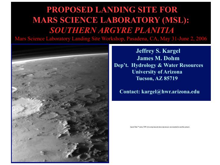
PROPOSED LANDING SITE FOR MARS SCIENCE LABORATORY (MSL): SOUTHERN ARGYRE PLANITIA Mars Science Laboratory Landing Site Workshop, Pasadena, CA, May 31-June 2, 2006. Jeffrey S. Kargel James M. Dohm Dep’t. Hydrology & Water Resources University of Arizona

E N D
PROPOSED LANDING SITE FOR MARS SCIENCE LABORATORY (MSL): SOUTHERN ARGYRE PLANITIAMars Science Laboratory Landing Site Workshop, Pasadena, CA, May 31-June 2, 2006 Jeffrey S. Kargel James M. Dohm Dep’t. Hydrology & Water Resources University of Arizona Tucson, AZ 85719 Contact: kargel@hwr.arizona.edu
Tertiary sites 11 km of relief, alpine topography and a smooth infilled basin.Channels cut across the basin rim, and most large craters here are breached.Thick sedimentary deposits derived from the complete regional crustal stratigraphy.Glacial/lacustrine paleoenvironment seems to be indicated. Secondary sites Prime sites DEM produced by Jim Skinner and Jeff Kargel using MOLA data.
100 km MSL constraint, 5 degree slope on 500 m scale: landing site needs to be red, yellow, green, blue, or violet. No gray, brown, black, or white.
TES thermal inertia Courtesy of Michael Mellon and NASA • Argyre Planitia overall has among the highest thermal inertias and highest boulder coverages on Mars. • Many smooth and low/medium thermal inertia areas provide safe landing site access to geologically interesting sites. • The basin holds a vast repository of sedimentary rocks eroded from the rim (Charitum Montes and Nereidum Montes) and adjoining highlands of Noachis Terra. • The rim and erosional debris may provide a 50 km-thick crustal section of igneous, metamorphic, sedimentary, and impact breccia rocks.
The rim of Argyre may expose the most complete, well-preserved thick section of the early crust and upper mantle of Mars.Sinuous ridges and other sedimentary deposits on the floor of Argyre may be a jumbled version of the same section. • Abundant magnesian olivine(Fo91) exposed in the Charitum Montes (is probably derived from the upper mantle perhaps > 50 km deep. (Clark and Hoefen 2000) • P-T conditions of early Mars would have generated zeolite and prehnite-pumpellyite facies metamorphism: minerals such as chlorite, talc, serpentine, tremolite, and zeolites. • These minerals would contain bound hydroxyl and fluid inclusions of the deep crustal hydrosphere. Argyre
Neutron data show that the upper meter of the floor of Argyre is one of the driest surfaces on the planet From Parker et al. 2000 From Feldman et al. 2004 • Geomorphology and geology indicate huge ancient inflows of volatiles: floods or glaciers or both (Kargel and Strom 1992, Parker et al. 2000, Head 2000). Huge outlet channel, too (Parker et al. 2000). • Either ponded/frozen volatiles are buried, or they have been lost. • Geomorphology--especially lobate debris aprons and polygons-- suggests that volatiles are still present in the Charitum Montes but buried to deeply for GRS/HEND to see.
Numbers 143 to 154 refer to numbers on the slides and to page num- bers in “Mars: A Warmer Wetter Planet,” Kargel 2004), where the fig- ures are dis- cussed.
148 • Sharp-crested ridge (interpret: glacial arete) • Downslope scour • Crevassed debris apron • Lobate (convex-up) profile of debris apron. • Eroded terminus of debris apron shows layering. (A subpolar climate record?) • Terminus marked by transverse bouldery ridges (interpret: moraines) • It looks like a debris-covered glacier and appears to have scoured the mountains. • May be hard for MSL to get to this specific scene.
149 Lobate debris apron appears heavily crevassed. (Interpret: brittle response to flow) Debris apron has longitudinal corrugations oriented down slope (Interpret: ductile flow.) Debris apron is gullied (inter- pret: Melting.) Debris apron has convex-up profile (interpret: flow of non-Newtonian material). Debris apron appears to be made of ice.
Sinuous, braided ridges: Flat-topped and sharp-crested forms; some are discontinuous. 30-120 m high, 400-2500 m wide. Large boulders 3-20 m. Weak layering or terracing; smooth deposit onlaps base. Characteristics resemble eskers, but boulders suggest debris flows. NOT: lava flows, wrinkle ridges, sand dunes, beach ridges or bars, clastic dikes. May be eskers (Kargel and Strom) or debris flows emplaced in ice-walled channels (Alan Howard’s original idea). May include moraines. 152 This spot would be hard to traverse.
Bouldery ridges, flat topped to rounded: Esker-like debris flows? Smooth deposit onlaps onto base of ridges to about -2700 m. Smooth deposit is polygonally Fractured; boulders locally protrude through. Interpretation of smooth deposit: fine-grained mantle of lake muds or silts overlying till plain. Affected by either mud desiccation cracking, or ice wedge polygon or permafrost sand wedge polygon formation. Late-stage glacial lake? 153 Smooth plain in places provides a safe landing site and a sampling ramp to access boulders/sinuous ridges.
154 Sinuous, bouldery ridges barely protrude above polygonally cracked smooth plain. The smooth plain would be safe to land on, scientifically insightful, and the scattered protruding boulders could be accessed and may be the treasure-trove of deep crustal infor- mation we seek.
143 Viking Orbiter-era photointerpretation identified many likely glacial landforms in the Charitum Montes (Kargel and Strom 1992 and other reports). MOLA finally provided quantitative shape information that buttres- sed the glacial interpre- tation.
144 Viking-era photointer- pretation also identified a smooth plain having embayment relations with the uplands. (Interpre- tation: possible glaciola- custrine plain.)
Topographic profiles across the Charitum Montes appear to be classic Alpine (glacier-eroded) profiles, but the underlying control is by impact craters.
Three prime candidate sites for MSL in southern Argyre Planitia, secondary site in southwestern Argyre, tertiary site in northeastern Argyre Each primary site has large scale slopes < 1 degree, has low to medium ther-mal inertia, and is located near -2700 m elevation. For early part of Ls landing window, model winds at 5 km AGL may be okay. Interpreted terrain features: • Site A: Smooth plain (glaciolacustrine deposits), sinuous ridges (esker-like ridges), polygons (desiccation cracks or ice-wedge or sand-wedge polygons), lobate debris aprons (debris-covered glaciers or rock glaciers). -56.31 Lat., 42.02 Lon., -2687 m. • Site B: Smooth plain (glaciolacustrine deposits), lobate debris aprons (rock glaciers/debris-covered glaciers), discrete onlapping contact of smooth plain against upland (shoreline contact), upland rock units (impact-uplifted deep crustal rocks), grooving/etching (glacial scour). Lat -55.21, 37.60 Lon, -2693 m. • Site C: Same as B, but deeper scouring and an outwash plain. -54.39 Lat, Lon. 37.79, -2638 m. If a far southern winter (Ls 120-150) landing with cold conditions, seasonal dry ice, poor Earth viewing pose too severe engineering issues, there are excellent sites farther north. -- Secondary site: southwestern Argyre at 51-52 S., 57-60 Lon. Interpreted as glacial site. “Yellow” medium thermal inertia. Mostly -1.5 km. -- Northeastern Argyre, 40.5-42 S, 34-37 Lon. Interpreted as periglacial-alluvial site with ex- tensive lacustrine deposit. “Green” low thermal inertia, slopes <1 degree on putative lake plains. Mostly -1 km.
If the site is a glacial/glaciolacustrine site, then: • There was a period of sustained snow accumulation. • There was a source for this snow. • Climate was such that this source evaporated or sublimated. • Conditions were suitable for glacial bedrock sculpture-- implies wet-based glaciers. • Sustained melting of glaciers and occurrence of large, dynamic glacial lakes. • Proof is in the rocks and icy outcrops: bedrock sculpture/polish, boulder faceting, moraine and esker fabrics, possible laminites/varves, stable isotopes in ice. • HiRISE can image boulder shape, bedrock sculpture, sedimentary and glacial rhythms. Other features require in situ observations (e.g., chattermarks and polish on boulders, fine sedimentary structures). If the site is not glacial/glaciolacustrine: • It still may be a lacustrine site (hard to imagine not lacustrine given observations). • Another erosional regime has breached craters, made sinuous ridges, and shaped mountains to mimic glacial alpine erosion. • Conditions were apparently suitable for existence of liquid water. Any way you interpret it: • Possible significant astrobiological and paleoclimatological site. • Extremely diverse lithology and wide range of crustal stratigraphy represented. • Boulders in sinuous ridges may contain records of early Mars long buried elsewhere. • Not to be discounted: Visually dramatic scenery.
“Argyre” Painting by Michael Carroll More information: