Download
1 / 37
370 likes | 584 Views
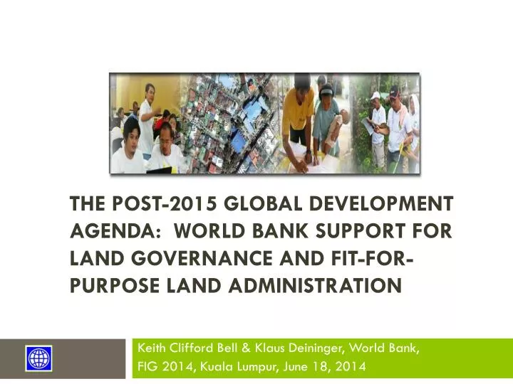
The Post-2015 Global Development Agenda: World Bank Support for Land Governance and Fit-for-Purpose Land Administration. Keith Clifford Bell & Klaus Deininger, World Bank, FIG 2014, Kuala Lumpur, June 18, 2014. FIG 2014 Conference Theme: “Engaging the Challenges, Enhancing the Relevance”

E N D
The Post-2015 Global Development Agenda: World Bank Support for Land Governance and Fit-for-Purpose Land Administration Keith Clifford Bell & Klaus Deininger, World Bank, FIG 2014, Kuala Lumpur, June 18, 2014
FIG 2014 Conference Theme: “Engaging the Challenges, Enhancing the Relevance” Plenary #2 General Focus: “The profession has key roles towards the betterment of society, environment and economy and needs to attend to emerging issues and trends.”
Message from the Prime Minister of Malaysia to FIG 2014 “The pressure on the land and resources - and therefore the environment - will increase. Sustainable growth therefore will determine strategies of politics, but also for surveyors. Spatial information is vital because it shapes policy-making, surveyors are responsible for translating raw data into pieces of information useful for policy-makers. Spatial information needs to be reliable and reusable, there lies a challenge for the surveyor of the future, according to the Prime Minister.” Source: GIM, Jun 17, 2014
Key Roles of Surveyors (and the other Land professions) is to Deliver Fit-for-Purpose Solutions & Services
A Reality Check for Land Professionals - “The Tyranny of Experts” “The technocratic illusion is that poverty results from a shortage of expertise, whereas poverty is really about a shortage of rights. The emphasis on the problem of expertise makes the problem of rights worse. The technical problems of the poor (and the absence of technical solutions for those problems) are a symptom of poverty, not a cause of poverty. This book argues that the cause of poverty is the absence of political and economic rights, the absence of a free political and economic system that would find the technical solutions to the poor’s problems. The dictator whom the experts expect will accomplish the technical fixes to technical problems is not the solution; he is the problem.” The Tyranny of Experts: Economists, Dictators, and the Forgotten Rights of the Poor, William Easterly, (2014), Chap 1, p. 7
(Donors &) Land Professionals Must Respect Rights and Not Impose Top-down Solutions “The title of Bill Easterly’s new book pretty much conveys the message: The Tyranny of Experts: Economists, Dictators, and the Forgotten Rights of the Poor. Out of arrogance and political convenience, Western donors are designing and financing destructive top-down development ‘solutions’ to be imposed on the poor. The donors are playing into the hands of dictators, even becoming mini-dictators themselves. The just and surer path to economic development lies in respecting the rights of poor people and empowering them to solve their own problems in ways no expert could plan.” David Roodman (2014), formerly Center for Global Development; Worldwatch Institute; & Gates Foundation. *****Surely this is why Fit-for-Purpose Land Administration and Management is so important! *****
Millennium Development Goals – Target 2015 A Silence of the Lands!! • Goal 1: Eradicate extreme poverty and hunger • Goal 2: Achieve universal primary education • Goal 3: Promote gender equality and empower women • Goal 4: Reduce child mortality • Goal 5: Improve maternal health • Goal 6: Combat HIV/AIDS, malaria, and other diseases • Goal 7: Ensure environmental sustainability • Goal 8: Develop a global partnership for development
Post-2015 Development Agenda – Defining Goals • An Open Working Group (OWG) was established to define agreed goals for the post-2015 Agenda. • On Jun 2, 2014, the Zero Draft of the proposed goals was released. Proposed Goal #1.5: “by 2030, ensure development opportunities for all men & women, including secure rights to own land, property & other productive resources, & access to financial services, with particular focus on the poor, the most marginalized & people in vulnerable situations” So, how will that be monitored?
Realities of Our Two Speed World • Developed & developing nations are moving at different speeds in land administration & management – a Two (or multi) Speed World. • Low-Income, Middle-Income & High-Income countries, each with different access to resources, capacity & priorities for land administration & spatial enablement. • 80% of humanity live below US$10.00 a day and around 75% of humanity lack land or property rights • “Technology is not a limitation” - BUT funding it is in many cases • An understanding of the political economy of the land-based sectors of any country provides clear insights into why there is weak governance, lack of political will for reform & governance which favors the status quo in support of elites. (Source: World Bank-FIG Spatial Innovations Forum, March 28, 2014).
Increasing Pressures on the Land-based Sectors Increasing competition for land in the 21st century, driven by • Population increase, urbanization, change in diets, biofuels, climate change. • Global “land rush” – large-scale land acquisitions by foreign & domestic investors. Concerns • Protecting the land rights of smallholder farmers, including women & local communities for food security & poverty reduction. • Ensuring an equitable, environmentally sustainable & economically efficient use of land resources. • Increasing urbanization and loss of productive rural lands. Hottest Underpinning Issue • Good Land Governance which is dependent on many factors including the rule of law, civil service, etc etc….. & reliable spatial data - “AAA” – accurate, authoritative, assured. (AAA – Williamson, 2011)
Best Practice Land Administration?Pics: WB May 2012, (Left and center) and USAID, 2012 (Right)
Land governance challenges • A broader view of land governance is needed at the country level – too many silos – NLA and NMOs • Urban land tenure essential for low-cost housing and livable cities • Tenure security key constraint for farmers, especially for women • Land grabbing and FDI • Land fiscal issues • Tenure security / demarcation & registration of Common lands/ forest lands/ ancestral lands • REDD+ • Climate Change • Institutional & political economy issues often neglected • NSDI - consistent, reliable, authoritative data • Fit-for-purpose land administration systems • Disasters • Conflict
Land Governance must not become rhetoric • Good governance is increasingly recognized as critical to effective development & sustainability – it is key for FFP • Specifically for land governance, a fully functioning land & property system is composed of 4 key building blocks: (a) a system of rules that defines the bundle of rights & obligations between people & assets;(b) a system for the rule of law; (c) a functioning market for the registration, exchange of assets; & (d) an instrument of social policy.
G8 – 2013 Gave Recognition to Land “43. Weak land governance and property rights systems can lead to opaque land deals, which facilitate corruption and undercut responsible actors seeking access to land for productive investment. Weak governance in many developing countries allows unproductive land speculation and undermines agricultural productivity. Increasing security of land rights and transparency of land governance fosters participation of citizens, contributes to government accountability, reduces costs for businesses, and strengthens the climate for responsible investment. ….. 44. We will support greater transparency in land transactions including at early stages, and increased capacity to develop good land governance systems in developing countries. Last year, the G8 welcomed the UN Committee on World Food Security’s Voluntary Guidelines on the Responsible Governance of Tenure of Land, Fisheries and Forests in the Context of National Food Security (VGGT). “ United Kingdom Government, 2013, “2013 Lough Erne”, G8 Leaders' Communiqué, Prime Minister’s Office, June 18, 2013, London., paras 43-45
G8 – 2013 Endorsed the Open Data - core to Good Governance “46. Open government data are an essential resource of the information age. Moving data into the public sphere can improve the lives of citizens, and increasing access to these data can drive innovation, economic growth and the creation of good jobs. Making government data publicly available by default and reusable free of charge in machine-readable, readily-accessible, open formats, and describing these data clearly so that the public can readily understand their contents and meanings, generates new fuel for innovation by private sector innovators, entrepreneurs, and non-governmental organizations. Open data also increase awareness about how countries’ natural resources are used, how extractives revenues are spent, and how land is transacted and managed. 47. We have today agreed and published an Open Data Charter (annexed) with the following principles: • Open Data by Default – foster expectations that government data be published openly while continuing to safeguard privacy; • Quality and Quantity – release quality, timely and well described open data; • Useable by All – release as much data in as many open formats as possible; • Releasing Data for Improved Governance – share expertise and be transparent about data collection, standards and publishing processes; • Releasing Data for Innovation – consult with users and empower future generations of innovators.” United Kingdom Government, 2013, “2013 Lough Erne”, G8 Leaders' Communiqué, Prime Minister’s Office, June 18, 2013, London, paras 46-49
Two Approaches are Required 1. LGAF - Land Governance Assessment Framework (Operational – 38+ countries completed, many more starting) • Detailed in-country assessment of governance – national and subnational • A comprehensive diagnostic of around 100 elements of governance of the land-based sectors. 2. Land Monitoring Indicators (Under Development – in 9 country pilots) • For post-2015 development agenda, a simplistic system of a few key indicators for country-comparative monitoring - global scale, as we are dealing with a global agenda - is required. • Can draw upon LGAF as well as administrative and core foundation spatial data
Why the LGAF was created • Thinking started around 2006/7 when discussions for regional/global initiatives (incl. VGGT) took off • Clear that upon endorsement need for • comprehensive assessment of land sector • priority setting • benchmark /baseline to track progress both for in-country policy reform • facilitation- stakeholder dialogue & engagement • Many experts & organizations involved (FAO, IFAD, UN-Habitat, GLTN, IFPRI, bilateral etc.) • Coordinated by WB
LGAF: Country-driven & Evidence-based • Land sector reforms are decided at the country level by local actors; both political economy / and “change” • Should be based on broad, participatory policy dialogue between/ within government and other stakeholders • guided by evidence-based assessment • Comprehensive assessment – across silos
Process and Steps: 4-6 months Final report & Score card 1 2 3 4 5 6 Platform/ observatory Dialogue monitoring
Structure of the assessment framework Area Indicators Dimensions Score Recognition of a continuum of rights A B C D Land tenure rights recognition (rural) Enforcement of rights Land tenure rights recognition (urban) Mechanisms for recognition of rights Legal and Institutional Framework Rural group rights recognition Restrictions on rights Clarity of institutional mandates Urban group rights recognition in informal areas Equity and nondiscrimination in the decision-making process Opportunities for tenure individualization
Land monitoring indicator/s • Why a global indicator is important • Focus the debate on a key issue that was missing - LAND • Foster change at policy and operational level • Allow users to hold institutions to account • Guide private decision-making (investors’ choices) & reward good behavior • Build analytical & policy analysis capacity at country level • Lessons from MDG s/poverty • Very little analytical work on poverty issues before the 80s • Stepwise progress: Data issues, methodology, and policy went hand in hand • Narrow scope: Excluded many things (assets/gender) • Top level indicator linked to country strategies • Advantages in the case of land • Information is a key output of the land admin. system • Developments in spatial & information technology • Can draw on wide range of data providers (incl. communities – crowd sourcing/VGI) • … but need to have criteria to assess instruments
Criteria for LMI/s • Frequency of updates • Country coverage • Scope for disaggregation (gender/space) • Cost-effectiveness • Objectivity/replicability
Collection of key admin. data feasible? * for mapped & recorded land ** data are scattered/not available *** paper based.
Recommended Approach to LMI/s • Recommended that LMI/s would draw upon LGAF and Administrative Data • LMI needs to be done spatially, drawing upon the core foundation data of NLAs and NMOs
NLAs and NMOs are custodians of key data for land sector monitoring • Mandates of institutions • Reliable, authoritative information is a core mandate • Custodian - information made available • Direct link to institutions’ performance reporting • Spatially explicit • Core or Foundation data • Expose inconsistencies Map once – use often (not only registry; tax maps plans) • Spatial disaggregation (poverty maps, poor areas) • Link tenure to land use (& change) maps (urban & rural) • Climate change and REDD+
Key Publications and more on LGAFhttp://econ.worldbank.org/lgaf
Recommended Next steps • Demonstrate the viability of collecting a global indicator • Interest is there – but people disagree about viability • Data availability not a primary concern (but sampling) • Cost estimate: 3 years to cover 2/3 of countries for $ 10m • Need standards & reputable institution to take the lead • Document benefits for national stakeholder platforms • Define disaggregated reporting formats • Link with other types of data collection and local processes • Land use monitoring - revenue potential • Gender dynamics of land rights • Feed into updating of land governance assessments (strong demand) • Share global best practice and build capacity • Use this to influence the post-2015 agenda • Unique opportunity to quickly jump-start SDG process • In parallel to interpretation/use of data • Get countries to express their preferences in the process
Take Home Messages • Good land governance is fundamental to the land-based sectors and reform – it is the overarching issue. • Land professions must be leaders in the reform process - must be part of the solution and not the problem - • NLA s and NMOs are custodians of the BIG DATA - core administrative data and foundation spatial data sets - for governance monitoring • LGAF used to diagnose & benchmark land governance, to prioritize land sector reforms & monitor progress over time in the land-based sectors consistent with VGGT - evidence-based land reforms • SDGs and Global Land Monitoring Indicator/s must be spatially monitored
So for Surveyors and Land Professionals • Embrace the challenges of the Post-2015 Development agenda • Let’s be professional surveyors, land administrators and geospatial scientists - NOT JUST USERS OF APPS! Trish Nicholson,( 2013), "From Apes to Apps: How Humans Evolved as Storytellers and Why it Matters“. “It matters because adaptations that enabled us to thrive in prehistoric times leave us vulnerable in the changed environment of our global digital age.” Pic: “Ning” adapted from http://farisyakob.typepad.com/blog/2007/04/monkey_we_need_.html THANK YOU! terima kasih