Download
1 / 20
200 likes | 324 Views
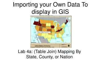
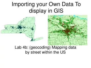
Importing your Own Data To display in GIS. Lab 4b: (geocoding) Mapping data by street within the US. 1. Open Arc Map, then Add Data. Select an appropriate map from the G drive Arc GIS. Tools, Geocoding, Address Locator Manager…Add. G, ArcGIS, Streetmap_usa, Streets,.

E N D
Importing your Own Data To display in GIS Lab 4b: (geocoding) Mapping data by street within the US
Click folder by address table, browse for your list of addresses, which must be saved as a dbf 4 file in the following format…
Click folder by address table, browse for your list of addresses, which must be saved as a dbf 4 file in the following format…
Review report of percent matched, if not enough, edit and clean up your data and re-do
Review report of percent matched, if not enough, edit and clean up your data and re-do
To access NYS Political Maps from Web • website has a query application for downloading GIS files. • They're available in ESRI, MapInfo, and Maptitude formats so you can • select what works best. Go to: • http://www.empire.state.ny.us/nysdc/download_intro.asp • Select the first link "Download Census and Geographic Files" • In Step 1, select "Statewide" since the Assembly and Senate district • files are only available as statewide layers. • In Step 2, scroll through the list to the bottom and select "NY State • Assembly Districts" • In Step 3, select the Geographic Data button and another box will open • to select the file format, make your selection and then hit "Submit" • You'll be prompted with a new screen and the file will be a download • link. Download the file then go back and select the senate districts.
Open senate or assembly folder in course folder, then pick shape file within it