Download
1 / 21
210 likes | 388 Views
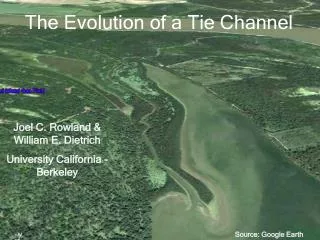
The Evolution of a Tie Channel. Joel C. Rowland & William E. Dietrich University California - Berkeley. Source: Google Earth. Goal of Study. Develop a conceptual model for the development of a self-formed leveed channel created by a sediment-laden current entering still water. Tie channel.

E N D
The Evolution of a Tie Channel Joel C. Rowland & William E. Dietrich University California - Berkeley Source: Google Earth
Goal of Study • Develop a conceptual model for the development of a self-formed leveed channel created by a sediment-laden current entering still water
Tie channel 250 m Fly River , Papua New Guinea What is a Tie Channel? • Self-formed leveed channel • Connect rivers to lakes • Jet entering still water • Bi-directional flow • Stable
Raccourci Old River Tie Channel • 65 km upstream Baton Rouge, LA • Formed in 1851 2 km
Why Raccourci Old River ? • Largest known tie channel • Largely unaltered channel in naturally functioning floodplain • Unprecedented documentation of channel development • Data sources: • Historical records • Hydrographic surveys (> 1880s) • Aerial photographs (> 1940s) • Satellite imagery • ALSM data (Lidar) • Long-term records for Miss River • Field data
Talk Outline • Channel Characteristics • Morphology • Sedimentology • Conceptual Model • Levee growth • Channel widening
Mississippi River Oxbow lake margin 1 km Long profile of channel levees and width
Channel bed from dam into lake mouth bar
Channel and levee growth • Vertically accretes • Channel widens • Levee flanks broaden
Levees composed of sub-horizontal alternating layers • Sand deposition: U* > Ws in channel, U* < Ws over levees • Mud and organic deposition: U* < Ws everywhere
TC Levee Coarse TC Levee Fine TC Bed Miss Susp Sed Miss Bed Incoming load sorted by tie channel processes clay silt sand
150 m Jet Sedimentation • Large “quasi-2D” turbulent structures • Scale with jet width • Sweep across newly forming channel advecting sediment to margins
150 m Localized shear along inundated levee crests ?
Lake level > levee crest • Unpaired levee crests heights • Super-elevated bends • Asymmetric levee x-sections Large-scale advective transfer of sediments Lake level < levee crest
Local advective transfer of sediments: Splays • Locally erode crests • Deposit on flanks Concepts Watershed, 2005
Conclusions • Channel selectively sorts and deposits incoming sediment • Majority of levee sedimentation occurs during submerged/inundated conditions • Splays redistributes sediments and broaden levees • Channel width controlled by mass failures which are linked to levee height