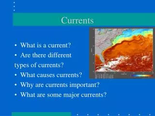
Currents
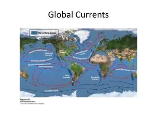
Currents. Surface Currents About 10% of the ocean’s water is in surface currents , water flowing horizontally in the uppermost 400 m Driven mostly by wind friction Most wind energy comes from the trade winds (easterlies) and westerlies. Gyres. Water flows clockwise around the N. Atlantic

Currents
E N D
Presentation Transcript
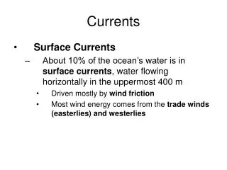
Currents • Surface Currents • About 10% of the ocean’s water is in surface currents, water flowing horizontally in the uppermost 400 m • Driven mostly by wind friction • Most wind energy comes from the trade winds (easterlies) and westerlies
Gyres • Water flows clockwise around the N. Atlantic • This results in an Ekman Spiral • This causes a build up of water in the center of the ocean, • Hill of water about 2 m higher than the rest of the ocean. • This hill is maintained by wind energy, friction with the surrounding continents, and the coriolis effect. • Geostrophic Gyres • Gyres in balance between the pressure gradient and the Coriolis effect are called geostrophic gyres (Geo=earth; strophe= turning), and their currents are called geostrophic currents.
Currents in Gyres • Western Boundary Currents • Located on the gyre’s western end • Ex: Gulf Stream (G.S.), Kuroshio, Brazil, Agulhas, East Australian • Eastern Boundary Currents • Located on gyre’s Eastern Boundary Currents • Ex: Canary Current, Benguela Current, California current, West Australian Current, Humboldt or Peru current • Transverse Currents • These are currents that connect the E.B.C.’s and W.B.C.’s • The N. and S. Equatorial Currents in the Talantic and Pacific are formed by the push of the trade winds. • Countercurrents and Undercurrents • Equitorial Currents are usually accompanied by countercurrents flowing on the surface in opposite direction of the main flow. • Countercurrents also exist beneath surface currents, undercurrents, they are 100 to 200 m below the surface and can carry as much water as the surface currents.
Upwelling • Upwelling: process by which deep, cold, nutrient-rich water is brought from depths to the surface • Coastal Upwelling: the movement of surface water away from a coast line causes deeper water to be brought up in order to replace it. • This deeper water is colder, because it is farther from the sun.
El Niño • During an El Niño the trade winds weaken, stop all together, or even reverse direction. • Causes that pile of warm water in the Western Pacific to slosh back along the equator until it hits the South America • The presence of that warm water creates a cap on the water column and effectively shuts down upwelling.
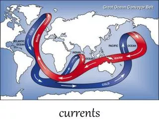
Thermohaline Circulation • Thermohaline (thermo=temperature, haline=salt) circulation is the movement of water due to its density • Responsible for the majority of non-surface water movement in the oceans, both vertical and horizontal