Download
1 / 15
150 likes | 275 Views
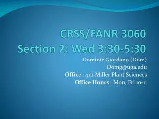
CRSS/FANR 3060 Section 2: Wed 3:30-5:30. Dominic Giordano (Dom) Domg@uga.edu Office : 4111 Miller Plant Sciences Office Hours : Mon, Fri 10-11. What You Are Going To Do.

E N D
CRSS/FANR 3060 Section 2: Wed 3:30-5:30 Dominic Giordano (Dom) Domg@uga.edu Office : 4111 Miller Plant Sciences Office Hours: Mon, Fri 10-11
What You Are Going To Do.... • 1) Use the topographic and soil maps in this handout, and those provided in lab, to complete the hand in sheet attached to this lab; • 2) Look at the rock and mineral displays set up on the lab benches, and answer the questions related to these displays; • 3) Look at the soil profile monoliths set up in the lab, and answer any questions on the hand in sheet related to these profiles
Topographic Maps • Display information about landscape features: Topography Drainage Swamps Roads/Buildings Watersheds
Topographic Map • Contour lines - points of equal elevation • Contour interval - distance between contour lines.
Topographic Maps • Scale – relates the distance on the map to the distance on the ground. • 1:1,200 scale means: 1in (map) = 1,200 in (ground) OR 1” (map) = 100’ (ground) 1,200 in x 1 ft/12 in = 100ft
Topographic Maps • Calculating Slope Gradient: [Elevation difference / Horizontal distance] x 100 • Rise - elevation difference • Run - horizontal distance • Rise/Run x 100 = % slope 8/60 x 100=13% Run: 60’ Rise: 8
Topographic Map • Finding a watershed on your topo map
Soil Survey Maps: • Reading soil maps: Mapping Unit Symbol: AnC3 An- soil series (“Appling”) C- slope class (6-10%) 3- how much soil is lost by erosion (1: uneroded, 2: mod. eroded, 3: severely eroded) • Soil Survey Clarke and Oconee
Soil Survey Maps: • Guide to Mapping Units - p.58 Soils Series, slope, and erosion • Capability - p.22 • Estimated Yields - p.28-29 • Woodland - p.30 • Wildlife - p.32 • Engineering - p. 35
Soil Profile • Soil profile - is a vertical section through a soil with depth down to the rock layer. • Horizons - are layers of soil with varying properties such as texture, color and structure.
Soil Profile - Horizons • O - decomposing leaf litter • A - topsoil, colored brown or black humus, low in clay (sandy or silty), has a granular structure • E- Leached out (light-colored), low clay, below the A, low in humus and iron. • B- horizon of accumulation of material from the A and E, higher in clay and iron • C- weathered parent material, lower in clay and iron, contains rock fragments. • R- hard bedrock
Rocks Minerals • Igneous – molten mantle of the earth from magma p.3 • Metamorphic – the re-melting of igneous or sedimentary rocks p.4 • Sedimentary- particulates that accumulated in thick beds and consolidated into rock either through pressure, cementation, or both p.4 • Primary minerals- form from molten materials. (Quartz, and Feldspars) • Secondary minerals- form at the earth’s surface from chemical breakdown/weathering (clay minerals)