Download
1 / 32
320 likes | 443 Views
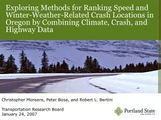
Exploring Methods for Ranking Speed and Winter-Weather-Related Crash Locations in Oregon by Combining Climate, Crash, and Highway Data. Christopher Monsere, Peter Bosa, and Robert L. Bertini Transportation Research Board January 24, 2007. Outline. Motivation Objectives Screening methods

E N D
Exploring Methods for Ranking Speed and Winter-Weather-Related Crash Locations in Oregon by Combining Climate, Crash, and Highway Data Christopher Monsere, Peter Bosa, and Robert L. BertiniTransportation Research BoardJanuary 24, 2007
Outline • Motivation • Objectives • Screening methods • Data sources • Modeling efforts • Results
Motivation • Speed and crashes • reduces driver’s ability to safely navigate • increases stopping distance • increases driver reaction time • Crashes on Oregon state highways between 2000-2002 • 27% of all crashes speed-related • 36% of all fatal crashes speed-related
Objectives • Explore methods to identify locations for specific countermeasures • Oregon DOT interested in speed/weather related countermeasures • Compare screening methods • techniques for screening transportation networks to identify high crash locations have become more sophisticated with more data requirements
Possible Countermeasures • Minnesota Automated Anti-Icing System - I-35 • Pavement Heating System Under Construction - I-84 Near Milepost 271
Data Sources • Crash data • 2000-2002, state highways, location • Geometry • number of lanes, total roadway width, shoulder width, and functional class • Exposure • average daily volumes • Environmental factors (30-year average) • mean annual days of measurable snowfall exceeding 0.1 in • mean annual days when the temperature fell below freezing
Screening Inputs • 3 years of speed and ice-related crashes • 1 mile sections of rural highways • 530 interstate sections • 2,224 principal arterial sections • 2,343 minor arterial sections • Average volume (middle year)
Screening Methods • frequency • critical rate (by functional class) • critical rate (by functional class and climate zone) • potential for crash reduction • expected frequency
Mean Annual Days with Temperature Below 32°F Mean Annual Days with Snow Accumulation > 0.01”
K - Observed # of crashes l is best estimate expected # of crashes E(l) -Modeled # of crashes Empirical Bayes-Methods Count of Crashes Volume Source: Harwood et al 2002
Developing Models • Assemble data • Develop models (SPFs) • glm.nb in R • http://www.r-project.org/ • Compare model results • Select best-fit model
Model Variables • TOTALSI_01 • total speed and ice crashes on the 1 mi segment for 2001 • AADT • average daily traffic for 2001 • SNWDYS • 30 year mean number of days with snowfall > than 0.1” • TOT_SURF_W • total width of the roadway (inc. shoulders), feet • WIDTH_LANE • total width of the roadway (inc. shoulders) per lane, ft. • SP_CD • posted speed limit, mi/h
Models • 1: TOTALSI_01 ~ LOGAADT • 2: TOTALSI_01 ~ LOGAADT + SNWDYS • 3: TOTALSI_01 ~ LOGAADT + SNWDYS + WIDTH_LANE • 4: TOTALSI_01 ~ LOGAADT + SNWDYS + TOT_SURF_W • 5: TOTALSI_01 ~ LOGAADT + SNWDYS + TOT_SURF_W + SP_CD • 6: TOTALSI_01 ~ LOGAADT + SNWDYS + WIDTH_LANE + SP_CD
Excess Potential for Crash Reduction
OR 58, MP 24 - 25 Zonal Rank: 1CRP Rank: 2 Frequency Rank: 14Speed & Ice Crashes: 11MVMT: 6.68Crash Rate: 1.65Number of Lanes: 2Pavement Width (ft): 30Mean Annual Days Snow: 2.5 – 5.4 MP 24.00 MP 24.25 MP 24.50 MP 24.75
OR 35, MP 62 - 63 Zonal Rank: 5CRP Rank: 13Speed & Ice Crashes: 9MVMT: 1.97Crash Rate: 4.57Number of Lanes: 2Pavement Width (ft): est 32Mean Annual Days Snowfall 60.4
Conclusions • Ranking methods identify different sites • Potential for crash most unique • Which method is superior? • Other research suggests PCR or frequency (EB) better • SPF models and approach could be improved • Less aggregate weather data • Sliding window approach
For more information, visit ITS at: • www.its.pdx.edu • Contributors - PSU • Dr. Robert L. Bertini, PE • Peter G. Bosa • Casey Nolan • Tarek Abou El-Seoud • Delia Chi • Acknowledgements • Edward Anderson, ODOT • Larry Christianson, ODOT • Rob Edgar, ODOT • Nick Fortey, FHWA • Mark Joerger, ODOT • Galen McGill, ODOT • David McKane, ODOT • Nathaniel Price, FHWA
Questions? Thank You! www.its.pdx.edu