Download
1 / 57
620 likes | 793 Views
Groundwater in Jordan: status and new developments. Nizar Abu-Jaber German Jordanian University. Introduction. According to the national water strategy of 2009, the demand for water in Jordan stands at 1500 million cubic meters per year.

E N D
Groundwater in Jordan: status and new developments Nizar Abu-Jaber German Jordanian University
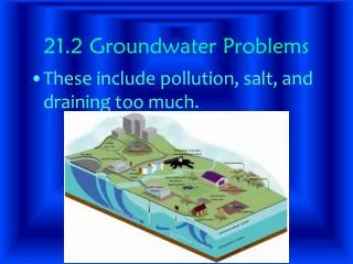
Introduction • According to the national water strategy of 2009, the demand for water in Jordan stands at 1500 million cubic meters per year. • The supply available for the country currently is 867 million cubic meters per year (42% deficit). • Of the supplies available, 366 million cubic meters are from groundwater (42% of the total). • Of these, 91 million cubic meters are non renewable.
Paleogroundwater • By definition, paleogroundwater is non-renewable, and thus any extraction of it is unsustainable. • Isotopic studies of various ground waters in Jordan show that numerous aquifers contain waters that were not recharged under modern climatic conditions.
Star signs are modern precipitation, closed triangles represent the Azraq basin waters, open diamonds represent the Mafraq area waters, open squares are Disi waters, closed squares are from the Sirhan waters, closed triangles are from the Dhiraa waters and the open circle is the S-90 sample described by Bajjali (1994), plus signs are Ashqaf waters and the closed circles are Hammad waters
Renewable aquifers • On the other hand, it is estimated that the amount of precipitation falling over the country ranges from 6-8 billion cubic meters per year, and that only 5% of that (300-400 MCM) goes to recharge the groundwater. • These numbers are crucial in understanding and effectively managing the water resources of the country.
Studies of modern recharge • In order to better manage groundwater in the country, it is crucial that the process of recharge be well understood and quantified. • Because of the gap of solid knowledge in this regard, two important studies have been conducted in Jordan to improve the knowledge on this issue. • These studies were conducted in the Tulul al Ashaqif area in the northeastern desert and in the Yarmouk Basin area of northwestern Jordan.
Recharge at Tulul Al Ashaqif • The Tulul al Ashaqif highlands consist of a volcanic ridge in northeastern Jordan, half way between the towns of Safawi and Ruwaishid. • It extends 80 km in a NS direction with a maximum width of 40 km, and the maximum elevation reaches 950 m above sea level. • The area is climatically arid, with average annual rainfall only reaching 90 mm (Al Qudah, 2003).
Shallow aquifers • Local inhabitants have tapped shallow aquifers in these highlands for many generations. • Simple pits dug to depths of a few meters accessed water within the shallow alluvium in the area. • The water is of acceptable quality, used for domestic and livestock purposes. • It is available all year round.
What do the shallow aquifers tell us about recharge? 1- The waters in the aquifers are recharged locally. 2- The recharge occurs during annual runoff events. 3- There are no sources of other recharge to interfere with the signals derived from the local runoff.
Recharge • Geochemical and isotopic data indicate that recharge occurs rapidly in these areas, with little or no evaporation. • This suggests that most recharge occurs in coarse-grained alluvium, rather than in the terminal playas. • This suggests that delaying the arrival of water to the playas will enhance recharge.
Runoff • Geomorphological studies show various types of surface cover lead to different runoff characteristics. • Study of the drainage basins by GIS can lead to better understanding of flow accumulation and runoff
Can other shallow aquifers be found in the area? • Remote sensing data suggest other areas with similar plant cover characteristics. • The DTM of the area shows some of these sites have similar slope characteristics. • Ten sites were chosen for detailed geoelectrical surveys.
Location of the geoelectrical survey lines (2001), by George Haddadin
What did this suggest? • The remote sensing and geophysical data suggested four sites which may contain shallow water. These are at Ghussein, Shwaiti, Misma and Abiad.
Results of drilling • Drilling of these locations has been completed. • Water is found at Ghussein and Abiad at depths between 15-20 m.
The Yarmouk Basin • Lies in the northwestern corner of the country, with an area of about 1426 km2. • Estimated recharge of the basin is about 40 Million Cubic Meters.
Beginning • Detailed base maps using geographic information systems (GIS) were prepared. • These include topography, drainage, geology and land use layers.
A more detailed look at much smaller scales is herein attempted. • These will give a better idea about where, how and how much recharge is occurring in the study area.
Rainfall distribution • Because rainfall tends to be heterogeneous, a number of small rainfall tipping gauges were distributed near the locations of the detailed investigations. • In all, four of these gauges were installed.
Rain runoff responses • A special system was designed and built to conduct rain-runoff simulations. • Such simulations will allow for a better idea of how much infiltration occurs at various locations and under different rainfall intensities and soil moisture conditions.
Soil moisture and chemistry • Soil pits are dug throughout the dry season in order to monitor the propagation of moisture and salts. • This data was used to evaluate the moisture budget in the soil. • Specifically, the amount of moisture seeping into the groundwater as opposed to evapotranspiration (ET) was evaluated. • ET was also evaluated based on mass balance calculations of the labile salts in the soil.