FLUVIAL PROCESSES
Discover how flowing water shapes the Earth's landscapes through erosion and deposition as detailed by Vicki Drake. Explore factors affecting streamflow, river profiles, and the impact of channel characteristics on water movement. Gain insights into river erosion, streamflow velocity, and stream discharge methods. Uncover the significance of base levels and the dynamic changes in stream channels over time. Learn about erosion mechanisms like dissolution, hydraulic action, and abrasion that shape stream banks and carve rills and gullies.

FLUVIAL PROCESSES
E N D
Presentation Transcript
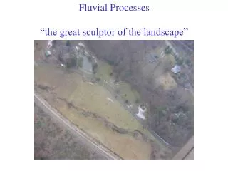
FLUVIAL PROCESSES HOW FLOWING WATER CHANGES THE EARTH’S SURFACE
FLUVIAL PROCESSES • FLUVIAL: from the Latin fluvins for ‘running water’ or streamflow • Streams alter the Earth’s surface and landscapes: • As erosional agentsthrough water movement in a channel • As depositional agents through sediment transport from headwaters to base level (c) Vicki Drake
EARTH’S WATER SUPPLY • Source % of Supply • Oceans 97.2 • Ice Sheets and Glaciers 2.15 • Ground Water 0.62 • Lakes (Fresh) 0.009 • Inland Seas / Salt Water Lakes 0.008 • Soil Moisture 0.005 • Atmosphere 0.001 • Rivers* 0.0001 • * Running water is the most significant agent sculpting the Earth’s land surface (c) Vicki Drake
Major Rivers in USA (c) Vicki Drake
SOURCE OF RIVER’S WATER • Between 25% - 40% of total precipitation runs off as streamflow • Streamflow divided into two types of flow: • Baseflow: streamflow in low flow periods fed by groundwater • Stormflow: streamflow that occurs quickly in response to precipitationevents. (c) Vicki Drake
FACTORS AFFECTING STREAMFLOW • Gradient (slope) – Stream Profile • Steeper gradients promote higher velocities • Graded versus ungraded stream profiles • Headwaters (steeper) and base level (more gentle) • Channel Characteristics • Shape, size, and roughness characteristics • Discharge (volumetric measure of flow) • Discharge = average velocity x cross- sectional area (Q=VA) • Measured in cubic feet per second (cfs) or cubic meters per second (cms) (c) Vicki Drake
STREAM PROFILE - GRADIENT The topographic long profile is concave-upwards. At the headwaters, grade of stream is steep. Closer to the base level (i.e., “mouth” or sea level), grade angle more gently sloped (c) Vicki Drake
Streamflow: Ungraded vs. Graded Streams Typical ungraded stream Graded profile smoothes channel out; no more waterfalls or rapids Hypothetical graded stream Graded stream: Balance between transport capacity and sediment load. Maintained by altering the shape of the channel and stream profile. (c) Vicki Drake
Stream Flow and Headwaters • Source of the river – usually mountains • Headwaters: Influence supply, transport and recharge of subsurface water stores, flows paths and more (c) Vicki Drake
STREAMFLOW AND BASE LEVEL • Base level: the lowest point to which astream can erode its channel.Ultimate base level: sea level Local base level can be a lake, or other continental barrier (c) Vicki Drake
STREAMFLOW AND CHANNEL CHARACTERISTICS • In Fig A, the channel is smooth with a few rounded pebbles on the river bed • A river that flows through a channel like Fig A has few obstacles with less friction and the velocity of the river is increased. • In Fig B the channel is rough or uneven with boulders on the river bed as well as rocks that protrude out from the bank. • A river that flows through a channel like Fig B has to overcome obstacles and there will be more friction and the velocity of the river is reduced. Fig A Fig B (c) Vicki Drake
STREAMFLOW AND CHANNEL CHARACTERISTICS: SHAPE CHANGES OVER TIME (CROSS SECTION) • The stream channel is the conduit for water being carried by the stream. • The channel shape changes over time • The deepest part of channel occurs where the stream velocity is the highest. • Both width and depth increase downstream because discharge increases downstream. (c) Vicki Drake
STREAMFLOW AND DISCHARGE (Q) • Stream discharge (Q): • A measure of the volume of water passing through a given cross-section per unit time • Q = ‘Area’ x ‘Velocity’ and is represented in cubic meters per second (cms) or cubic feet per second (cfs) • Area • The average width and depth of flow in a stream channel • Velocity • Stream velocity measured as the distance water in a stream travels over an interval of time (m/s or f/s) (c) Vicki Drake
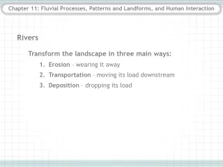
The Work of Streams: Erosion, Transportation, and Deposition • Rivers erode materials at the headwaters, and deposit transported materials near their base level. • Rivers are natural ‘sorters’ – as velocity decreases in a river, larger cobbles and boulders dropped out first, then pebbles, gravels and sands, and finally silts and clays carried the farthest before deposition (c) Vicki Drake
EROSION • Flowing water creates and erodes a channel in three ways: • (1) Dissolving material entering the flowing water channel • (2) Hydraulic action as force of flowing water on the sides and bed of the channel dislodges materials and makes them available for transport as stream load. • (3) Abrasion (scouring) as materials too heavy to suspend, are pushed or rolled across the stream bed eroding the channel. (c) Vicki Drake
Erosion of Stream Banks Cutbank erosion – wearing away along stream banks Headward erosion – backward (or ‘up river’) erosion near head of stream channel erosion (c) Vicki Drake
Erosion: Rills and Gullies • Rills – Small channels flowing down a slope after an intense rain. • Start a few inches deep and wide • Rills join to become a stream channel • Gullies - An advanced form of channel erosion. • The channels carry water after rains and can become permanent landscape features. (c) Vicki Drake
Erosion: Rills and Gullies Gullies developing from rills Rills developing on slope (c) Vicki Drake
RILLS AND GULLIES TO STREAM CHANNELS AND VALLEYS • Small rills and gullies become stream channels and develop valleys through: • Downcutting - downward erosion of the stream channel. • Stream energy exceeds the stream's load • Creates narrow and steep-sided V-shaped canyons and gorges. • Lateral erosion - undermines part of the bank or valley wall, leading to mass wasting and widening of the valley. • Headward erosion - lengthens valley upstream by erosion of headwater divide areas. (c) Vicki Drake
Evolution of a Stream and its Valley (c) Vicki Drake
LIFECYCLE OF A STREAM - “YOUTH” HEADWATERS EROSION • YOUTH • At the headwaters, the stream gradient and topography are steep. • Stream velocity at maximum cuts a deep channel • V-shaped Valley • Minimal floodplain development Yellowstone River cutting down through ‘young’ volcanic rocks (c) Vicki Drake
Stream Channel: “Maturity” Mid Profile Braided Stream • MATURITY • Stream leaves mountainous terrain, more gently sloping landscape • Reduction in stream velocity begins development of flood plain • Deposition of coarser cobbles, pebbles and sands • Braided streams (c) Vicki Drake
Stream Channel: “Old Age” Mouth of Stream - Base Level • OLD AGE • Extensive floodplain from meandering stream • Lower slope gradient • Channel is large as stream moves across floodplain • Maximum discharge (Q) carrying fine-grained materials (c) Vicki Drake
Rejuvenation – Incised Meanders • “Old Age” streams develop meanders at base level • Tectonic uplift of drainage basin results in meanders that are incised and fixed • Floodplain development slows as downcutting begins again (c) Vicki Drake
Work of Streams: Transportation • Stream Load: the material (either as a solid or in solution) carried by a river or stream • a function of topographic relief, drainage basin, climate, and vegetation • Streams transport Stream Load three ways: • (1) Dissolved load • (2) Suspended load • (3) Bed load (c) Vicki Drake
Stream Load and Transportation • Dissolved load comes from groundwater seepage into the stream as well as the dissolution of solids in the flowing water. • Suspended load is comprised of sediment suspended and transported through the stream. • Comes from material eroded from the surface bordering the channel and deposited in the stream, as well as erosion of the channel itself. • Bed load is moved along the bed of the channel in two ways: • (1) Traction: a pushing or rolling of particles along the bed. • (2) Saltation: a bouncing-like movement of lighter particles moving downstream (c) Vicki Drake
Transporting Stream Load (c) Vicki Drake
http://www.youtube.com/watch?v=7Z0XwYkqXy4&feature=related (c) Vicki Drake
MEASURING STREAM TRANSPORT • Stream capacity is the total suspended load and bed load that a stream can transport • “How much” • Stream competence is the ability of a stream to transport a particular size of particle (e.g., boulder, cobble, pebble, gravel, sand, etc.) • “How big” (c) Vicki Drake
Work of Streams: Deposition andTypical Floodplain Characteristics • As floodplains become more established in the maturity of a stream, typical features include: • Meanders • Cutbanks • Point bars • Oxbow Lakes • Natural levees • Stream Terraces (c) Vicki Drake
CREATING A FLOODPLAIN • Floodplains are the relatively flat regions near a stream channel. • Floodplains develop over long periods of time through river meanders and occasional river flooding. • Distinctive floodplain characteristics develop with age of stream (c) Vicki Drake
Lateral Erosion: Developing Meanders and Floodplains • A meander is a ‘bend’ in a stream that develops as base level is achieved – no more downcutting. • Meanders lengthen the distance the stream is flowing as it drops its elevation, thereby, lowering the gradient. • Meanders form because the water on the outside flows faster and the transported materials (i.e. stones and rocks) scratch against the side of the river. • This wears away the side of the river forming the bend or meander (c) Vicki Drake
Deposition and Erosion in a Meander Cut bank Point bar (c) Vicki Drake
Floodplain Characteristics: Meander Cut Banks and Point Bars • Cut Banks: The maximum velocity on the outside of a meander cuts into the bank. • Point Bars: The minimum velocity on the inside of a meander allows for deposition of sands and gravels. • Meanders slowly migrate back and forth across valley floor with the cycle of erosion and deposition. • This process builds the floodplain over many years (c) Vicki Drake
Floodplains: Cut Banks and Point Bars (c) Vicki Drake
MEANDER CUTOFFS AND OXBOW LAKES Shortens length of river, increases slope gradient, renewed downcutting with higher velocity. In areas with high water table, Oxbow lakes can become permanent features. Meander scars (“dry” lakes) form in areas with less available water. (c) Vicki Drake
Meanders Change Over Time Gentler gradient Meander cutoffs shorten the length of a stream and temporarily increase the stream velocity and re-activate downcutting due to new steeper gradient (c) Vicki Drake
Floodplain Characteristics: Natural Levees • Natural levees are formed after many floods • Larger, coarser material deposited immediately after water leaves its channel • Finer material carried further away and deposited on the floodplain (c) Vicki Drake
MISSISSIPPI LEVEES (c) Vicki Drake
Drainage Basins - Watersheds • A drainage basin is the topographic region from which a stream receives runoff, groundwater and surface flow • A watershed is an area of land over and through which water flows to the lowest point - a stream, river, wetland, or lake • Drainage divides are the high topographic points within a watershed that determine the direction of flow of water Highest elevation Lowest elevation (c) Vicki Drake
Watershed of Mississippi River, USA (c) Vicki Drake
SOUTHERN CALIFORNIA RIVER WATERSHEDS (c) Vicki Drake
Watershed of Malibu Creek (c) Vicki Drake
BALLONA CREEK WATERSHED (c) Vicki Drake
Los Angeles River Watershed (c) Vicki Drake
Streams and Base level: Deltas • Deltas form by the deposition of sediment at the mouth of stream when water flows into a lake or the ocean • Stream velocity decreases upon reaching base level (either a lake, reservoir, or the ocean): the stream deposits its load. • A delta’s surface is marked by distributaries • Small shifting channels that carry water away from main river channel • Sediment deposited at mouth of eventually block flow causing shift of deposition (c) Vicki Drake
MISSISSIPPI DELTA (c) Vicki Drake
STORMFLOW - FLOODS • Floods are the most common and widespread of all natural hazards. • Floods kill more Americans than lightning, tornadoes, or hurricanes • Flash floods happen in minutes. • There are estimated to be thousands of homes, commercial, industrial, and business structures in identified floodplains. • A 100-year flood is one that has a 1%, or one out of 100, chance of being equaled or exceeded in any given year. • The term gives an estimate of the probability that a flood of a certain size will occur, not when it will occur. (c) Vicki Drake
Sample Flood Hazard Maps (c) Vicki Drake