Download
1 / 15
150 likes | 268 Views
The GeoMAPP initiative focuses on the collaborative preservation of at-risk geospatial content across multiple states. This presentation discusses the importance of robust metadata standards, including FGDC and ISO, in ensuring geospatial datasets are well-documented and preserved. By building partnerships among state Geographic Information Systems (GIS) and Archives staff, the project promotes the effective use of metadata for preservation and discovery purposes, supporting local, state, and national outreach efforts in geospatial data management.

E N D
GeoMAPP: Using Metadata to Help Preserve Geospatial Content Matt Peters, Utah’s Automated Geographic Reference Center Glen McAninch, Kentucky Department for Libraries and Archives Alec Bethune, North Carolina’s Center for Geographic Information and Analysis NDIIPP Partners Meeting| Washington, DC| June 25, 2009|
What is GeoMAPP? • Preservation of “at risk” superseded geospatial content • Building the relationship between State GIS and Archives staff • Interstate partnerships • Exploration of business case drivers • Data replication among several states • Implementation of a geographically disperse content-exchange network • Local, state and national outreach
Who is GeoMAPP? Kentucky Department of Libraries and Archives (KDLA) Kentucky Division of Geographic Information (DGI) NC Center for Geographic Information and Analysis (CGIA) North Carolina State Archives NC State University Libraries Utah Automated Geographic Reference Center (AGRC) Utah State Archives
Geospatial Metadata: A primer on the FDGC and ISO standards Matt Peters Utah Automated Geographic Information Reference Center
Overview of Two Geospatial Metadata Standards • Federal Geographic Data Committee (FGDC) Content Standard for Digital Geospatial Metadata • Version one (1994) mandated for use by federal agencies in 1995 • Descriptive metadata, plus some administrative and technical • Extensive use at state level, spotty use at local level • Problem: content standard without an encoding specification • FGDC profiles: ESRI, NBII, Remote Sensing, etc. • ISO Standards • ISO 19115: Geospatial Information – Metadata (2003) • ISO 19139: Geospatial Information – Metadata – XML (2007) • North American Profile of ISO to replace FGDC CGDSM • Not yet widely implemented in the U.S.
What’s in a Geospatial Metadata Record • Identification Information • Data Quality Information • Spatial Data Information • Spatial Reference Information • Entity and Attribute Information • Distribution Information • Metadata Reference
For Preservation and Discovery, Data must have Metadata that tells: • Who: creator of data, • What: title and description of data, • Where: geographical extent of data, • Why: reason the data was created, • When: when the data was created, • How: how the data was created. • Definition of data attributes.
Making Metadata Useful:The Utah Approach Matt Peters Utah Automated Geographic Information Reference Center
Draft of Utah’s GIS to Archives Data Flow • All Metadata is completed to FGDC Standards • AGRC creates geoPDF files of individual datasets, plus ZIP files of the native format. • One ZIP file would contain all the pieces belonging to one shapefile or, alternatively, the file would contain a geodatabase. • Geodatabases would not be just one big database with everything in it (multiple series and years). • Instead, the native files would be composed of a single downloadable file per series per year. AGRC exports data from SGID and splits out datasets by series. Metadata occasionally incomplete complete Local governments supply GIS datasets on CD/DVD to AGRC. Metadata often missing AGRC copies these files to Archives’ FTP server. • Example FTP Site Structure: • ftp.archives-agrc.utah.gov/Archives Metadata harvested to populate Archive’s Finding Aids • Biota Dublin Core Metadata • Boundaries Dublin Core Metadata • MunicipalityRecords-Series-26846Dublin Core Metadata • 2000 • MunicipalBoundaries.zip FGDC Metadata • MunicipalBoundaries.pdf FGDCMetadata • 2001 • 2002 • 2003 • CountyBoundaries-Series-26845 Dublin Core Metadata • 2003 • 2004
Making Metadata Useful:The Kentucky Approach Glen McAninch Kentucky Department for Libraries and Archives
Kentucky Metadata Workflow into DSpace and iRODS Environment UNC other KDLA Database with Dublin Core Descriptive and Administrative Metadata Metadata & content entered by agencies using template and modified by Archivist DSpace Single item & batch ingest into DSpace by Archivist Database with Administrative & Preservation Metadata Content Files iRODS Batch metadata extraction using iRODS rules Preservation metadata from iRODS rules Distributed Storage Layer
Making Metadata Useful:The North Carolina Approach Alec Bethune NC Center for Geographic Information and Analysis
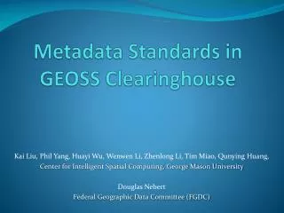
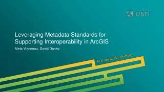
NC: From FGDC to MARS • GIS metadata processing for NC OneMap • Geospatial metadata has lots of great info, but who as the time to fill it all out? • Using ISO Categories to organize data in our demonstration repository • Extracting preservation elements from FGDC metadata to allow data access with MARS cataloging


![CM [A] R’s “MarLIN” Metadata System - or, how do we discover what data we’ve got??](https://cdn2.slideserve.com/4543203/cm-a-r-s-marlin-metadata-system-or-how-do-we-discover-what-data-we-ve-got-dt.jpg)