Download
1 / 32
390 likes | 702 Views
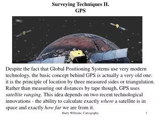
GPS and Surveying the Earth. Treg Christopher NR25: Measurements and Mapping. Outline. GPS Overview and History How it works Sources of Error Corrections for Error Surveying the Earth Datums Precision and Accuracy. What is GPS?.

E N D
GPS and Surveying the Earth Treg Christopher NR25: Measurements and Mapping
Outline • GPS • Overview and History • How it works • Sources of Error • Corrections for Error • Surveying the Earth • Datums • Precision and Accuracy
What is GPS? • The Global Positioning System (GPS) is a location system based on a constellation of satellites orbiting the earth at altitudes of approximately 12,500 miles (20,200 km). • Uncorrected positions determined from GPS satellite signals produce accuracies in the range of 7 to 10 meters.
GPS History • 1930’s:Origins with earth-based, radar systems to allow airplanes to triangulate their positions • 1960’s: 6 satellites launched but poor accuracy • 1974:1st current, GPS satellite launched by U.S. program, “NAVSTAR” (Navigation System and Ranging) • 1993: “Initial Operational Capability” with a constellation of 24 satellites • 2000: “Selective Availability” turned off
GPS Costs and Markets in the U.S. • $12 billion U.S. Government R&D between 1973 - 2002 • $750 million annually • operate and maintain the constellation • R&D • replacement of satellites • 1.4 million GPS units produced each year since 1997, generating $6.2 billion by the year 2000 • $50+ billion direct, economic income by 2010
Applications for Natural Resources • Navigation to plots • Marking plot positions • Navigation for off trail hiking • Delineating a trail or route • Delineation of areas of interest
GPS: How It Works • The basis of GPS is “triangulation" from satellites. • To "triangulate," a GPS receiver measures distance using the travel time of radio signals. • To measure travel time, GPS needs very accurate timing which it achieves with some tricks. • Along with distance, you need to know exactly where the satellites are in space. • Finally you must correct for any delays the signal experiences as it travels through the atmosphere.
Factors Causing GPS Error • Atmospheric effects • Multipath • Satellite geometry • Satellite ephemeris • Satellite clock • Other problems • Selective availability (SA)
Atmospheric Effects • Local Weather (snow, rain, etc.) does NOT create errors • Ionospheric & Tropospheric Refraction • Solar storms
Satellite Ephemeris • Satellite is not where it should be!
Satellite Clock • A clock error of 1 nanosecond (1,000th of a second) -> GPS position error of 200 miles • 3 satellites needed to find and correct for clock errors • A 4th satellite is used to improve this recalculation
Other problems • Electrical interference • Inside buildings • Canopy cover • Corrections: • Wait until after leaf drop in deciduous forests • Correct through “Projecting a location”
Selective Availability (SA) • The accuracy of GPS signals was intentionally degraded by the DoD for concerns of national security • SA was the largest component of GPS error (+/- 100m) • SA was turned off on May 1, 2000 SA on (100 meter spread) SA off (3 meter spread)
Improvements to Accuracy • Differential Correction • Real-time • Post-Processing • WAAS • Position Averaging
Datums…who needs them anyways? • "Why do the coordinates on my GPS not match those on my map?" • most likely this is because the coordinates are referring to different datums. • A Datum is a set of reference locations (points) that describes your position relative to the true shape of the earth
3 Analogies for what a datum is • Temperature • “It is zero degrees outside!” • What is the “datum”?: Celsius, Fahrenheit, Kelvin? • The datum is often implied depending on where you are • You can translate between these systems • Timezones as datums • “It is 11:00!“ • What is the “datum”?: Greenwich Mean Time, Eastern, Pacific • Directions as Datums • It is the same with directions, unless you know the datum they refer to, they have no meaning. • “I am 500 feet northwest !” or “I am 1 block north and 1 block west!”
Datums for coordinate systems • “I am at Nxx.xx°, Wxx.xx°.” • What is the “datum”?: NAD27,NAD83,WGS84 • Unlike the analogies, where you are does NOT imply which datum you are using! • Like the analogies, you CAN convert between datums (with a caveat) • Differences between datums affect your position both horizontally and vertically (by hundreds of meters horizontally) • The actual difference depends on where you are relative to the datums origin
Local vs. Geocentric Datums • Local vs. Geocentric Datums • Different Ellipsoid model/shape • Local: Origin of that ellipsoid is at a specific location on the earth surface (min distortion for that area) • Geocentric: Position centered on the earth center of gravity • Tools: Survey monuments from 1800’s vs Satellites
NAD27 • Local datum • Aligns the spheroid to closely fit the earth in a particular area • Origin is on the surface (Meade’s Ranch in Kansas) • Old ellipsoid shape/model • Seismic motion and station positions
Geocentric Datums • NAD83 (North American Datum 1983) • GRS1980 ellipsoid • WGS84 (World Geodetic System 1984) • WGS84 ellipsoid • There are over 240 other Geodetic Datums currently in use, ranging from Antigua 43 to Zanderij (Surinam)
Precision, Accuracy and Bias in Sampling and GPS • Precision: • The ability to make repeated measurements with the same value • Accuracy: • The ability to make an estimate that is close to the “truth” • Bias: • The difference between “truth” and your estimate
High Accuracy & High Precision • Accuracy: • Measurements close to truth • Precision: • Repeated measurements come close to each other • GPS Datum: • WGS84 • GPS Error: • Averaging On • No Multipath
High Accuracy & Low Precision • Accuracy: • Measurements close to truth • Precision: • Repeated measurements NOT close to each other • GPS Datum: • NAD83 • GPS Error: • Averaging off • No Multipath
Low Accuracy & High Precision • Accuracy: • Measurements NOT close to truth • Precision: • Repeated measurements come close to each other • GPS Datum: • ? • GPS Error: • Averaging On • Multipath Errors
Low Accuracy & Low Precision • Accuracy: • Measurements NOT close to truth • Precision: • Repeated measurements NOT close to each other • GPS Datum: • NAD27 compared to other data in NAD83 or WGS84 • GPS Error: • Averaging off • Multipath errors
End • sddcVS
Review Questions (from Lecture) • List 3 applications of GPS for Natural Resources Management • List and describe 6 errors affecting GPS readings • List and describe some corrections for these errors • Describe the two errors that can NOT be corrected for with differential correction. • What is a datum? What is the effect on coordinates from switching between NAD27 and NAD83? • What is the modern datum used by GPS? • Describe and draw examples of precision, accuracy and bias
Review Questions (from Lab) • How many satellites are need to accurately find a position on the earth? (3D reading) • What is a field method we used for increasing the accuracy of a GPS reading? • What is a field method we used for getting a plot position under dense canopy? • Understand the basic functions of the 5 GPS pages shown in the lab presentation