Download
1 / 23
230 likes | 245 Views
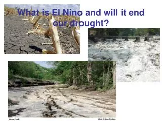
Did the El Niño of 2002-03 break the drought in Colorado or elsewhere in the West?. Klaus Wolter NOAA-CIRES Climate Diagnostics Center klaus.wolter@noaa.gov. With Kudos to Jon Eischeid, Roger Pielke, Sr., and Robin Webb. • Drought in the Western U.S.: 1999 - 2003

E N D
Did the El Niño of 2002-03 break the drought in Colorado or elsewhere in the West? Klaus Wolter NOAA-CIRES Climate Diagnostics Center klaus.wolter@noaa.gov With Kudos to Jon Eischeid, Roger Pielke, Sr., and Robin Webb •Drought in the Western U.S.: 1999 - 2003 • Expected precipitation anomalies in 2002-03 • Observed precipitation anomalies in 2002-03 • Role of individual precipitation events • Preliminary Conclusions
During the winter of 2002-03, the West Coast got “wet” first; followed by interior states from Arizona to Montana that recovered at least partially from a severe multi-year drought. This fall, drought has reaffirmed its grip on states like New Mexico and Montana. Where did the West recover from drought conditions in 2002-03?
Stateof ENSO mid-2002 into early 2003 based on MEI: a moderately strong El Niño event MEI ranks in JA’02: 11, SO: 13, ND: 10, JF’03: 9, MA: 20
Percentage of Significant Departures During El Niño: 18.0% 10 cases: 1957, 63, 65, 72, 82, 86, 87, 91, 94, 97 If the MEI were used, 1977 would replace 1963.
Percentage of Significant Departures During El Niño: 20.5% 10 cases: 1957-58, 65-66, 68-69, 72-73, 82-83, 86-87, 87-88, 91-92, 94-95, 97-98 If the MEI were used, 1977-78 would replace 1968-9.
Percentage of Significant Departures During El Niño: 6.1% 10 cases: 1958, 66, 69, 73, 83, 87, 88, 92, 95, 98 If the MEI were used, 1978 would replace 1964.
Percentage of significant composite precipitation anomalies in the Western U.S. vs. three different ENSO indices: Niño 3.4, Southern Oscillation Index (SOI), and Multivariate ENSO Index (MEI). Highest values in each season are underlined. Niño 3.4, the “official” measure of ENSO, is not optimal for anticipating regional impacts.
Recent precipitation trends for the U.S.: (left) SON, (bottom left) DJF, and (bottom right) MAM. Correlations above 0.3 can be considered significant. According to this analysis, Montana has had the most pervasive drying trend in the West over the last 30 years. This comes on top of the expected El Niño signal, or does it express the preference for El Niño conditions during that period? Compared to recent temperature trends, most of the precipitation trends appear insignificant.
How representative are climate divisions? Biggest problems exist with precipitation in the interior West, and Climate Divisions do NOT include SNOTEL data.
New Climate Divisions Official CDs for Colorado (left) and Experimental CDs (right) based on multivariate statistical analysis of climate data that also include SNOTEL data. Such new CDs are being derived for the entire U.S.A. Let us focus on 1 (red), 3 (black), 6 (purple), and 8 (green) for this El Niño “impact study”.
El Niño in Colorado Seasonal precipitation amounts (in percentiles from 1950-99) for 10 El Niño cases: 1957-8, 65-6, 72-3, 77-8, 82-3, 86-7, 87-8, 91-2, 94-5, and 97-8, based on the MEI. If 8 or more cases out of 10 reside above or below the median, the distribution is shifted significantly. If 4 or more cases reside in the upper (80%) or lower (20%) quintile, there is only a 10% chance that this result is by accident. The 2002-3 El Niño event ended up ranked 10th, pushing 1977-78 into 11th place. Wet Dry Wet Wet WET
Observed precipitation rankings in 2002-3 During the fall season of 2002, increased western U.S. precipitation matches expectations quite well, in particular over Utah, western Colorado and northern New Mexico. During the following winter, the overall El Niño foot print remains visible, with Washington receiving more than expected and AZ/NM less. Dry conditions over the central high plains are the least consistent with El Niño expectations.
Observed precipitation rankings in 2002-3 During the spring of 2003, California continues to receive good moisture consistent with lingering El Niño conditions. The Pacific Northwest into Montana appear lucky to receive more moisture than expected. Over the interior southwest, northeast Colorado ‘hit the jackpot’ due to its March snowstorm, while AZ/NM continue to ‘under perform’. A more detailed look at Colorado follows below, revealing that the spring moisture bonanza is actually very consistent with MEI-based expectations.
What a difference a year makes, The Big Picture September 2001 through August 2002 maximizes the impact of the 12-month running drought in the southwestern U.S. Compared to the record-setting recovery in the eastern U.S., our return to near-normal in 2002-03 appears rather bland. It was most welcome nevertheless, and, together with prudent water management, it allowed for at least a modest recovery in the western water supply situation.
What a difference a year makes, Colorado-style WY 2002 was the driest on record in much of southern Colorado, and close to that in the north. WY 2003 ended up close to or wetter than normal along the Front Range and in most of northern Colorado. Dry pockets persist in the southeastern plains and the San Luis Valley. The biggest positive anomaly (around Summit County) overlaps with massive cloud-seeding efforts last winter…
Did the 2002-3 seasonal totals in Colorado match expectations (high hopes)? • Using the simplest possible classification of the data (above or below the median), let’s compare the expected WET/DRY/WET sequence in most of Colorado (expect for the Arkansas Valley that tends to get WET in all 3 seasons from fall to spring) with preliminary observations: • The northern two “climate divisions” (1 and 8) received WET/DRY/WET, while the south (3 and 6) ended up DRY during the spring. This means that 10 out of 12 “forecasts” were correct in their sign, and two were not. How unusual is that? • If you classify each season since 1950 into above and below median precipitation totals, and compare against the WET/DRY/WET scenario (WWW for region 6), there are only two cases (out of 42) in which there is a match this good (10 out of 12) during non-El Niño years (1984-5 and 98-99), while there are three such cases (out of 10) during El Niño years. IOW, the a priori odds for such a good match were 30%, given the El Niño setup, and only 5% during the other years. • Another way of quantifying this: the median number of matches of this type is only FIVE out of 12 during non-El Niño years, and between EIGHT and NINE during El Niño years. IOW, 2002-3 did not only match, but exceed expectations in Colorado.
The importance of individual events Big storms battered California on and off during the winter and spring of 2002-3. One can argue that the siege of storms in mid-December made all the difference for the Sierra Nevada snowpack, while the biggest rain in L.A. came right in the middle of the annual AMS meeting. Higher odds for big storms are typical of El Niño, but this one broke some records!
Snowstorm of the century?! Speaking of records, the mid-March 2003 storm was easily one of the biggest three snowstorms of the last century in Colorado, rivaling or exceeding totals last seen in April 1921 (24h U.S. record at Silver Lake, Boulder County), and December 1913 (the ‘analog’ case in terms of the synoptic set-up?). Liquid totals reached 7-9” H2O at numerous COOP and SNOTEL sites along the Front Range, or 20-30% of the average annual precipitation at these locales.
The role of individual storms in Colorado • The March 17-20 snow storm turned a lackluster winter around, and refilled Front Range reservoirs. It is easily the biggest single snow storm (in terms of SWE) in Front Range SNOTEL history (since 1978). • A near-record breaking snow storm in late April hit West Slope ski resorts right after many of them had closed down for the season. As can be seen in this SNOTEL diagram for Vail, this one contributed only about 10% to the annual total, while the March storm added 25% to Lake Eldora’s totals.
Preliminary Conclusions • As discussed last year, multi-year drought conditions in the West reached record proportions by late summer 2002, matching or exceeding the severity of one of the worst droughts on record along the eastern seaboard. • Recovery since then has been not nearly as decisive for the West as it has been for the East. In fact, if it had not been for a few key events (that did not “produce” for everyone), the drought would have continued virtually unabated. • The El Niño of 2002-03 provided for a rare opportunity to combine the typically skilful forecasts during such events with increased public interest in the West. Much was riding on this one!
Preliminary Conclusions • Probably not unrelated to its only moderate size, the El Niño of 2002-3 did not provide for universal relief in the southwestern U.S. Nevertheless, beneficial moisture during the fall and late winter season in particular helped turn things around from California to Colorado. • Of course, this preliminary assessment does not prove that the observed precipitation anomalies were related to El Niño. However, I hope I was able to point out areas of agreement and disagreement. • While the tier of states from Washington to Montana fared better than expected, unchanged or worsened drought conditions in New Mexico and parts of Arizona attest to the worst disappointments of this El Niño year in the West.