Download
1 / 23
230 likes | 346 Views
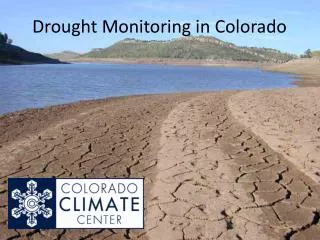
The May-June-July 2013 Climate and Drought Outlook for Colorado Including a Review of Recent Weather, Snowpack and Drought Conditions . Mike Baker Climate Services Focal Point National Weather Service Boulder, Colorado April 27, 2013. Introduction.

E N D
The May-June-July 2013 Climate and Drought Outlook for Colorado Including a Review of Recent Weather, Snowpack and Drought Conditions Mike Baker Climate Services Focal Point National Weather Service Boulder, Colorado April 27, 2013
Introduction Neutral ENSO (El Nino-Southern Oscillation) conditions persist and are likely to continue through at least the summer of 2013 according a majority of the ENSO predicting climate models from around the world. The large scale circulation pattern over the United States underwent a significant longitudinal shift in February of this year. The strong and persistent upper level high pressure ridge that brought unseasonably warm and dry weather to much of the western United States, including Colorado, during January migrated westward over the west coast of the U.S. and the nearby Pacific Ocean in February. This westward shift in this upper level ridge continued during March, allowing an abnormally strong Polar jet stream to dive down from the Gulf of Alaska and to carve out an unusually “deep” long wave upper level low pressure trough from the Great Basin to the Great Plains where it has remained to a large extent. This allowed the Polar jet stream (e.g., storm track) to position over the central Rocky mountain region for several days at a time. This resulted in several days of unseasonably cold and snowy weather for much of northern and eastern Colorado, including the northern Front Range urban corridor, during March and April. Recent snow storms significantly contributed to the late season snowpack in Colorado, particularly in the Yampa/White River, Colorado River, Laramie-North Platte River and South Platte River basins in northern Colorado. Even with ample snowfall across the north, the statewide snowpack remains low average partly due to the meager snowfall and warmer temperatures across the southern part of the state.
Introduction - continued The recent snowfall and below average temperatures have increased soil moistures across northern Colorado during the past 60 days, and consequently eased some of the short-term drought concerns in the region. Meanwhile, the lack of precipitation and warmer temperatures across southern Colorado continue to reduce soil moistures and perpetuate the extreme to exceptional drought conditions across southeast Colorado. 5. The drought outlook for Colorado for the next 90 days calls for some improvement in areas east of the mountains, and for drought conditions to persist in the mountains and valleys of central and western Colorado. The precipitation outlook from the Climate Prediction Center (CPC) issued 18 April 2013, called for better than a one-in-three chance of below average precipitation across Colorado during May, and an equal or undeterminable chance for above, near and below average precipitation during May, June and July. The temperature outlook from CPC for May called for a 40 to 50 percent chance of above average temperature for the northeast corner of Colorado, and a 50 to 60 percent chance for warmer than average temperatures for the remainder of the state. This level of confidence is not often seen in CPC outlooks.
Latest ENSO Conditions in the Eastern Pacific Ocean Current Status – ENSO Neutral During the past several weeks, near average sea surface temperatures (SST) dominate the eastern tropical Pacific Ocean. However, pockets of warmer-than-average sea surface water east of 120 W longitude continue to generate areas of enhanced tropical convection along the equator. In other areas of the eastern equatorial Pacific, such as along the west coast of South America, SST anomalies have cooled to values associated with a weak La Niña. Niño 3.4 Near Average SST Anomalies in Eastern Tropical Pacific Niño 3.4 – The principal region in the eastern Equatorial Pacific Ocean (red outlined box along the equator) used by the Climate Prediction Center (CPC) for monitoring, assessing and predicting the El Niño- Southern Oscillation (ENSO).
The monthly SST anomaly index for ENSO 3.4 as of March 2013 remains in negative territory (-0.22C ) for the forth month in a row. However, this is not an indication of a La Niña as this does not fit the threshold necessary to be classified as such. Therefore, at this time , a neutral or non-ENSO condition exits.
The Oceanic Niño Index (ONI) for Niño 3.4 • The ONI is based on sea surface temperature (SST) departures from average in the Niño 3.4 region of the eastern tropical Pacific Ocean. It is the principal measure used by NOAA’s Climate Prediction Center (CPC) for monitoring, assessing and predicting El Niño/Southern Oscillation (ENSO.) • ONI is defined as the three-month running mean SST departures in the Niño 3.4 region of the Pacific. • ONI is used to place current ENSO and non-ENSO events into a historical perspective. • CPC’s operational definitions of El Niño and La Niña are keyed to the ONI index. • For historical purposes, warm and cold phases of ENSO (the red and blue colored numbers) are defined when the threshold is met for a minimum of 5 consecutive over-lapping 3-month seasons. NOAA/CPC Last Update 04-04-13 The ONI during the latest three month climate season (JFM) was -0.7. Though less than -0.45, it does not meet the criteria for a La Niña (as defined in lower right.) El Niño : ONI higher than +0.45 Neutral ENSO : ONI of -0.45 to +0.45 La Niña: ONI lower than -0.45
The Forecast for ENSO • The table in the lower left contains the cumulative average of sea surface temperature anomalies (SSTa) forecasted by 17 dynamical models and 8 statistical models, and a cumulative average for all 25 models for overlapping 3-month climate seasons through the December-February (DJF) 2013-2014. • An SST anomaly greater than -0.45˚C and lower than +0.45˚C indicates the presence of neutral ENSO conditions in the Pacific. • A large majority of the dynamical and statistical climate models continue to predict non-ENSO or neutral conditions through the summer of 2013. Beyond that though, members begin to diverge with the dynamic model mean continuing to indicate neutral conditions through autumn of 2013, while the mean of the statistical models trends cooler towards La Niña conditions. AMJ MJJ JJA JAS ASO SON OND NDJ DJF Source: International Research Institute for Climate and Society (IRI) – Apr 18 2013:_-
Probabilistic ENSO Forecast for Nine Overlapping 3-Month Climate Seasons Through December-February of 2013-2014 The bar chart shows the probability of El Niño, neutral and La Niña conditions for three-month climate seasons beginning with the April-June (AMJ) season and ending with December-February (DJF) 2013-2014. Neutral conditions have the highest probability of occurrence during the 9 overlapping seasons. However, the probability for La Niña conditions increases during the fall.
C O L O R A D O Recent Weather, Snowpack and Drought Conditions Across Colorado
Temperature Departures for the 30 Day Period Ending April 26, 2013
Departure from Normal Precipitation for the 60 Day and 30 Day Periods Ending April 26, 2013
Percent of Normal Precipitation for the 60 Day and 30 Day Periods Ending April 26, 2013 The northwest-to-southeast orientation of the maximum and minimum precipitation anomalies in the above maps resembles a pattern often observed during La Niña episodes.
Standardized Precipitation Index for the 60 Day and 30 Day Periods Ending April 26, 2013 The SPI was developed to monitor potential short term agricultural and long-term hydrological drought conditions. The SPI is a probability index that considers only precipitation.
Colorado Snowpack As of April 24, 2013
The snowpack in Colorado continues to improve, particularly across northern portions of the state. As of April 24, 2013, the statewide average snowpack was 92 percent. Snow water equivalents have inched above their seasonal normals in the northwest basins (102 percent in the Yampa/White River Basins, 103 percent in the Laramie and North Platte River Basins, and 109 percent in the Upper Colorado River Basin). The snowpack has also made positive gains in the South Platte River Basin where it is now 94 percent.
Northern Colorado Snowpack Latest snowpack measurements reveal a marked improvement in snow-water equivalents across northern Colorado, specifically in the South Platte , Laramie/North Platte and Colorado River basins. Even with the sizable increase in snowpack during the past 30 days, snow pack levels remain below average. The dark blue snowpack trend line is for the 2012-2013 winter season.
Southern Colorado Snowpack Snowpack measurements in river basins across southern Colorado remain below average for this time of year. The affected basins include the Gunnison River Basin, the San Migual, Dolores and San Juan River Basins, the Upper Rio Grande River Basin, and the Arkansas River Basin. The dark blue snowpack trend line is for the 2012-2013 winter season.
As of April 23, 2013, extreme (D3) to exceptional (D4) drought conditions persist across southeast and far northeast portions of Colorado. Moderate to severe drought conditions are found elsewhere. The improvement noted in drought conditions across north central and northeast Colorado is large the result of several recent snowfall events.
The latest seasonal drought outlook issued by NOAA’s Climate Prediction Center valid for the period April 18 to July 31, 2013 is calling for drought conditions to improve some across eastern Colorado, and persist for the rest of the state. For an outlook for the entire U.S., go to www.cpc.ncep.noaa.gov/products/expert_assessment/season_drought.gif.
May-June-July 2013 Temperature and Precipitation Outlooks for Colorado Issued by the Climate Prediction Center
30 Day Precipitation and Temperature Outlooks The temperature outlook for May calls for a 40 to 60 percent chance of above average temperatures across Colorado, with the best chance on the western slope. Keep in mind, this probability forecast is NOT an indicator of warmth or coolness, only the likelihood of their occurrence. For May, the Climate Prediction Center (CPC) has a 33.3 to 40 percent chance of below average precipitation in eastern and extreme southwest Colorado, and a 40 to 50 percent chance for below average precipitation for the remainder of the state.
CPC is calling for an equal (or undeterminable) chance for above, near and below of precipitation across Colorado during May, June and July. Finally, there is a 40 to 50 percent chance of above average temperatures in the far northeast corner of Colorado during May, June and July, and an even greater likelihood (50 to 60 percent chance) for warmer than average temperatures for the remainder of the state.