Download
1 / 16
160 likes | 269 Views
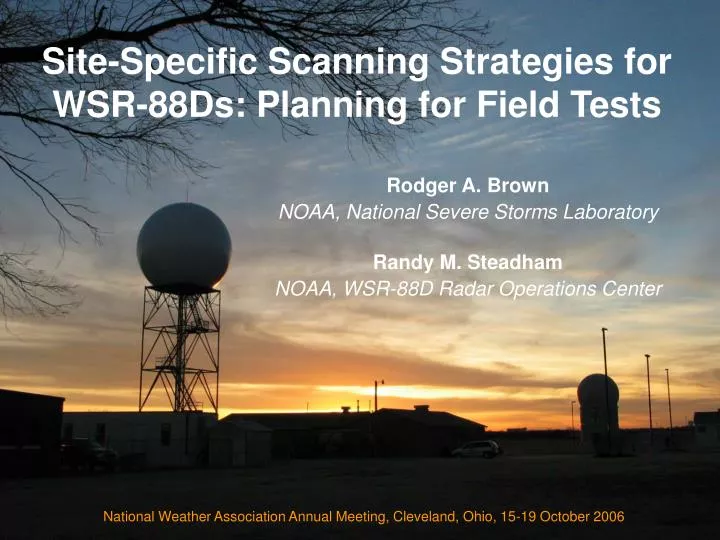
Site-Specific Scanning Strategies for WSR-88Ds: Planning for Field Tests. Rodger A. Brown NOAA, National Severe Storms Laboratory Randy M. Steadham NOAA, WSR-88D Radar Operations Center. National Weather Association Annual Meeting, Cleveland, Ohio, 15-19 October 2006. Background.

E N D
Site-Specific Scanning Strategies for WSR-88Ds: Planning for Field Tests Rodger A. Brown NOAA, National Severe Storms Laboratory Randy M. Steadham NOAA, WSR-88D Radar Operations Center National Weather Association Annual Meeting, Cleveland, Ohio, 15-19 October 2006
Background • The National Weather Service – which has a critical need to provide hazardous weather warnings to the public – is served by radars that currently have inadequate scanning strategies • When WSR-88D radars were installed in the early 1990s, the lowest elevation angle was set at 0.5o – even though mountaintop radars would overshoot crucial low-altitude phenomena
Forecaster Requests Soon after the WSR-88Ds were installed, the following types of requests were being made: • Extend the lower limit of elevation angles to as much as -1.0o for mountaintop WSR-88D sites in the Western Region of the National Weather Service (1995) • Decrease the lowest elevation angle to 0.2o for WSR-88Ds in the Great Lakes region in order to monitor shallow lake-effect snowstorms (1995)
2006 Survey of NWS Offices • A decade later, there still is a need for lower elevation angles • One sixth of the responses to a recent survey indicate the need for elevation angles below 0.5o
How Low Can A WSR-88D Scan? • Based on a theoretical study by Paul Smith (1998 J. Atmos. Oceanic Technol.), the lowest reasonable elevation angle is 0.25 – 0.35 beamwidths above the ground • For a WSR-88D, this means that the lowest elevation angle can be within 0.2o – 0.3o of the ground • WSR-88Ds can physically scan as low as –1.0o
Simulations - Cedar City, UT With negative elevation angles, KICX in southwestern Utah can make much more accurate estimates of precipitation rates
Simulations - Montague, NY KTYX, overlooking Lake Ontario and surrounding terrain, can better detect shallow lake-effect snowstorms (dashed line) and better estimate snowfall rates with lower elevation angles
Benefits of Lower Angles • Better estimates of surface rainfall and snowfall rates • Better detection of outflow boundaries that can represent damaging winds • Better detection of surface boundaries that can initiate convective storms and “gustnadoes” • Better detection and monitoring of tornadoes • Better detection of damaging microbursts • Better detection and tracking of shallow storms • Better monitoring of distant storms
SSSS Working Group • In 2005, the WSR-88D Radar Operations Center (ROC) established a Site-Specific Scanning Strategy (SSSS) Working Group • The goal of the SSSS Working Group is to investigate the benefits of lowered elevation angles by conducting field tests at a few WSR-88D sites
SSSS Working Group • Working Group members come from the ROC, National Severe Storms Laboratory, the involved NWS Forecast Offices, NWS Warning Decision Training Branch, NWS Headquarters, FAA, U.S. Air Force, and South Dakota School of Mines & Technology
WSR-88D Sites • Mountaintop radars in red • Also note the number of radars surrounding the Great Lakes and along both coasts
Field Test Plan • The plan is to conduct a two-year field test at three WSR-88D sites on the tops of mountains and three sites on relatively flat terrain, with lower elevation angles tailored for each specific site • The lower elevation angles would be appended to the current scanning strategies, but they would not affect the current processing and distribution of radar data
Field Test Plan • Instead, there would be a second Radar Product Generator (RPG) at each site (with a separate ID) to process and distribute data from the lower angles as well as from the regular elevation angles • The test data would be available to the local forecast office and to Working Group members via the regular WSR-88D distribution network
Field Test Status • Being a new project, the test plan is making its way through the NWS’s Operations and Services Improvement Process (OSIP) • The OSIP process has a number of unknowns, so we are in a wait–and–see mode
Summary • To take full advantage of the detection and warning potential of WSR-88Ds, the lowest elevation angle should be within 0.2o– 0.3o of the terrain • A field experiment is being pursued that will test the benefits of lowering the elevation angles
Questions ? Rodger.Brown@noaa.gov Randy.M.Steadham@noaa.gov