Download
1 / 33
400 likes | 659 Views
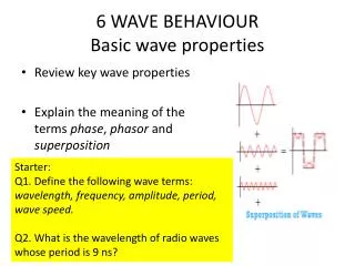
Basic Wave Theory Review. Graham Warren Bureau of Meteorology Australia. Why Forecast Waves?. SOLAS Shore Protection Surf Oil and gas exploration. Wave Characteristics. Some simple definitions Dispersion relation Deep water waves Wave Spectrum. Definitions.

E N D
Basic Wave Theory Review Graham Warren Bureau of Meteorology Australia
Why Forecast Waves? • SOLAS • Shore Protection • Surf • Oil and gas exploration
Wave Characteristics • Some simple definitions • Dispersion relation • Deep water waves • Wave Spectrum Workshop on Wind Wave and Storm Surge Analysis and Forecasting for Carribean Countries
Definitions • Wind (or sea) waves - generated by the local prevailing wind • Swell waves - the regular longer period waves that were generated by the winds of distant weather systems. There may be several sets of swell waves travelling in different directions, causing a confused sea state. • Sea state is the combination of wind waves and swell. Workshop on Wind Wave and Storm Surge Analysis and Forecasting for Carribean Countries
Properties of Waves • Wavelength (metres) • Height H (=2x amplitude) (metres) • Period T (seconds) • Phase velocity c • = c T Workshop on Wind Wave and Storm Surge Analysis and Forecasting for Carribean Countries
Total wave height • Height of the wind waves = Hw • Height of Swell waves = Hsw • Total wave height = (Hw2 + Hsw2)1/2 Workshop on Wind Wave and Storm Surge Analysis and Forecasting for Carribean Countries
Dispersion • Dispersion is the variation of wave speed with wavelength • Define • Dispersion relation is • deep water: • shallow water: Workshop on Wind Wave and Storm Surge Analysis and Forecasting for Carribean Countries
Group Velocity • Phase velocity is the speed at which a particular phase of the wave propagates • Group velocity • Velocity at which a group of waves travel • Velocity of propagation of wave energy Workshop on Wind Wave and Storm Surge Analysis and Forecasting for Carribean Countries
Deep Water Waves • Applies when depth of water > /4 • c2k2=gk • Phase Velocity : c = g/=gT /2 • = cT = gT2/2 = 1.56T2 m (T in secs) • c=1.56T (m/sec) • Group velocity: cg= gT /4 = c/2 = 0.78 T m/sec • Thus: Longer waves travel faster Workshop on Wind Wave and Storm Surge Analysis and Forecasting for Carribean Countries
The Wave Spectrum Fourier Analysis of wave trains: E Variance of the wave record is obtained by averaging the squares of the deviations of each of the wave components from the mean - gives wave spectrum (Energy spectrum) Frequency Workshop on Wind Wave and Storm Surge Analysis and Forecasting for Carribean Countries
WaveGrowth • Basic concepts • Manual forecasting techniques • Changing Wind • Swell Forecasting Workshop on Wind Wave and Storm Surge Analysis and Forecasting for Carribean Countries
Wave Heights, Wind and Fetch • Energy from the wind is transferred to waves • Waves lose energy • Whitecapping • Interaction with sea floor etc • The greater the wind speed, the higher the waves • The longer theduration of the wind, the higher the waves • The greater the distance over which the wind blows (the FETCH) the higher the waves. Wave height depends on a balance between energy in and energy out Workshop on Wind Wave and Storm Surge Analysis and Forecasting for Carribean Countries
Wind Wave Growth • Growth usually explained by shear flow instability • Airflow sucks at crests and pushes on troughs • Rate of growth is exponential as it depends on the existing sea state and wave age • Empirical formulae have been derived from large data set • Curves developed for manual forecasting Workshop on Wind Wave and Storm Surge Analysis and Forecasting for Carribean Countries
Characteristic Height and Period of Deep Water Waves t = duration of wind X=fetch u = wind speed g = 9.8m/s2 • Empirical Studies show: Duration limited Fetch limited ht, hx, pt and px are dimensionless functions. They all tend to a limit as the parameter (gt/u or gX/u2) increases to ~ 105
hx() ht() px() pt() Wave Height and Period • = gt/u or gX/u2
Wave Height and Period for General Conditions • Need to take the fetch and duration (time for which the wind is blowing) into account • Can use the general curves based on non-dimensional parameters • simple diagram, “complicated” calculation • OR use a more complicated set of curves • Complicated diagram, no calculation • May need to take into account varying wind conditions (changes in direction and/or speed) Workshop on Wind Wave and Storm Surge Analysis and Forecasting for Carribean Countries
Manual Wave Forecasting Diagram(Gröen and Dorrestein, 1976 Need fetch >80km 2.8m 5.8s Fetch=25km 1.8m 4s
Range of Wave Heights and Periods • Wave heights can range from 0 to 2Hc • The factor of 2 relates to the maximum wave likely to be observed in a period of a few hours, not the absolute maximum possible. The value depends only weakly on the length of time. • Most waves have periods in the range 0.5Tc to 1.5Tc • Important when forecasting swell Workshop on Wind Wave and Storm Surge Analysis and Forecasting for Carribean Countries
Wave Heights with Changing Wind Conditions • Change in wind direction • If wind direction changes by < 30°, calculate waves conditions as if no change in direction has occurred • If wind direction changes by > 30°, treat existing waves as swell waves, and start calculation for new wind direction from scratch. • As a rule of thumb, swell will decrease in height by 25% over period of 12 hours Workshop on Wind Wave and Storm Surge Analysis and Forecasting for Carribean Countries
Wave Heights with Changing Wind Conditions 2. Increasing wind speed (direction change <30°) • New wind speed is V2 • Take wave height at time of increase = H1 • Calculate the duration required to achieve H1 given the new wind speed (=T1) • If the new speed lasts for time T2, calculate wave conditions assuming duration = T1 + T2 and speed = V2. Workshop on Wind Wave and Storm Surge Analysis and Forecasting for Carribean Countries
Example of Increasing Wind • An 8 m/s wind has blown for 6 hours, fetch 100km • The wind gradually increases to 16m/s over a 6 hour period. • Estimate Hc and Tc at the end of the period • For a quick calculation, when wind speed increase is gradual from v1 to v2 over a period, use speed = v2 – (v2-v1)/4 as the speed in the calculation. Workshop on Wind Wave and Storm Surge Analysis and Forecasting for Carribean Countries
Wave Heights with Changing Wind Conditions 3. Slackening wind speed • When wind drops below speed needed to maintain height of existing waves*, the waves turn into swell. • As a first approximation, swell height may be reduced by 25% every 12 hours. * The minimum wind speed that will produce the existing wave height at the specified fetch
Swell Forecasting • For distant storms, regard the source of the swell as a point • For nearby storms the situation is more complicated • Questions: • When will the swell arrive? • Which wavelengths are involved? • What is the height of the swell? Here we develop some simple, first approximations
Swell Length and Arrival Time • Longest wavelengths travel fastest, so they arrive first • Range of periods is T~ 0.5Tc to 1.5Tc • Other periods exist, but the energy in them is small • = 1.56T2 m (T in secs) • Speed is 1.515 T knots (T in secs) • Longest waves arrive after time: Time ~ distance (NM)/(1.5*1.5Tc) hrs • Shortest waves take 3 times as long to arrive. • Eg: Tc=6secs, distance = 600 nm, min time = 44 hours • maximumswell length = 126m
Swell Height • Height of swell depends on • Height of waves in source region, and extent of source region • Speed dispersion (longer waves and shorter waves have different speeds – don’t arrive together) • Angular spreading of the waves (height decreases with distance as wave energy spreads over larger areas) • Angle between wind direction and direction to storm Workshop on Wind Wave and Storm Surge Analysis and Forecasting for Carribean Countries
Wind direction in storm Distance to storm/extent of storm Extent of storm Swell calculated here Factor =0.15 Angular Spreading of Swell from a Storm % spreading factor for energy Take square root for swell height Eg: Swell = 0.15 * Hc
Wave Measurements • Visual observations • Instruments for measuring waves • Buoys • Sub-surface pressure sensors • Laser • Remote sensing • Radar Altimeter • Synthetic Aperture Radar Workshop on Wind Wave and Storm Surge Analysis and Forecasting for Carribean Countries
Visual Observations • Guide only as visual observations are not generally reliable • Observations of height tend to approximate to the significant wave height Workshop on Wind Wave and Storm Surge Analysis and Forecasting for Carribean Countries
Instruments • Wave buoys • Vertical acceleration measured – can be converted to wave height • Wave staff • Attached to platforms – wave height measured by change in resistance or capacitance of the wave staff Workshop on Wind Wave and Storm Surge Analysis and Forecasting for Carribean Countries
Instruments (2) • Pressure sensors • Mounted from platforms below surface – change in pressure is measure of wave height • Laser • Attached to platforms – pointing downward Workshop on Wind Wave and Storm Surge Analysis and Forecasting for Carribean Countries
Remote SensingWaves from ERS-2 Radar Altimeter Workshop on Wind Wave and Storm Surge Analysis and Forecasting for Carribean Countries
Remote Sensing (2) • Synthetic Aperture Radar • Successive radar observations made along satellite track • Optical or digital processing produces high grade imaging of the longer waves • Wave directional spectrum (with 180o ambiguity) obtained by analysis of image Workshop on Wind Wave and Storm Surge Analysis and Forecasting for Carribean Countries
Finally…. • The accuracy of any wave forecast is dependant on the accuracy of the wind forecast. Workshop on Wind Wave and Storm Surge Analysis and Forecasting for Carribean Countries