Download
1 / 22
220 likes | 399 Views
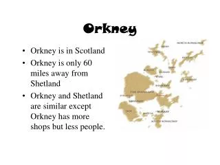
International Centre for Island Technology Heriot-Watt University (Orkney Campus) Old Academy Stromness Orkney Scotland. ~SUMARE~. The distribution of maerl around the Orkney Islands Malcolm Thomson. Orkney Islands. 20 km.

E N D
International Centre for Island TechnologyHeriot-Watt University (Orkney Campus)Old AcademyStromness OrkneyScotland ~SUMARE~ The distribution of maerl around the Orkney IslandsMalcolm Thomson
20 km Map of Orkney showing the location of ICIT and Wyre Sound, where the first sea trials of the PHANTOM vehicle are to be held. Wyre Sound ICIT Scapa Flow
what is maerl? environmental requirements importance European distribution maerl in Orkney
What is maerl? • coralline red seaweed • secrete calcium carbonate (CaCO3) • coastal distribution • long lived • living & dead deposits • “patchiness”
Environmental requirements • water depth/light penetration • water movement • tides & waves • temperature • water chemistry • seabed type
Importance of maerl • commercial • scientific • biodiversity • sensitivity / fragility • natural & man-made threats
Commercial value of maerl • soil conditioner • water purification • cosmetic ingredient • dietary additive • bone surgery • agricultural - feed, bedding material
Maerl in Orkney • ICIT student research • modelling the distribution of maerl • SUMARE
Personal accounts RoxAnn acoustic data Admiralty navigation charts Marine Nature Conservation Review (MNCR) Combined data set on maerl distribution Existing data on maerl Occurrence of maerl according to environmental parameters
Figure 1: The distribution of maerl as a function of depth (Admiralty and MNCR data combined)
Figure 2: Distribution of maerl as a function of tidal velocity
Figure 3: Distribution of maerl as a function of wave exposure
Figure 4: Predicted distribution of maerl in Orkney. ( ) indicates where the presence of maerl has since been confirmed.
General trends: • < 20m depth • moderate tidal velocity (0.9-3.0 knots ~ 0.45 - 1.5 ms-1) • low - moderate wave exposure
Effectiveness of model • Sound of Arisaig • less accurate • large scale application • living vs dead?? • probability data
Figure 4: The probability of finding maerl at a specific point as a function of depth - Admiralty chart data
Figure 4: The probability of finding maerl at a specific point as a function of depth - MNCR data
Figure 5: The probability of finding maerl at a specific point as a function of tidal velocity
“to show the advantages of using autonomous technology” in developing a sustainable extraction policy for maerl Goals of SUMARE re. maerl area estimates (patchiness) navigation discrimination of living & dead areas