Download
1 / 15
150 likes | 191 Views
Explore impacts of lake data on irrigation and drought indicators. Project provides near-real-time lake level variations for analysis. Data sourced from TOPEX/POSEIDON & Jason-1.

E N D
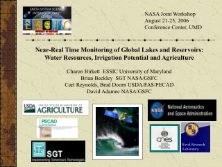
NASA Joint Workshop August 21-25, 2006 Conference Center, UMD Near-Real Time Monitoring of Global Lakes and Reservoirs: Water Resources, Irrigation Potential and Agriculture Charon Birkett ESSIC University of Maryland Brian Beckley SGT NASA/GSFC Curt Reynolds, Brad Doorn USDA/FAS/PECAD David Adamec NASA/GSFC Naval Research Laboratory
Satellite Radar Altimetry - Historical perspective Early studies and validations SEASAT R.L. Brooks, 1982 - Mapping of Canadian Lakes J.G. Olliver, 1987 - US Lakes and Caspian Sea Rapley et al., 1987 - Non-ocean surfaces A. Au et al., 1989 - (+GEOS-3) Caspian, Black Seas Cudlip et al., 1992 - Sudd Marshes, Amazon Basin GEOSAT Guzkowska et al., 1990 - Non-ocean surfaces Koblinsky et al., 1993 - Amazon Basin Morris and Gill, 1994 - USA Great Lakes Birkett, 1994 -Global outlook ERS-1 Scott et al., 1994 - Non-ocean surfaces TOPEX/POSEIDON Morris and Gill, 1994 - The Great Lakes Birkett, 1995 - The Great Lakes and Global Dalton and Kite, 1995 - Lake Victoria, Africa Birkett, 1998 - Global Rivers and Wetlands
Validation (examples from Birkett, JGR, 1995 and Ross, McKellip, Moore, Fendley, V+V Report, NASA SCC. 2005) Application (to lake, reservoir inland sea, river, floodplain, and wetland zone)
PECAD Objectives To examine the contribution of lake/reservoir elevation information for a) Determination of irrigation potential in agriculture-sensitive regions b) General indicators of drought/high-water situations Project Requirements To provide lake-level variations in near-real time for a designated set of lakes and reservoirs. Product = graphical + text output, relative variations (meters) with respect to an historical mean Data Sets Archive TOPEX/POSEIDON (1992-2002) Near Real Time IGDR Jason-1(post 2002) Temporal Sampling = 10days Time Period Coverage = September 1992 to present day Expectations 60-100 lakes (~180 large lakes with expected success rate of ~35%) Elevation Accuracy < 5cm rms for the largest lakes, 10-20 cm rms for smaller (<500 sq km) lakes and calm-water surfaces, tens of centimeters rms for ribbon lakes, extreme topography Product Delivery Latency = 7-14days after satellite overpass Product Availability = http://www.pecad.fas.usda.gov/cropexplorer/global_reservoir
PHASE 1 (USDA funding FY 2003) Focus on Africa, with on-line T/P and J-1 products, and preliminary database construction January, 2002 Preliminary project discussions USDA/ESSIC Sep02, Jan 03 Proposal submission, NASA/GSFC Task December, 2003 Preliminary products and temporary WWW site Spring, 2004 Web system installed on USDA CropExplorer site PHASE 2 (USDA funding FY 2004+2005) Global outlook, ~100 targets, web site completion, with routine product delivery and updates Semi-automated system in place - weekly updates Verification and Validation (Benchmarking Report) NASA/Stennis Space Center NASA/CNES Jason-1 data problems identified but not rectified. PHASE 3 (USDA/FY06, NASA Jan06-Feb07,NASA FY06-08*) Operational updates, expansion + enhancement of the lake products. (Investigation of technical data issues NASA/CNES/NRL/ESA q+q)* Expansion: NRL GFO and NASA/CNES Topex-Tandem mission data Enhancement: Revision of T/P and Jason-1 products Contribution to and interaction with ISS/DSS and Benchmarking
INPUTS OUTPUTS Altimetric Repeat Track Techniques SGT/UMD Adaptations for lake and reservoir monitoring OUTCOMES IMPACTS Products (GST) Computation of Stage Measurement Validation and Verification ESSIC/UMD Accuracy and delivery checks Near-Real Time Operations GST/USDA USDA/FAS Global Crop Production DSS Integration of multiple Datasets and Modeling Outputs Crop Condition and Production Data Application and Impact USDA + other users Shared Datasets for Policy and Management Decisions Earth Observations Satellite Radar Altimetry T/P, Jason-1 GFO, Topex-Tandem (ERS, ENVISAT) Research: NASA, UMD, GST Partners: USDA/FAS Integrated Systems Solution - USDA Crop Explorer
Altimetric graph+text products LAKENET US non-profit organization with database archive, data set collation + www links. USGS Global Visualization Viewer 3-D Imagery
http://www.pecad.fas.usda.gov/cropexplorer/global_reservoir On-line and operational with ~70 target lakes and weekly updates
Decrease in lake water levels since 1997/98 El Nino Lake Turkana Lake Victoria Lake Tanganyika Regional Drought in East Africa http://www.pecad.fas.usda.gov/cropexplorer/global_reservoir/
Water levels begin to drop in 2001, after the Owens Falls Dam Extension is inaugurated. Owens Falls Dam was commissioned in 1954 at Jinja Uganda, Lake Victoria’s only outlet. Lake Victoria’s water level on February 25, 2006is approximately 10.53 meters, the lowest water level since 1946.The water level recovers slightly during recent rain season, but drops again and is at 10.65 meters on August 12, 2006 Regional drought, excessive water releases for power generation after 2001 and non-compliance of the 1954 Nile Treaty Data Source: Historical water level gauge data from Jinja, Uganda (outlet). Satellite radar altimeter data from USDS/NASA/UMD at: http://www.pecad.fas.usda.gov/ cropexplorer/global_reservoir/ U.S. Department of Agricultural (USDA) Foreign Agricultural Service (FAS) Production Estimates & Crop Assessment Division (PECAD)
Project Expansion Utilization of the Naval Research Lab’s Geosat Follow-On mission data set NRL
Enhancement of existing products NASA/CNES Jason-1 GDR versus IGDR
Outlook - Additional and Future Satellite Missions Topex-Tandem 2002-2005 GFO 2000-current Jason-2 2008-2011 10days 297,69 ESA missions do have far greater spatial coverage although this will be offset by a lower temporal resolution for many of the smaller lakes. Observation frequency to be investigated for this application.